TopoQuest Logo
Do you find TopoQuest useful?
Help keep TopoQuest running and adding new maps/features by donating!
Bitcoin:  19c7KJd3qBynnjoSw5npx9KScwjBe4ifkT
Litecoin:  LXs6TkuXGGXo1vDsWCkWVdjQX94eUKd6ui
Home View Maps Find Maps Find Places Resources & Links


Oppenheim, New York Topographic Map

USGS Map Title: Oppenheim, NY
USGS Map MRC: 43074A6
DRG (GeoTIFF) Download: o43074a6.tif


Neighboring USGS Topographic Map Quads:


  Salisbury, NY  
43074B7
 

  Stratford, NY  
43074B6
 

  Canada Lake, NY  
43074B5
 

  Little Falls, NY  
43074A7
 

  Oppenheim, NY  
43074A6
 

  Lassellsville, NY  
43074A5
 

  Van Hornesville, NY  
42074H7
 

  Fort Plain, NY  
42074H6
 

  Canajoharie, NY  
42074H5


Map MRC Location:

N44°
W75°
N44°
W74°
H8 H7 H6 H5 H4 H3 H2 H1
G8 G7 G6 G5 G4 G3 G2 G1
F8 F7 F6 F5 F4 F3 F2 F1
E8 E7 E6 E5 E4 E3 E2 E1
D8 D7 D6 D5 D4 D3 D2 D1
C8 C7 C6 C5 C4 C3 C2 C1
B8 B7 B6 B5 B4 B3 B2 B1
A8 A7 A6 A5 A4 A3 A2 A1
N43°
W75°
N43°
W74°

Oppenheim, NY USGS 1:24K Topographic Map Preview:
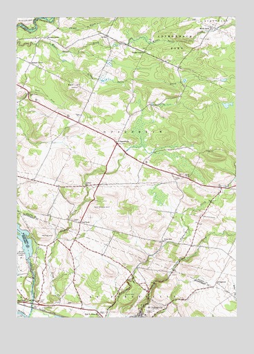
Oppenheim, NY USGS Topographic Map
Click on map above to begin viewing in our Map Viewer.

This topographic map contains these locations and features:
Feature Name Type Latitude Longitude GNIS ID View Map
Bacon Brook SchoolSchoolN43.0937°W74.7424°942763View Map
Beekman SchoolSchoolN43.0548°W74.7104°943553View Map
Brown CemeteryCemeteryN43.0895°W74.6752°2543444View Map
Chatsey CemeteryCemeteryN43.0587°W74.6580°946452View Map
Clemmons CemeteryCemeteryN43.0692°W74.6413°946841View Map
Clouse CemeteryCemeteryN43.0090°W74.6264°946917View Map
Crum CreekPopulated PlaceN43.0395°W74.7138°947862View Map
Crystal Grove Diamond Mine CampgroundLocaleN43.0499°W74.6360°2615198View Map
Damin FarmLocaleN43.0039°W74.7247°2556285View Map
Dolgeville AirportAirportN43.1184°W74.7433°977986View Map
Doxtater CornerPopulated PlaceN43.1167°W74.7332°972392View Map
Dutch Reformed Church CemeteryCemeteryN43.0353°W74.6914°2543445View Map
East Canada Creek BridgeBridgeN43.0059°W74.7411°2598778View Map
East Canada LakeReservoirN43.0330°W74.7464°949030View Map
East CreekPopulated PlaceN43.0073°W74.7435°949049View Map
Failing HillSummitN43.0342°W74.7363°949799View Map
Grace Christian ChurchChurchN43.0003°W74.6790°2616113View Map
Green CemeteryCemeteryN43.0070°W74.7363°951670View Map
Klock CemeteryCemeteryN43.0062°W74.7210°954743View Map
Klock ParkParkN43.0081°W74.6857°954746View Map
KringsbushPopulated PlaceN43.0145°W74.6360°972696View Map
Little Sprite CreekStreamN43.1095°W74.7260°955700View Map
LotvillePopulated PlaceN43.1173°W74.6988°956043View Map
Middle SpritePopulated PlaceN43.1206°W74.6388°972797View Map
Middle Sprite CemeteryCemeteryN43.1216°W74.6366°2543443View Map
One Cow FarmLocaleN43.0075°W74.6353°2556292View Map
OppenheimPopulated PlaceN43.0723°W74.6926°959421View Map
Oppenheim - Ephratah Central SchoolSchoolN43.0610°W74.6632°2669072View Map
Oppenheim Volunteer Fire Company 1BuildingN43.0700°W74.6888°2718426View Map
Phipps CornersLocaleN43.1103°W74.6774°960317View Map
Prospect View CemeteryCemeteryN43.0029°W74.6770°961197View Map
Rain Dance PondLakeN43.0897°W74.6564°2772205View Map
Rasbach CornerPopulated PlaceN43.1062°W74.7418°962199View Map
Saint Bridgetts CemeteryCemeteryN43.1159°W74.6424°2543446View Map
Saint Johnsville Junior - Senior High SchoolSchoolN43.0012°W74.6762°2669092View Map
Saint Johnsville QuarryMineN43.0083°W74.7028°2567149View Map
School Number 12 (historical)SchoolN43.0581°W74.6518°975039View Map
School Number 6 (historical)SchoolN43.0403°W74.7174°975495View Map
School Number 7 (historical)SchoolN43.0020°W74.7024°975555View Map
School Number 9 (historical)SchoolN43.0845°W74.7135°975650View Map
Sweet HillSummitN43.0965°W74.7168°966916View Map
Town of OppenheimCivilN43.0773°W74.6838°979314View Map
Town of Saint JohnsvilleCivilN43.0066°W74.6778°979448View Map
Twin Church HillSummitN43.0451°W74.7032°968035View Map
Village of Saint JohnsvilleCivilN43.0011°W74.6782°2391157View Map
Youker Buch SchoolSchoolN43.0317°W74.6660°971844View Map

Note: Coordinates in the location and feature list above are referenced to NAD83 datum.


Copyright (C) 2008-2025 Ryan Niemi / Sunset Dynamics ... All Rights Reserved