TopoQuest Logo
Do you find TopoQuest useful?
Help keep TopoQuest running and adding new maps/features by donating!
Bitcoin:  19c7KJd3qBynnjoSw5npx9KScwjBe4ifkT
Litecoin:  LXs6TkuXGGXo1vDsWCkWVdjQX94eUKd6ui
Home View Maps Find Maps Find Places Resources & Links


Lassellsville, New York Topographic Map

USGS Map Title: Lassellsville, NY
USGS Map MRC: 43074A5
DRG (GeoTIFF) Download: o43074a5.tif


Neighboring USGS Topographic Map Quads:


  Stratford, NY  
43074B6
 

  Canada Lake, NY  
43074B5
 

  Caroga Lake, NY  
43074B4
 

  Oppenheim, NY  
43074A6
 

  Lassellsville, NY  
43074A5
 

  Peck Lake, NY  
43074A4
 

  Fort Plain, NY  
42074H6
 

  Canajoharie, NY  
42074H5
 

  Randall, NY  
42074H4


Map MRC Location:

N44°
W75°
N44°
W74°
H8 H7 H6 H5 H4 H3 H2 H1
G8 G7 G6 G5 G4 G3 G2 G1
F8 F7 F6 F5 F4 F3 F2 F1
E8 E7 E6 E5 E4 E3 E2 E1
D8 D7 D6 D5 D4 D3 D2 D1
C8 C7 C6 C5 C4 C3 C2 C1
B8 B7 B6 B5 B4 B3 B2 B1
A8 A7 A6 A5 A4 A3 A2 A1
N43°
W75°
N43°
W74°

Lassellsville, NY USGS 1:24K Topographic Map Preview:
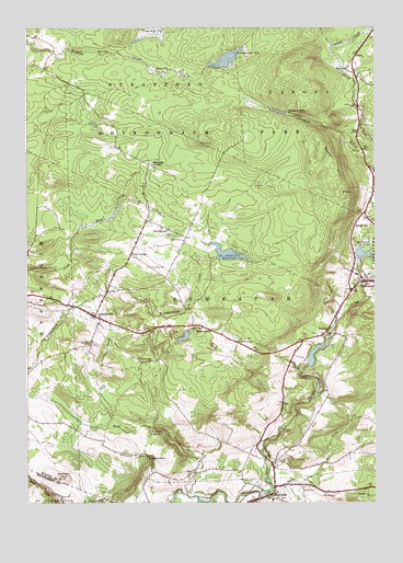
Lassellsville, NY USGS Topographic Map
Click on map above to begin viewing in our Map Viewer.

This topographic map contains these locations and features:
Feature Name Type Latitude Longitude GNIS ID View Map
Acadian FarmLocaleN43.0142°W74.5547°2556779View Map
Adirondack State ParkParkN43.0956°W74.5688°942089View Map
Bolster HillSummitN43.0134°W74.6013°944408View Map
BradtvillePopulated PlaceN43.0726°W74.5068°944590View Map
Christman CemeteryCemeteryN43.0426°W74.5492°946643View Map
Dempster CemeteryCemeteryN43.0468°W74.5947°2543447View Map
Dempster CornersPopulated PlaceN43.0892°W74.5813°948294View Map
Dillaborough CemeteryCemeteryN43.0372°W74.5821°948450View Map
EphratahPopulated PlaceN43.0009°W74.5424°949675View Map
Ephratah Rural CemeteryCemeteryN43.0041°W74.5243°963089View Map
Ephratah Volunteer Fire DepartmentBuildingN43.0067°W74.5359°2718414View Map
Fical CemeteryCemeteryN43.0621°W74.5797°950017View Map
Fical CornersLocaleN43.0651°W74.5874°950018View Map
Fort Plain ReservoirReservoirN43.0190°W74.5761°950491View Map
GarogaPopulated PlaceN43.0440°W74.5165°950919View Map
Getman HillSummitN43.0065°W74.6132°951052View Map
Glasgow MillsPopulated PlaceN43.1028°W74.5307°972541View Map
Hillabrandt VlyLakeN43.1167°W74.5530°952810View Map
Johnson VlySwampN43.1131°W74.5749°954141View Map
Klock CreekStreamN43.0659°W74.6088°954744View Map
LassellsvillePopulated PlaceN43.0492°W74.6001°955065View Map
Lassellsville Fire House Volunteer CompanyBuildingN43.0485°W74.5931°2718278View Map
Michael CemeteryCemeteryN43.0417°W74.6022°957066View Map
Miles SchoolSchoolN43.0451°W74.5596°957181View Map
Mud Road FarmLocaleN43.0103°W74.5086°2556784View Map
NewkirkPopulated PlaceN43.1131°W74.5093°958515View Map
North CreekStreamN43.0023°W74.5676°958765View Map
RockwoodPopulated PlaceN43.0581°W74.5040°962773View Map
Rockwood - Garoga - Lassellsville Volunteer Fire Company Station 2BuildingN43.0488°W74.5986°2735145View Map
Rockwood Fire StationBuildingN43.0507°W74.5131°2718648View Map
Rockwood Rural CemeteryCemeteryN43.0596°W74.5016°2543448View Map
Royal HillSummitN43.0815°W74.5110°963060View Map
Saint Johnsville ReservoirReservoirN43.0654°W74.5524°963695View Map
School Number 2 (historical)SchoolN43.0690°W74.5688°975201View Map
ScotchbrushPopulated PlaceN43.0717°W74.5738°964669View Map
Shaver SchoolSchoolN43.0120°W74.5810°964963View Map
Sponable CreekStreamN43.0059°W74.5243°966023View Map
Sprite CreekStreamN43.0020°W74.5390°966111View Map
Tamarack VlySwampN43.1237°W74.5804°970698View Map
Town of EphratahCivilN43.0409°W74.5537°978941View Map

Note: Coordinates in the location and feature list above are referenced to NAD83 datum.


Copyright (C) 2008-2024 Ryan Niemi / Sunset Dynamics ... All Rights Reserved