TopoQuest Logo
Do you find TopoQuest useful?
Help keep TopoQuest running and adding new maps/features by donating!
Bitcoin:  19c7KJd3qBynnjoSw5npx9KScwjBe4ifkT
Litecoin:  LXs6TkuXGGXo1vDsWCkWVdjQX94eUKd6ui
Home View Maps Find Maps Find Places Resources & Links


Leighton, Kentucky Topographic Map

USGS Map Title: Leighton, KY
USGS Map MRC: 37083E8
DRG (GeoTIFF) Download: o37083e8.tif


Neighboring USGS Topographic Map Quads:


  Panola, KY  
37084F1
 

  Irvine, KY  
37083F8
 

  Cobhill, KY  
37083F7
 

  Alcorn, KY  
37084E1
 

  Leighton, KY  
37083E8
 

  Heidelberg, KY  
37083E7
 

  Sandgap, KY  
37084D1
 

  McKee, KY  
37083D8
 

  Sturgeon, KY  
37083D7


Map MRC Location:

N38°
W84°
N38°
W83°
H8 H7 H6 H5 H4 H3 H2 H1
G8 G7 G6 G5 G4 G3 G2 G1
F8 F7 F6 F5 F4 F3 F2 F1
E8 E7 E6 E5 E4 E3 E2 E1
D8 D7 D6 D5 D4 D3 D2 D1
C8 C7 C6 C5 C4 C3 C2 C1
B8 B7 B6 B5 B4 B3 B2 B1
A8 A7 A6 A5 A4 A3 A2 A1
N37°
W84°
N37°
W83°

Leighton, KY USGS 1:24K Topographic Map Preview:
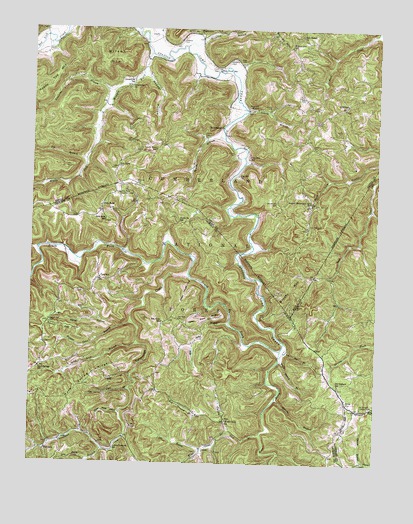
Leighton, KY USGS Topographic Map
Click on map above to begin viewing in our Map Viewer.

This topographic map contains these locations and features:
Feature Name Type Latitude Longitude GNIS ID View Map
Abner HollowValleyN37.5413°W83.9748°510203View Map
Alcorn BranchStreamN37.5190°W83.9102°510226View Map
AlumbaughPopulated PlaceN37.5976°W83.9299°510255View Map
Alumbaugh Post Office (historical)Post OfficeN37.6014°W83.9226°2440472View Map
ArvelPopulated PlaceN37.5184°W83.8852°510307View Map
Ash Ground BranchStreamN37.5145°W83.9399°510310View Map
Ash Gut BranchStreamN37.5351°W83.9077°510311View Map
Beth BranchStreamN37.6093°W83.9646°1891148View Map
Big Springs School (historical)SchoolN37.6064°W83.8886°2440522View Map
Blanton FlatsFlatN37.5703°W83.9977°2505039View Map
Brushy MountainSummitN37.5509°W83.9046°510981View Map
Callahan CemeteryCemeteryN37.6217°W83.9464°511133View Map
Cavanaugh CreekStreamN37.5540°W83.9419°511256View Map
Cedar House HollowValleyN37.5531°W83.9418°511297View Map
Cedar Point RidgeRidgeN37.5420°W83.9344°511300View Map
Clay Hill ChurchChurchN37.5831°W83.9244°511385View Map
Clay Hill SchoolSchoolN37.5879°W83.9208°511386View Map
Cox Cave BranchStreamN37.5212°W83.9638°511608View Map
Double Oak CemeteryCemeteryN37.5754°W83.9108°511878View Map
Drip Rick Post Office (historical)Post OfficeN37.5741°W83.9751°2505071View Map
Drip RockPopulated PlaceN37.5751°W83.9735°511887View Map
Drip Rock Lookout TowerTowerN37.5779°W83.9680°517142View Map
Drip Rock Post OfficePost OfficeN37.5856°W83.9685°517532View Map
Drip Rock SchoolSchoolN37.5704°W83.9730°511888View Map
Dry Fork BranchStreamN37.5040°W83.9730°511930View Map
Durbin CemeteryCemeteryN37.6029°W83.9133°511962View Map
Edwards BranchStreamN37.6073°W83.9705°512014View Map
Elk BranchStreamN37.5876°W83.9802°512034View Map
Estes CemeteryCemeteryN37.6065°W83.9024°512089View Map
Estilco Post Office (historical)Post OfficeN37.6096°W83.9798°2440478View Map
Fairview (historical)Populated PlaceN37.5533°W83.9755°2505078View Map
Fall BranchStreamN37.5254°W83.9635°512117View Map
Flynn CemeteryCemeteryN37.6142°W83.9327°512211View Map
FoxtownPopulated PlaceN37.5043°W83.9935°512235View Map
Foxtown Post Office (historical)Post OfficeN37.5044°W83.9932°2505082View Map
Gabbard CemeteryCemeteryN37.6165°W83.9271°512270View Map
Granny Richardson Springs SchoolSchoolN37.5751°W83.8980°512367View Map
Greenbriar (historical)Populated PlaceN37.6089°W83.9647°2508707View Map
Greenbriar ChurchChurchN37.6087°W83.9644°512441View Map
Greenbriar SchoolSchoolN37.6109°W83.9641°512443View Map
Harris BranchStreamN37.5012°W83.8783°512569View Map
Hoover CemeteryCemeteryN37.5892°W83.9258°512776View Map
Hopper Cave BranchStreamN37.5404°W83.9635°512781View Map
Hurd Spring RidgeRidgeN37.5234°W83.9791°512854View Map
James Scrivner CemeteryCemeteryN37.6241°W83.9413°515305View Map
Jones BranchStreamN37.6231°W83.9583°513062View Map
King CemeteryCemeteryN37.6162°W83.9246°513151View Map
LakesPopulated PlaceN37.5042°W83.9372°2094145View Map
Lakes BranchStreamN37.5043°W83.9371°513191View Map
Laura Post Office (historical)Post OfficeN37.5070°W83.9654°2504912View Map
Left Fork Sand Springs BranchStreamN37.5104°W83.9949°1958452View Map
LeightonPopulated PlaceN37.6037°W83.8860°513337View Map
Leighton Post Office (historical)Post OfficeN37.6036°W83.9552°2440487View Map
Little Buck Lick BranchStreamN37.5033°W83.9094°2504919View Map
Lower Foxtown SchoolSchoolN37.5040°W83.9691°513691View Map
Lynch Town (historical)Populated PlaceN37.5903°W83.9555°2440545View Map
Lynch Town SchoolSchoolN37.5904°W83.9546°513734View Map
Marcum CemeteryCemeteryN37.5804°W83.9619°513781View Map
Middle Fork Station Camp CreekStreamN37.6181°W83.9569°513940View Map
Mill Seat BranchStreamN37.5404°W83.9277°513998View Map
Napper HollowValleyN37.6119°W83.9596°514190View Map
Nazareth MissionChurchN37.6023°W83.9183°514203View Map
New Bethel ChurchChurchN37.6234°W83.9027°514234View Map
Old Orchard Lookout TowerTowerN37.5165°W83.8794°517258View Map
Old Orchard SchoolSchoolN37.5229°W83.8877°514330View Map
Polly Spark BranchStreamN37.5301°W83.9094°514685View Map
Pond SchoolSchoolN37.5537°W83.9746°514702View Map
Powell Post Office (historical)Post OfficeN37.6140°W83.9320°2440499View Map
Reece CemeteryCemeteryN37.5915°W83.8977°514876View Map
Russell FlatFlatN37.5393°W83.9885°515149View Map
Russell Flat CemeteryCemeteryN37.5401°W83.9927°515150View Map
Salt Rock (historical)Populated PlaceN37.5405°W83.9523°2504955View Map
Salt Rock CemeteryCemeteryN37.5420°W83.9463°515194View Map
Salt Rock SchoolSchoolN37.5406°W83.9519°515195View Map
Sand Spring BranchStreamN37.5054°W83.9919°1958451View Map
Sand SpringsPopulated PlaceN37.5262°W83.9999°515229View Map
Sand Springs Post Office (historical)Post OfficeN37.5278°W83.9961°2504957View Map
Sand Springs SchoolSchoolN37.5276°W83.9966°515231View Map
Saw Mill ChurchChurchN37.5401°W83.9935°2504959View Map
Scrivner BranchStreamN37.6204°W83.9441°515304View Map
Searcy BranchStreamN37.6020°W83.9216°515309View Map
Silver Mine HollowValleyN37.5147°W83.9675°515416View Map
Slick FordCrossingN37.6131°W83.9331°2440537View Map
Slick Fork SchoolSchoolN37.6140°W83.9313°515486View Map
South Fork (historical)Populated PlaceN37.5700°W83.9469°2504965View Map
South Fork SchoolSchoolN37.5695°W83.9463°515549View Map
South Fork Station Camp CreekStreamN37.5329°W83.9088°515550View Map
Sparks BranchStreamN37.5940°W83.9299°515564View Map
Sparks CemeteryCemeteryN37.5945°W83.9363°515568View Map
Sparks CemeteryCemeteryN37.5959°W83.8885°515569View Map
Sparks School (historical)SchoolN37.5765°W83.9481°2440526View Map
Sparks School (historical)SchoolN37.5732°W83.9405°2504967View Map
Spice Lick BranchStreamN37.5345°W83.9610°515588View Map
Tarpin Lick BranchStreamN37.5087°W83.9158°515867View Map
Wagersville ChurchChurchN37.6240°W83.9391°516198View Map
Wagersville-South Irvine DivisionCivilN37.6146°W83.9478°1937276View Map
Walnut Gap (historical)Populated PlaceN37.6203°W83.9071°2440549View Map
Walnut Gap SchoolSchoolN37.6206°W83.9060°516214View Map
War ForkStreamN37.5326°W83.9091°516224View Map
Wilson MountainSummitN37.6162°W83.9705°516409View Map
Wind CavePopulated PlaceN37.5126°W83.9288°516416View Map
Wind Cave BranchStreamN37.5093°W83.9266°516417View Map
Wind Cave ChurchChurchN37.5126°W83.9288°516666View Map
Wind Cave Post Office (historical)Post OfficeN37.5130°W83.9289°2504986View Map
Wood Cutting BranchStreamN37.5003°W83.9117°2505008View Map

Note: Coordinates in the location and feature list above are referenced to NAD83 datum.


Copyright (C) 2008-2024 Ryan Niemi / Sunset Dynamics ... All Rights Reserved