TopoQuest Logo
Do you find TopoQuest useful?
Help keep TopoQuest running and adding new maps/features by donating!
Bitcoin:  19c7KJd3qBynnjoSw5npx9KScwjBe4ifkT
Litecoin:  LXs6TkuXGGXo1vDsWCkWVdjQX94eUKd6ui
Home View Maps Find Maps Find Places Resources & Links


Summerfield, Louisiana Topographic Map

USGS Map Title: Summerfield, LA
USGS Map MRC: 32092H7
DRG (GeoTIFF) Download: o32092h7.tif


Neighboring USGS Topographic Map Quads:


  Wesson SW, AR  
33092A8
 

  Wesson, AR  
33092A7
 

  Junction City, AR  
33092A6
 

  Colquitt, LA  
32092H8
 

  Summerfield, LA  
32092H7
 

  Lillie, LA  
32092H6
 

  Arizona, LA  
32092G8
 

  Lisbon, LA  
32092G7
 

  Bernice, LA  
32092G6


Map MRC Location:

N33°
W93°
N33°
W92°
H8 H7 H6 H5 H4 H3 H2 H1
G8 G7 G6 G5 G4 G3 G2 G1
F8 F7 F6 F5 F4 F3 F2 F1
E8 E7 E6 E5 E4 E3 E2 E1
D8 D7 D6 D5 D4 D3 D2 D1
C8 C7 C6 C5 C4 C3 C2 C1
B8 B7 B6 B5 B4 B3 B2 B1
A8 A7 A6 A5 A4 A3 A2 A1
N32°
W93°
N32°
W92°

Summerfield, LA USGS 1:24K Topographic Map Preview:
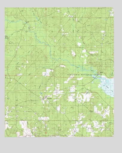
Summerfield, LA USGS Topographic Map
Click on map above to begin viewing in our Map Viewer.

This topographic map contains these locations and features:
Feature Name Type Latitude Longitude GNIS ID View Map
Alford CreekStreamN32.9421°W92.8257°546961View Map
Barber CreekStreamN32.9210°W92.7688°546997View Map
Claiborne Parish Fire District 6 Summerfield StationBuildingN32.9125°W92.8283°2673139View Map
Corney DamDamN32.9001°W92.7668°556797View Map
Corney LakeReservoirN32.9001°W92.7668°556798View Map
Dowdy BranchStreamN32.9610°W92.7860°547318View Map
Dry CreekStreamN32.9817°W92.7957°48635View Map
Fellowship SchoolSchoolN32.9649°W92.7565°547356View Map
Greer CreekStreamN32.9340°W92.7515°547421View Map
HebronPopulated PlaceN32.8765°W92.7960°544132View Map
Hebron ChurchChurchN32.8765°W92.7960°547455View Map
Hickory Grove CemeteryCemeteryN32.9412°W92.8616°548024View Map
Leadbetter CreekStreamN32.9488°W92.8168°547568View Map
Lisbon Gas FieldOilfieldN32.8968°W92.8279°544142View Map
Little Corney CreekStreamN32.9774°W92.8460°547597View Map
Mount Calm ChurchChurchN32.9143°W92.7971°547744View Map
Mount Calm SchoolSchoolN32.9143°W92.7965°547745View Map
New Home SchoolSchoolN32.9915°W92.8024°547768View Map
Parish Governing Authority District 1CivilN32.9389°W92.8502°1929731View Map
Rocky Hill Lookout TowerTowerN32.9376°W92.7674°558818View Map
ScottsvillePopulated PlaceN32.9374°W92.7668°555996View Map
Southwest Lillie Oil FieldOilfieldN32.9460°W92.7585°544159View Map
Spring Grove SchoolSchoolN32.9413°W92.8563°548023View Map
Sugar CreekStreamN32.9438°W92.7859°55295View Map
Sugar Creek CampLocaleN32.9632°W92.7924°1630042View Map
SummerfieldPopulated PlaceN32.9126°W92.8293°548053View Map
Summerfield High SchoolSchoolN32.9137°W92.8279°544160View Map
Summerfield Post OfficePost OfficeN32.9118°W92.8315°1630069View Map
Tanner CreekStreamN32.9657°W92.8349°548063View Map
Three CreeksStreamN32.9646°W92.8252°55559View Map
Ward NineCivilN32.9665°W92.7535°544989View Map
Ward OneCivilN32.9115°W92.8302°544981View Map

Note: Coordinates in the location and feature list above are referenced to NAD83 datum.


Copyright (C) 2008-2025 Ryan Niemi / Sunset Dynamics ... All Rights Reserved