TopoQuest Logo
Do you find TopoQuest useful?
Help keep TopoQuest running and adding new maps/features by donating!
Bitcoin:  19c7KJd3qBynnjoSw5npx9KScwjBe4ifkT
Litecoin:  LXs6TkuXGGXo1vDsWCkWVdjQX94eUKd6ui
Home View Maps Find Maps Find Places Resources & Links


Wesson, Arkansas Topographic Map

USGS Map Title: Wesson, AR
USGS Map MRC: 33092A7
DRG (GeoTIFF) Download: o33092a7.tif


Neighboring USGS Topographic Map Quads:


  Marysville, AR  
33092B8
 

  Newell, AR  
33092B7
 

  El Dorado West, AR  
33092B6
 

  Wesson SW, AR  
33092A8
 

  Wesson, AR  
33092A7
 

  Junction City, AR  
33092A6
 

  Colquitt, LA  
32092H8
 

  Summerfield, LA  
32092H7
 

  Lillie, LA  
32092H6


Map MRC Location:

N34°
W93°
N34°
W92°
H8 H7 H6 H5 H4 H3 H2 H1
G8 G7 G6 G5 G4 G3 G2 G1
F8 F7 F6 F5 F4 F3 F2 F1
E8 E7 E6 E5 E4 E3 E2 E1
D8 D7 D6 D5 D4 D3 D2 D1
C8 C7 C6 C5 C4 C3 C2 C1
B8 B7 B6 B5 B4 B3 B2 B1
A8 A7 A6 A5 A4 A3 A2 A1
N33°
W93°
N33°
W92°

Wesson, AR USGS 1:24K Topographic Map Preview:
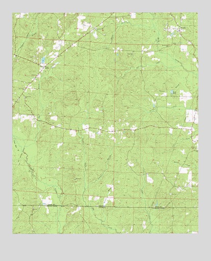
Wesson, AR USGS Topographic Map
Click on map above to begin viewing in our Map Viewer.

This topographic map contains these locations and features:
Feature Name Type Latitude Longitude GNIS ID View Map
Andrews Chapel CemeteryCemeteryN33.1010°W92.8415°60915View Map
Arkansas Noname 49 DamDamN33.0985°W92.8552°80204View Map
Ash BranchStreamN33.0468°W92.8679°45941View Map
Bear CreekStreamN33.0949°W92.7610°77337View Map
Beulah Grove CemeteryCemeteryN33.1065°W92.7699°46494View Map
Brown CemeteryCemeteryN33.0749°W92.8704°60917View Map
Cooks PondReservoirN33.0802°W92.7678°76664View Map
El Bethel CemeteryCemeteryN33.0896°W92.8579°59645View Map
El Bethel ChurchChurchN33.0899°W92.8582°48831View Map
Francis CreekStreamN33.0251°W92.8265°49218View Map
Graves CreekStreamN33.1171°W92.7793°49599View Map
Hayes BranchStreamN33.0537°W92.8740°49958View Map
Holly Grove CemeteryCemeteryN33.0146°W92.8607°544133View Map
Holly Grove ChurchChurchN33.0143°W92.8610°535727View Map
Jones CemeteryCemeteryN33.0699°W92.8621°60940View Map
Lower Moss BranchStreamN33.0468°W92.8685°51502View Map
Lowery BranchStreamN33.0260°W92.8254°77563View Map
Macedonia ChurchChurchN33.0310°W92.8318°77570View Map
Masondia CemeteryCemeteryN33.0307°W92.8321°60943View Map
Mount Pigeon ChurchChurchN33.0485°W92.7515°52370View Map
Pleasant Grove CemeteryCemeteryN33.1165°W92.8188°59805View Map
Pleasant Grove Methodist ChurchChurchN33.1160°W92.8188°78031View Map
Pleasant Hill CemeteryCemeteryN33.1024°W92.7946°59809View Map
Pleasant Hill ChurchChurchN33.1024°W92.7938°53563View Map
Scotland CemeteryCemeteryN33.0479°W92.7504°54632View Map
Sheppard BranchStreamN33.1026°W92.8718°45760View Map
Three CreeksPopulated PlaceN33.0946°W92.8538°78548View Map
Three Creeks Baptist ChurchChurchN33.0821°W92.8668°78549View Map
Three Creeks CemeteryCemeteryN33.0768°W92.8665°55560View Map
Township of CornieCivilN33.1002°W92.8506°69744View Map
Township of HendersonCivilN33.0508°W92.7621°69749View Map
WessonPopulated PlaceN33.1154°W92.7627°58848View Map
Wesson Baptist ChurchChurchN33.1149°W92.7632°59889View Map
Wesson CemeteryCemeteryN33.1076°W92.7643°56161View Map
Wesson Post Office (historical)Post OfficeN33.1143°W92.7624°83886View Map
Wilson BranchStreamN33.0074°W92.8135°56425View Map

Note: Coordinates in the location and feature list above are referenced to NAD83 datum.


Copyright (C) 2008-2024 Ryan Niemi / Sunset Dynamics ... All Rights Reserved