TopoQuest Logo
Do you find TopoQuest useful?
Help keep TopoQuest running and adding new maps/features by donating!
Bitcoin:  19c7KJd3qBynnjoSw5npx9KScwjBe4ifkT
Litecoin:  LXs6TkuXGGXo1vDsWCkWVdjQX94eUKd6ui
Home View Maps Find Maps Find Places Resources & Links


Mahoney Butte, Idaho Topographic Map

USGS Map Title: Mahoney Butte, ID
USGS Map MRC: 43114E4
DRG (GeoTIFF) Download: o43114e4.tif


Neighboring USGS Topographic Map Quads:


  Boyle Mountain, ID  
43114F5
 

  Griffin Butte, ID  
43114F4
 

  Sun Valley, ID  
43114F3
 

  Buttercup Mountain, ID  
43114E5
 

  Mahoney Butte, ID  
43114E4
 

  Hailey, ID  
43114E3
 

  Beaver Creek, ID  
43114D5
 

  Richardson Summit, ID  
43114D4
 

  Bellevue, ID  
43114D3


Map MRC Location:

N44°
W115°
N44°
W114°
H8 H7 H6 H5 H4 H3 H2 H1
G8 G7 G6 G5 G4 G3 G2 G1
F8 F7 F6 F5 F4 F3 F2 F1
E8 E7 E6 E5 E4 E3 E2 E1
D8 D7 D6 D5 D4 D3 D2 D1
C8 C7 C6 C5 C4 C3 C2 C1
B8 B7 B6 B5 B4 B3 B2 B1
A8 A7 A6 A5 A4 A3 A2 A1
N43°
W115°
N43°
W114°

Mahoney Butte, ID USGS 1:24K Topographic Map Preview:
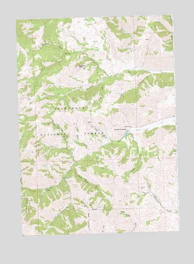
Mahoney Butte, ID USGS Topographic Map
Click on map above to begin viewing in our Map Viewer.

This topographic map contains these locations and features:
Feature Name Type Latitude Longitude GNIS ID View Map
Bridge CampgroundLocaleN43.5260°W114.4809°378214View Map
Clarendon Hot SpringsPopulated PlaceN43.5594°W114.4151°397552View Map
Clarendon Hot Springs DamDamN43.5582°W114.4126°398904View Map
Cow CreekStreamN43.5907°W114.4248°379939View Map
Democrat MineMineN43.5255°W114.4056°380498View Map
Greenhorn Guard StationLocaleN43.5938°W114.4112°399051View Map
Imperial GulchValleyN43.5913°W114.3945°383630View Map
Jimmie CreekStreamN43.5571°W114.4145°399939View Map
Jolly Sailor GulchValleyN43.5466°W114.4459°384006View Map
Limekiln GulchValleyN43.5960°W114.4051°384672View Map
Lodgepole GulchValleyN43.6055°W114.4628°385037View Map
Mahoney ButteSummitN43.5968°W114.4542°386385View Map
Mahoney CreekStreamN43.5902°W114.4292°386387View Map
Narrow Gauge GulchValleyN43.5388°W114.4589°387473View Map
Nay Aug GulchValleyN43.5505°W114.4639°387483View Map
North Fork Deer CreekStreamN43.5280°W114.4992°387683View Map
Panther GulchValleyN43.5418°W114.4584°388150View Map
Red Cloud MineMineN43.5163°W114.4487°389187View Map
Sawmill CreekStreamN43.5891°W114.4342°389955View Map
Snowslide GulchValleyN43.5268°W114.4962°390781View Map
Twin Bridges CreekStreamN43.5471°W114.4428°392496View Map
War Dance GulchValleyN43.5532°W114.4314°392822View Map
Wolftone CampgroundLocaleN43.5327°W114.4667°393637View Map
Wolftone CreekStreamN43.5324°W114.4676°398378View Map

Note: Coordinates in the location and feature list above are referenced to NAD83 datum.


Copyright (C) 2008-2025 Ryan Niemi / Sunset Dynamics ... All Rights Reserved