TopoQuest Logo
Do you find TopoQuest useful?
Help keep TopoQuest running and adding new maps/features by donating!
Bitcoin:  19c7KJd3qBynnjoSw5npx9KScwjBe4ifkT
Litecoin:  LXs6TkuXGGXo1vDsWCkWVdjQX94eUKd6ui
Home View Maps Find Maps Find Places Resources & Links


Wayland, Iowa Topographic Map

USGS Map Title: Wayland, IA
USGS Map MRC: 41091B6
DRG (GeoTIFF) Download: o41091b6.tif


Neighboring USGS Topographic Map Quads:


  West Chester, IA  
41091C7
 

  Washington, IA  
41091C6
 

  Ainsworth, IA  
41091C5
 

  Brighton, IA  
41091B7
 

  Wayland, IA  
41091B6
 

  Crawfordsville, IA  
41091B5
 

  Salina, IA  
41091A7
 

  Trenton, IA  
41091A6
 

  Swedesburg, IA  
41091A5


Map MRC Location:

N42°
W92°
N42°
W91°
H8 H7 H6 H5 H4 H3 H2 H1
G8 G7 G6 G5 G4 G3 G2 G1
F8 F7 F6 F5 F4 F3 F2 F1
E8 E7 E6 E5 E4 E3 E2 E1
D8 D7 D6 D5 D4 D3 D2 D1
C8 C7 C6 C5 C4 C3 C2 C1
B8 B7 B6 B5 B4 B3 B2 B1
A8 A7 A6 A5 A4 A3 A2 A1
N41°
W92°
N41°
W91°

Wayland, IA USGS 1:24K Topographic Map Preview:
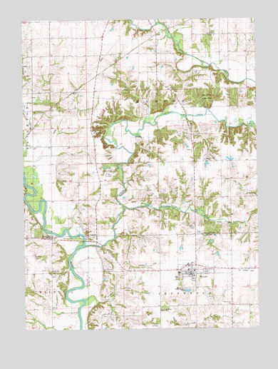
Wayland, IA USGS Topographic Map
Click on map above to begin viewing in our Map Viewer.

This topographic map contains these locations and features:
Feature Name Type Latitude Longitude GNIS ID View Map
Armstrong CemeteryCemeteryN41.1546°W91.7448°454238View Map
Bethel CemeteryCemeteryN41.1964°W91.6599°454549View Map
Bethel ChurchChurchN41.1967°W91.6596°454563View Map
City of CoppockCivilN41.1635°W91.7151°2393632View Map
City of WaylandCivilN41.1487°W91.6576°2397231View Map
CoppockPopulated PlaceN41.1622°W91.7113°465626View Map
Coppock (historical)LocaleN41.1622°W91.7113°1981402View Map
Coppock AccessLocaleN41.1653°W91.7252°1981605View Map
Coppock Post Office (historical)Post OfficeN41.1622°W91.7113°1981401View Map
Cottonwood CemeteryCemeteryN41.1488°W91.7026°455660View Map
Cottonwood ChurchChurchN41.1489°W91.7027°455661View Map
Crooked CreekStreamN41.1586°W91.7171°455732View Map
Custer CemeteryCemeteryN41.1922°W91.7124°455763View Map
Eicher CemeteryCemeteryN41.1783°W91.6265°456255View Map
Eicher Emmanuel ChurchChurchN41.1784°W91.6254°456256View Map
Eureka (historical)Populated PlaceN41.2206°W91.7138°465508View Map
Family Medicine Center of WaylandHospitalN41.1472°W91.6607°1981495View Map
Flower SchoolSchoolN41.1270°W91.6632°456645View Map
Haynes CemeteryCemeteryN41.1420°W91.7081°1981548View Map
Independent Bible ChurchChurchN41.1503°W91.6604°1981489View Map
Kurtz CemeteryCemeteryN41.1418°W91.7084°1981547View Map
Lake Post Office (historical)Post OfficeN41.2417°W91.6307°1981634View Map
Marcellus Post Office (historical)Post OfficeN41.2217°W91.7113°1981635View Map
Martin CemeteryCemeteryN41.2000°W91.6668°1981807View Map
New Life ParishChurchN41.1467°W91.6593°1981488View Map
North Hill CemeteryCemeteryN41.1664°W91.6595°459596View Map
Parkview HomeHospitalN41.1472°W91.6607°1981494View Map
Pleasant Hill CemeteryCemeteryN41.2436°W91.6477°460237View Map
Pleasant Hill ChurchChurchN41.2434°W91.6471°460260View Map
Schrock CemeteryCemeteryN41.2050°W91.7127°461479View Map
Shawnee CreekStreamN41.1372°W91.7174°461544View Map
Shiloh CemeteryCemeteryN41.2278°W91.6877°1981794View Map
Shively CemeteryCemeteryN41.1417°W91.7084°1981546View Map
Sockum Ridge County ParkParkN41.2184°W91.6504°461737View Map
Sockum Ridge Park TrailTrailN41.2195°W91.6516°1981790View Map
Sommers CemeteryCemeteryN41.1928°W91.6507°461751View Map
Sugar Creek CemeteryCemeteryN41.1347°W91.6346°462063View Map
Sugar Creek ChurchChurchN41.1347°W91.6402°462065View Map
Tick Ridge Woods County ParkParkN41.1336°W91.6752°1825046View Map
Tick Ridge Woods ParkParkN41.1347°W91.7043°1981394View Map
Township of MarionCivilN41.2072°W91.6733°468358View Map
Waco Junior / Senior High SchoolSchoolN41.1534°W91.6599°1981492View Map
Walnut CreekStreamN41.1881°W91.7493°462630View Map
WaylandPopulated PlaceN41.1472°W91.6607°462760View Map
Wayland (historical)LocaleN41.1497°W91.6607°1981496View Map
Wayland CemeteryCemeteryN41.1483°W91.6582°1981549View Map
Wayland City HallBuildingN41.1472°W91.6607°1981493View Map
Wayland Mennonite ChurchChurchN41.1472°W91.6607°1981490View Map
Wayland Post OfficePost OfficeN41.1472°W91.6607°1981491View Map
Wayland Volunteer Fire DepartmentBuildingN41.1487°W91.6600°2577477View Map
West ParkParkN41.1456°W91.6674°1825047View Map
Williams CreekStreamN41.1745°W91.6952°463057View Map

Note: Coordinates in the location and feature list above are referenced to NAD83 datum.


Copyright (C) 2008-2024 Ryan Niemi / Sunset Dynamics ... All Rights Reserved