TopoQuest Logo
Do you find TopoQuest useful?
Help keep TopoQuest running and adding new maps/features by donating!
Bitcoin:  19c7KJd3qBynnjoSw5npx9KScwjBe4ifkT
Litecoin:  LXs6TkuXGGXo1vDsWCkWVdjQX94eUKd6ui
Home View Maps Find Maps Find Places Resources & Links


Tamarack, Wisconsin Topographic Map

USGS Map Title: Tamarack, WI
USGS Map MRC: 44091B4
DRG (GeoTIFF) Download: o44091b4.tif


Neighboring USGS Topographic Map Quads:


  Swinns Valley, WI  
44091C5
 

  Independence, WI  
44091C4
 

  Whitehall, WI  
44091C3
 

  Dodge, WI  
44091B5
 

  Tamarack, WI  
44091B4
 

  Ettrick, WI  
44091B3
 

  Winona East, MN  
44091A5
 

  Trempealeau, WI  
44091A4
 

  Galesville, WI  
44091A3


Map MRC Location:

N45°
W92°
N45°
W91°
H8 H7 H6 H5 H4 H3 H2 H1
G8 G7 G6 G5 G4 G3 G2 G1
F8 F7 F6 F5 F4 F3 F2 F1
E8 E7 E6 E5 E4 E3 E2 E1
D8 D7 D6 D5 D4 D3 D2 D1
C8 C7 C6 C5 C4 C3 C2 C1
B8 B7 B6 B5 B4 B3 B2 B1
A8 A7 A6 A5 A4 A3 A2 A1
N44°
W92°
N44°
W91°

Tamarack, WI USGS 1:24K Topographic Map Preview:
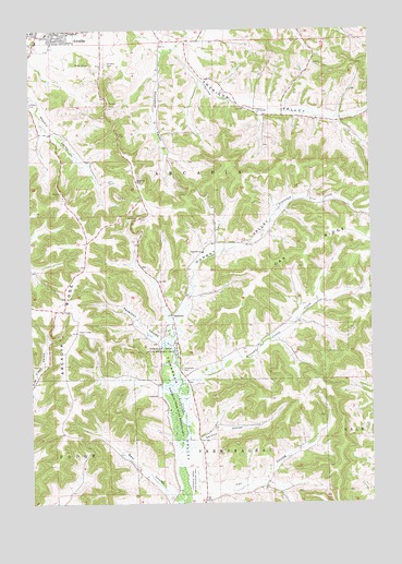
Tamarack, WI USGS Topographic Map
Click on map above to begin viewing in our Map Viewer.

This topographic map contains these locations and features:
Feature Name Type Latitude Longitude GNIS ID View Map
0.22 ReservoirReservoirN44.1950°W91.4768°1793488View Map
American ValleyValleyN44.2445°W91.4431°1560827View Map
American Valley School (historical)SchoolN44.2261°W91.3852°1851054View Map
Arcadia Ambulance ServiceBuildingN44.2468°W91.4973°2698231View Map
Arcadia CemeteryCemeteryN44.2416°W91.4715°1560927View Map
Arcadia High SchoolSchoolN44.2418°W91.4872°1851056View Map
Arcadia RidgeRidgeN44.1766°W91.4865°1560928View Map
Arcadia Ridge School (historical)SchoolN44.1764°W91.4924°1851058View Map
Bear CouleeValleyN44.1267°W91.4490°1561345View Map
City of ArcadiaCivilN44.2485°W91.4917°1582705View Map
Fox CouleeValleyN44.1276°W91.4361°1565204View Map
Franciscan Skemp Healthcare Arcadia ClinicHospitalN44.2468°W91.4975°1851168View Map
German CouleeValleyN44.1417°W91.4380°1565480View Map
German Goulee School (historical)SchoolN44.1439°W91.4354°1851104View Map
Holcomb Coulee CreekStreamN44.1566°W91.4446°1566536View Map
Holcomb School (historical)SchoolN44.1689°W91.4129°1851114View Map
Kolstad School (historical)SchoolN44.1689°W91.4527°1851122View Map
Newcomb ValleyValleyN44.2461°W91.4407°1570253View Map
Norway ValleyValleyN44.1704°W91.4466°1570549View Map
Norway Valley School (historical)SchoolN44.1936°W91.4307°1851139View Map
Oak RidgeRidgeN44.1933°W91.3927°1570678View Map
Penny School (historical)SchoolN44.2472°W91.4421°1851147View Map
Saint Stanislaus Catholic ChurchChurchN44.2491°W91.4935°1851169View Map
Schultz G9976 DamDamN44.1950°W91.4768°1793487View Map
Severson CouleeValleyN44.1680°W91.4525°1573928View Map
TamarackPopulated PlaceN44.1750°W91.4479°1577849View Map
Tamarack CemeteryCemeteryN44.1605°W91.4446°1575233View Map
Tamarack ChurchChurchN44.1914°W91.4360°1575234View Map
Tamarack Creek Bog State Natural AreaParkN44.1533°W91.4488°2061782View Map
Tamarack Creek State Wildlife AreaParkN44.1541°W91.4474°1575238View Map
Thompson ValleyValleyN44.2439°W91.4505°1575389View Map
Town of ArcadiaCivilN44.1975°W91.4799°1582706View Map
White School (historical)SchoolN44.1269°W91.4307°1851203View Map

Note: Coordinates in the location and feature list above are referenced to NAD83 datum.


Copyright (C) 2008-2024 Ryan Niemi / Sunset Dynamics ... All Rights Reserved