TopoQuest Logo
Do you find TopoQuest useful?
Help keep TopoQuest running and adding new maps/features by donating!
Bitcoin:  19c7KJd3qBynnjoSw5npx9KScwjBe4ifkT
Litecoin:  LXs6TkuXGGXo1vDsWCkWVdjQX94eUKd6ui
Home View Maps Find Maps Find Places Resources & Links


Ettrick, Wisconsin Topographic Map

USGS Map Title: Ettrick, WI
USGS Map MRC: 44091B3
DRG (GeoTIFF) Download: o44091b3.tif


Neighboring USGS Topographic Map Quads:


  Independence, WI  
44091C4
 

  Whitehall, WI  
44091C3
 

  Blair, WI  
44091C2
 

  Tamarack, WI  
44091B4
 

  Ettrick, WI  
44091B3
 

  Hegg, WI  
44091B2
 

  Trempealeau, WI  
44091A4
 

  Galesville, WI  
44091A3
 

  Stevenstown, WI  
44091A2


Map MRC Location:

N45°
W92°
N45°
W91°
H8 H7 H6 H5 H4 H3 H2 H1
G8 G7 G6 G5 G4 G3 G2 G1
F8 F7 F6 F5 F4 F3 F2 F1
E8 E7 E6 E5 E4 E3 E2 E1
D8 D7 D6 D5 D4 D3 D2 D1
C8 C7 C6 C5 C4 C3 C2 C1
B8 B7 B6 B5 B4 B3 B2 B1
A8 A7 A6 A5 A4 A3 A2 A1
N44°
W92°
N44°
W91°

Ettrick, WI USGS 1:24K Topographic Map Preview:
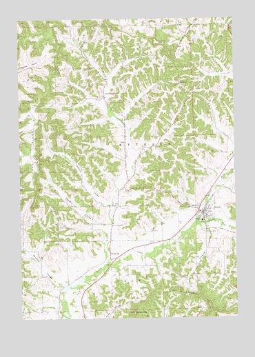
Ettrick, WI USGS Topographic Map
Click on map above to begin viewing in our Map Viewer.

This topographic map contains these locations and features:
Feature Name Type Latitude Longitude GNIS ID View Map
Abraham CouleeValleyN44.1385°W91.3505°1560666View Map
Bidwell CreekStreamN44.1359°W91.3497°2760868View Map
Chapultepec School (historical)SchoolN44.2225°W91.2799°1851079View Map
ChapultepeePopulated PlaceN44.2230°W91.2813°1577541View Map
EttrickPopulated PlaceN44.1683°W91.2690°1564705View Map
Ettrick CemeteryCemeteryN44.1725°W91.2801°1564706View Map
Ettrick Elementary SchoolSchoolN44.1677°W91.2669°1851095View Map
Ettrick Volunteer Fire DepartmentBuildingN44.1678°W91.2718°2697671View Map
French CreekStreamN44.1480°W91.3254°1565304View Map
French Creek ChurchChurchN44.1725°W91.3185°1565311View Map
FrenchvillePopulated PlaceN44.1497°W91.3229°1565318View Map
Frenchville School (historical)SchoolN44.1550°W91.3085°1851619View Map
IdunaPopulated PlaceN44.1986°W91.3127°1577654View Map
Johnson PeakSummitN44.1275°W91.3096°1567244View Map
Linderund CouleeValleyN44.1724°W91.3244°1568137View Map
Mais CreekStreamN44.1274°W91.3514°2760859View Map
Mason CouleeValleyN44.1622°W91.3273°1569114View Map
North Fork Beaver CreekStreamN44.1644°W91.2727°1570428View Map
Oak Ridge School (historical)SchoolN44.1922°W91.3674°1851141View Map
Saint Bridget CemeteryCemeteryN44.1608°W91.2682°1572870View Map
Smikrud CouleeValleyN44.1644°W91.2677°1574289View Map
Smith CreekStreamN44.1342°W91.3509°2760858View Map
Smith School (historical)SchoolN44.1383°W91.3513°1851174View Map
South Fork Beaver CreekStreamN44.1644°W91.2727°1574439View Map
Upper French CreekPopulated PlaceN44.2175°W91.3249°1577868View Map
Upper French Creek School (historical)SchoolN44.2177°W91.3263°1851192View Map
Village of EttrickCivilN44.1700°W91.2657°1583174View Map
Vor Frelsers CemeteryCemeteryN44.1641°W91.3218°1576129View Map
Wayside School (historical)SchoolN44.1786°W91.3174°1851199View Map

Note: Coordinates in the location and feature list above are referenced to NAD83 datum.


Copyright (C) 2008-2025 Ryan Niemi / Sunset Dynamics ... All Rights Reserved