TopoQuest Logo
Do you find TopoQuest useful?
Help keep TopoQuest running and adding new maps/features by donating!
Bitcoin:  19c7KJd3qBynnjoSw5npx9KScwjBe4ifkT
Litecoin:  LXs6TkuXGGXo1vDsWCkWVdjQX94eUKd6ui
Home View Maps Find Maps Find Places Resources & Links


Bloomfield, Missouri Topographic Map

USGS Map Title: Bloomfield, MO
USGS Map MRC: 36089H8
DRG (GeoTIFF) Download: o36089h8.tif


Neighboring USGS Topographic Map Quads:


  Sturdivant, MO  
37090A1
 

  Advance, MO  
37089A8
 

  Bell City, MO  
37089A7
 

  Acorn Ridge, MO  
36090H1
 

  Bloomfield, MO  
36089H8
 

  Clines Island, MO  
36089H7
 

  Dudley, MO  
36090G1
 

  Dexter, MO  
36089G8
 

  Essex, MO  
36089G7


Map MRC Location:

N37°
W90°
N37°
W89°
H8 H7 H6 H5 H4 H3 H2 H1
G8 G7 G6 G5 G4 G3 G2 G1
F8 F7 F6 F5 F4 F3 F2 F1
E8 E7 E6 E5 E4 E3 E2 E1
D8 D7 D6 D5 D4 D3 D2 D1
C8 C7 C6 C5 C4 C3 C2 C1
B8 B7 B6 B5 B4 B3 B2 B1
A8 A7 A6 A5 A4 A3 A2 A1
N36°
W90°
N36°
W89°

Bloomfield, MO USGS 1:24K Topographic Map Preview:
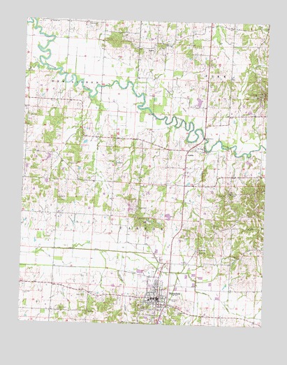
Bloomfield, MO USGS Topographic Map
Click on map above to begin viewing in our Map Viewer.

This topographic map contains these locations and features:
Feature Name Type Latitude Longitude GNIS ID View Map
AquillaPopulated PlaceN36.9470°W89.9148°713363View Map
BloomfieldPopulated PlaceN36.8859°W89.9293°714383View Map
Bloomfield CemeteryCemeteryN36.8803°W89.9190°714385View Map
Bloomfield Fire Department Station 1BuildingN36.8854°W89.9300°2621058View Map
Bloomfield Fire Department Station 2BuildingN36.8876°W89.9319°2621766View Map
Bloomfield Police DepartmentBuildingN36.8850°W89.9300°2752313View Map
Bloomfield Post OfficePost OfficeN36.8874°W89.9294°2782772View Map
Buckhorn SchoolSchoolN36.9401°W89.9262°747674View Map
City of BloomfieldCivilN36.8878°W89.9309°2394194View Map
EzellLocaleN36.9451°W89.9837°740300View Map
George CemeteryCemeteryN36.9998°W89.9867°718397View Map
Gravel Hill ChurchChurchN36.9701°W89.8804°735632View Map
Gum Point SchoolSchoolN36.9923°W89.9601°747668View Map
Hendley Lake DamDamN36.9651°W89.9101°765545View Map
Joe Hendley LakeReservoirN36.9674°W89.9101°765546View Map
Liberty ChurchChurchN36.9031°W89.8879°720968View Map
Liberty SchoolSchoolN36.9028°W89.8873°747677View Map
Lick Creek CemeteryCemeteryN36.8873°W89.9979°721031View Map
Lick Creek Chapel (historical)ChurchN36.8878°W89.9979°747672View Map
Link CemeteryCemeteryN36.9164°W89.9015°721114View Map
Link ChurchChurchN36.9292°W89.8929°721117View Map
Link CreekStreamN36.9484°W89.8976°721118View Map
Link School (historical)SchoolN36.9292°W89.8934°747675View Map
Mount Pisgah ChurchChurchN36.9476°W89.9070°722842View Map
Mount Zion ChurchChurchN36.9062°W89.9090°735736View Map
Mud CreekStreamN36.9809°W89.9904°723018View Map
North Antioch CemeteryCemeteryN36.9228°W89.9404°723428View Map
North Antioch School (historical)SchoolN36.9164°W89.9356°747676View Map
Oak Ridge ChurchChurchN36.9906°W89.9248°735760View Map
Old Shawnee Village (historical)Populated PlaceN36.9439°W89.8924°2437109View Map
Philadelphia ChurchChurchN36.9417°W89.9523°724285View Map
Philadelphia School (historical)SchoolN36.9417°W89.9534°747670View Map
Pleasant Valley SchoolSchoolN36.9201°W89.9954°747671View Map
ProffersLocaleN36.9764°W89.9331°740299View Map
Stoddard County Sheriff's OfficeBuildingN36.8848°W89.9287°2752419View Map
Tedrick CreekStreamN36.9045°W89.9479°727517View Map
Township of CastorCivilN36.8852°W89.9398°767416View Map
Union Grove ChurchChurchN36.9989°W89.9637°728011View Map
Walker CemeteryCemeteryN36.9048°W89.9090°728255View Map
Wambel CemeteryCemeteryN36.9409°W89.9765°728333View Map
West Antioch CemeteryCemeteryN36.8803°W89.9801°728525View Map
West Antioch School (historical)SchoolN36.8878°W89.9837°747673View Map
Whites LakeReservoirN36.9197°W89.9246°765536View Map
Whites Lake DamDamN36.9201°W89.9251°765535View Map
ZadockPopulated PlaceN36.9889°W89.9373°741378View Map
Zion ChurchChurchN36.9601°W89.9965°729252View Map
Zion School (historical)SchoolN36.9601°W89.9956°747669View Map

Note: Coordinates in the location and feature list above are referenced to NAD83 datum.


Copyright (C) 2008-2024 Ryan Niemi / Sunset Dynamics ... All Rights Reserved