TopoQuest Logo
Do you find TopoQuest useful?
Help keep TopoQuest running and adding new maps/features by donating!
Bitcoin:  19c7KJd3qBynnjoSw5npx9KScwjBe4ifkT
Litecoin:  LXs6TkuXGGXo1vDsWCkWVdjQX94eUKd6ui
Home View Maps Find Maps Find Places Resources & Links


Sulphur Well, Kentucky Topographic Map

USGS Map Title: Sulphur Well, KY
USGS Map MRC: 37085A6
DRG (GeoTIFF) Download: o37085a6.tif


Neighboring USGS Topographic Map Quads:


  Park, KY  
37085B7
 

  Center, KY  
37085B6
 

  Exie, KY  
37085B5
 

  Hiseville, KY  
37085A7
 

  Sulphur Well, KY  
37085A6
 

  East Fork, KY  
37085A5
 

  Temple Hill, KY  
36085H7
 

  Summer Shade, KY  
36085H6
 

  Edmonton, KY  
36085H5


Map MRC Location:

N38°
W86°
N38°
W85°
H8 H7 H6 H5 H4 H3 H2 H1
G8 G7 G6 G5 G4 G3 G2 G1
F8 F7 F6 F5 F4 F3 F2 F1
E8 E7 E6 E5 E4 E3 E2 E1
D8 D7 D6 D5 D4 D3 D2 D1
C8 C7 C6 C5 C4 C3 C2 C1
B8 B7 B6 B5 B4 B3 B2 B1
A8 A7 A6 A5 A4 A3 A2 A1
N37°
W86°
N37°
W85°

Sulphur Well, KY USGS 1:24K Topographic Map Preview:
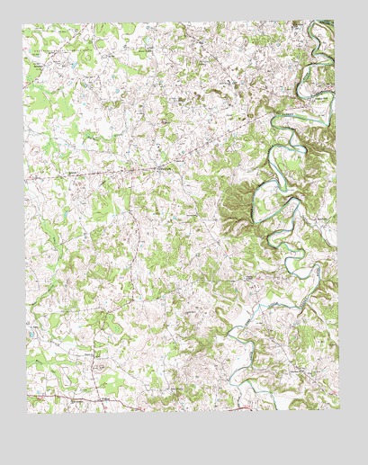
Sulphur Well, KY USGS Topographic Map
Click on map above to begin viewing in our Map Viewer.

This topographic map contains these locations and features:
Feature Name Type Latitude Longitude GNIS ID View Map
Antioch ChurchChurchN37.0806°W85.6883°485978View Map
BeechvillePopulated PlaceN37.0614°W85.6327°507480View Map
Bethlehem ChurchChurchN37.0764°W85.7319°487018View Map
Big Blue SpringSpringN37.0209°W85.7256°2742630View Map
Buck Hill CemeteryCemeteryN37.1125°W85.7339°488225View Map
Cave BranchStreamN37.0581°W85.6316°489112View Map
Center DivisionCivilN37.0989°W85.6749°1936928View Map
Clarks CornerPopulated PlaceN37.0420°W85.6611°507708View Map
Dripping Spring ChurchChurchN37.0042°W85.7319°491121View Map
Dry Fork CreekStreamN37.0078°W85.6655°491217View Map
Ebenezer ChurchChurchN37.0628°W85.6800°491538View Map
EchoPopulated PlaceN37.0278°W85.7475°507904View Map
Good Hope ChurchChurchN37.0123°W85.6391°492955View Map
Knob LickPopulated PlaceN37.0784°W85.6944°508404View Map
Knob Lick CreekStreamN37.0837°W85.6953°2742633View Map
Locust Grove ChurchChurchN37.0314°W85.6855°496954View Map
New LibertyPopulated PlaceN37.0076°W85.6930°508693View Map
North Metcalfe Elementary SchoolSchoolN37.1059°W85.6674°499580View Map
Pleasant Valley ChurchChurchN37.1156°W85.6964°500925View Map
SavoyardPopulated PlaceN37.1120°W85.7411°509020View Map
Seven Springs Cumberlanld Presbyterian ChurchChurchN37.1229°W85.6407°503184View Map
Sulphur CreekStreamN37.0648°W85.6402°504733View Map
Sulphur WellLocaleN37.0992°W85.6336°504776View Map
Ten Acre BranchStreamN37.0976°W85.7077°505066View Map
WisdomPopulated PlaceN37.0039°W85.7200°509389View Map
Wisdom Cumberland Presbyterian ChurchChurchN37.0184°W85.7231°506967View Map

Note: Coordinates in the location and feature list above are referenced to NAD83 datum.


Copyright (C) 2008-2025 Ryan Niemi / Sunset Dynamics ... All Rights Reserved