TopoQuest Logo
Do you find TopoQuest useful?
Help keep TopoQuest running and adding new maps/features by donating!
Bitcoin:  19c7KJd3qBynnjoSw5npx9KScwjBe4ifkT
Litecoin:  LXs6TkuXGGXo1vDsWCkWVdjQX94eUKd6ui
Home View Maps Find Maps Find Places Resources & Links


Tenaha East, Texas Topographic Map

USGS Map Title: Tenaha East, TX
USGS Map MRC: 31094H2
DRG (GeoTIFF) Download: o31094h2.tif


Neighboring USGS Topographic Map Quads:


  Gary, TX  
32094A3
 

  Old Center, TX  
32094A2
 

  Galloway, TX  
32094A1
 

  Tenaha West, TX  
31094H3
 

  Tenaha East, TX  
31094H2
 

  Logansport West, LA  
31094H1
 

  Arcadia, TX  
31094G3
 

  Center, TX  
31094G2
 

  Shelbyville, TX  
31094G1


Map MRC Location:

N32°
W95°
N32°
W94°
H8 H7 H6 H5 H4 H3 H2 H1
G8 G7 G6 G5 G4 G3 G2 G1
F8 F7 F6 F5 F4 F3 F2 F1
E8 E7 E6 E5 E4 E3 E2 E1
D8 D7 D6 D5 D4 D3 D2 D1
C8 C7 C6 C5 C4 C3 C2 C1
B8 B7 B6 B5 B4 B3 B2 B1
A8 A7 A6 A5 A4 A3 A2 A1
N31°
W95°
N31°
W94°

Tenaha East, TX USGS 1:24K Topographic Map Preview:
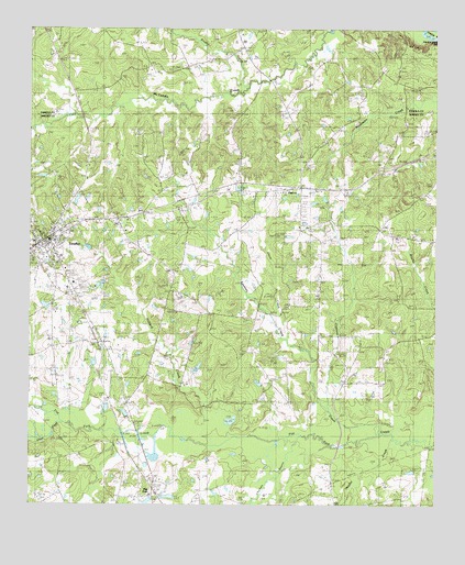
Tenaha East, TX USGS Topographic Map
Click on map above to begin viewing in our Map Viewer.

This topographic map contains these locations and features:
Feature Name Type Latitude Longitude GNIS ID View Map
Brushy CreekStreamN31.9843°W94.1821°1353053View Map
Chicken BayouStreamN31.8907°W94.1705°1354380View Map
Cypress CreekStreamN31.9018°W94.1569°1355517View Map
Dry CreekStreamN31.8902°W94.1533°1356334View Map
Flat ForkPopulated PlaceN31.8810°W94.2110°1379775View Map
Hilliard CreekStreamN31.8929°W94.1844°1359273View Map
Jericho CreekStreamN31.8910°W94.1263°1360223View Map
Lone Oak CemeteryCemeteryN31.9069°W94.1758°1361651View Map
Old Home ChurchChurchN31.9279°W94.1683°1364436View Map
PaxtonPopulated PlaceN31.9579°W94.1652°1380332View Map
Peddy LakeReservoirN31.9105°W94.1989°1864170View Map
Peddy Lake DamDamN31.9085°W94.2019°1864169View Map
Pleasant Hill ChurchChurchN31.9491°W94.2233°1365433View Map
Ramah ChurchChurchN31.9521°W94.2158°1365977View Map
Restland CemeteryCemeteryN31.9321°W94.2360°1366379View Map
Shoat CreekStreamN31.9188°W94.1688°1368214View Map
Smith CreekStreamN31.8991°W94.2419°1350822View Map
Smith CreekStreamN31.8960°W94.2416°1368481View Map
Spinney CreekStreamN31.8927°W94.1455°1368912View Map
TenahaPopulated PlaceN31.9438°W94.2441°1369702View Map
Tenaha City HallBuildingN31.9445°W94.2443°2753798View Map
Tenaha City MarshalBuildingN31.9445°W94.2443°2751199View Map
Tenaha Police DepartmentBuildingN31.9442°W94.2431°2751368View Map
Tenaha Post OfficePost OfficeN31.9432°W94.2461°2732137View Map
Tenaha Volunteer Fire DepartmentBuildingN31.9440°W94.2449°2655587View Map
Town of TenahaCivilN31.9440°W94.2457°2413374View Map
Truitt ChapelChurchN31.9746°W94.1324°1370160View Map
Union CemeteryCemeteryN31.9177°W94.2283°1370436View Map
Valmac LakeReservoirN31.9330°W94.2283°1864168View Map
Valmac Lake DamDamN31.9335°W94.2285°1864167View Map
Willow Grove ChurchChurchN31.9452°W94.1358°1371654View Map

Note: Coordinates in the location and feature list above are referenced to NAD83 datum.


Copyright (C) 2008-2025 Ryan Niemi / Sunset Dynamics ... All Rights Reserved