TopoQuest Logo
Do you find TopoQuest useful?
Help keep TopoQuest running and adding new maps/features by donating!
Bitcoin:  19c7KJd3qBynnjoSw5npx9KScwjBe4ifkT
Litecoin:  LXs6TkuXGGXo1vDsWCkWVdjQX94eUKd6ui
Home View Maps Find Maps Find Places Resources & Links


Blue Canyon, California Topographic Map

USGS Map Title: Blue Canyon, CA
USGS Map MRC: 39120C6
DRG (GeoTIFF) Download: o39120c6.tif


Neighboring USGS Topographic Map Quads:


  Alleghany, CA  
39120D7
 

  Graniteville, CA  
39120D6
 

  English Mountain, CA  
39120D5
 

  Washington, CA  
39120C7
 

  Blue Canyon, CA  
39120C6
 

  Cisco Grove, CA  
39120C5
 

  Dutch Flat, CA  
39120B7
 

  Westville, CA  
39120B6
 

  Duncan Peak, CA  
39120B5


Map MRC Location:

N40°
W121°
N40°
W120°
H8 H7 H6 H5 H4 H3 H2 H1
G8 G7 G6 G5 G4 G3 G2 G1
F8 F7 F6 F5 F4 F3 F2 F1
E8 E7 E6 E5 E4 E3 E2 E1
D8 D7 D6 D5 D4 D3 D2 D1
C8 C7 C6 C5 C4 C3 C2 C1
B8 B7 B6 B5 B4 B3 B2 B1
A8 A7 A6 A5 A4 A3 A2 A1
N39°
W121°
N39°
W120°

Blue Canyon, CA USGS 1:24K Topographic Map Preview:
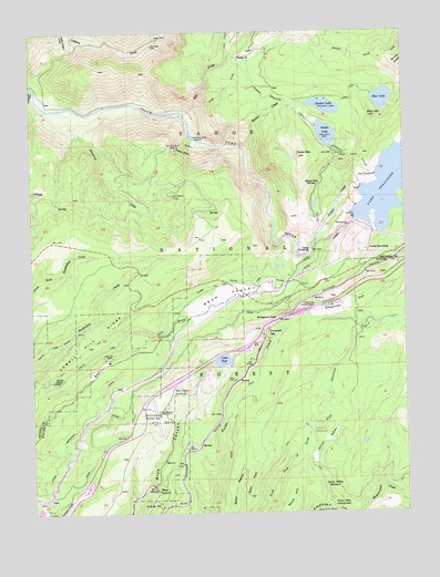
Blue Canyon, CA USGS Topographic Map
Click on map above to begin viewing in our Map Viewer.

This topographic map contains these locations and features:
Feature Name Type Latitude Longitude GNIS ID View Map
Arctic MineMineN39.3732°W120.7072°256312View Map
Bear ValleyValleyN39.3004°W120.6984°256713View Map
Bear Valley (historical)Populated PlaceN39.3093°W120.6844°1682840View Map
Bear Valley CampgroundLocaleN39.3074°W120.6669°276055View Map
Black Oak SpringSpringN39.3352°W120.6546°257147View Map
Blue CanyonPopulated PlaceN39.2571°W120.7110°257228View Map
Blue Canyon - Nyack AirportAirportN39.2745°W120.7091°1653434View Map
Blue Canyon Guard StationLocaleN39.2824°W120.7041°257229View Map
Blue Canyon Post OfficePost OfficeN39.2549°W120.7097°1662463View Map
Blue Canyon Weather StationLocaleN39.2755°W120.7085°257231View Map
Blue LakeLakeN39.3572°W120.6327°257253View Map
Blue Lake 97-012 DamDamN39.3582°W120.6360°1663594View Map
Bowman-Spaulding Conduit FlumeCanalN39.3585°W120.6710°266482View Map
Camp NineteenLocaleN39.3682°W120.6802°257848View Map
Camp SpauldingPopulated PlaceN39.3191°W120.6380°1658204View Map
Carpenter FlatFlatN39.3041°W120.6444°257991View Map
Clear CreekStreamN39.3691°W120.6838°258430View Map
Clyde MountainSummitN39.3427°W120.6605°258487View Map
Diamond CreekStreamN39.3549°W120.7405°259341View Map
Drum CanalCanalN39.2896°W120.7030°259536View Map
Eagle Bird (historical)Populated PlaceN39.3466°W120.6966°1682879View Map
Eagle Bird MineMineN39.3471°W120.6963°259649View Map
Eagle Bird TrailTrailN39.3446°W120.6980°259650View Map
Emigrant GapPopulated PlaceN39.2968°W120.6727°1658500View Map
Emigrant GapGapN39.3005°W120.6683°259908View Map
Emigrant Gap Elementary SchoolSchoolN39.2979°W120.6713°1723342View Map
Emigrant Gap Historical MarkerParkN39.3032°W120.6563°259909View Map
Emigrant Gap Scenic ViewpointLocaleN39.2938°W120.6819°276058View Map
Fall CreekStreamN39.3532°W120.6991°260028View Map
Fuller LakeReservoirN39.3484°W120.6517°260445View Map
Fuller Lake 97-021 DamDamN39.3449°W120.6494°1663599View Map
Fuller Lake CampgroundLocaleN39.3491°W120.6549°276052View Map
Gold Bug MineMineN39.3443°W120.7022°260641View Map
Golden Quartz Picnic AreaLocaleN39.3596°W120.7472°276051View Map
IDS OrganizationLocaleN39.2743°W120.6791°1662464View Map
Jordan CreekStreamN39.3205°W120.6558°262016View Map
Lake PuttReservoirN39.2894°W120.6871°265072View Map
Lake SpauldingReservoirN39.3359°W120.6298°267558View Map
Lake Spaulding 97-029 DamDamN39.3268°W120.6433°1663606View Map
Lake Spaulding CampgroundLocaleN39.3224°W120.6338°276056View Map
Lang CrossingCrossingN39.3188°W120.6572°1682908View Map
Langs (historical)Populated PlaceN39.3199°W120.6577°1682909View Map
Last Chance MineMineN39.3321°W120.7027°262337View Map
Levey Ditch CampLocaleN39.2852°W120.7408°262421View Map
Little Canyon CreekStreamN39.3710°W120.7391°262560View Map
Lowell Hill RidgeRidgeN39.2852°W120.7460°263001View Map
Maybert (historical)Populated PlaceN39.3527°W120.6997°1682918View Map
Monumental Creek TrailTrailN39.2588°W120.6272°263780View Map
Mountain View MineMineN39.3716°W120.7097°263910View Map
North Fork CampgroundLocaleN39.2705°W120.6588°1670059View Map
OmegaPopulated PlaceN39.3332°W120.7494°1659304View Map
Onion ValleyValleyN39.2518°W120.6541°264376View Map
Onion Valley Spring TwoSpringN39.2569°W120.6529°264378View Map
Putnam ValleyFlatN39.2841°W120.6755°1701177View Map
Putts Lake 311-004 DamDamN39.2882°W120.6894°1663823View Map
Rim PowerhouseLocaleN39.3377°W120.6355°1654403View Map
Rucker CreekStreamN39.3443°W120.6791°265658View Map
Rucker LakeReservoirN39.3555°W120.6521°265659View Map
Rucker Lake 97-044 DamDamN39.3566°W120.6577°1663620View Map
Sailor PointCliffN39.2541°W120.6791°265736View Map
Scott HillSummitN39.2555°W120.6649°1659611View Map
South Yuba CanalCanalN39.2913°W120.7302°267539View Map
The BalloonLocaleN39.2660°W120.6980°268173View Map
Trap CreekStreamN39.3555°W120.6952°268385View Map
Tunnel Mills CampgroundLocaleN39.2527°W120.6527°268473View Map
Zeibright MineMineN39.2907°W120.7272°269391View Map
Zion HillSummitN39.3530°W120.6352°269398View Map
Zion Hill TunnelTunnelN39.3432°W120.6452°269399View Map

Note: Coordinates in the location and feature list above are referenced to NAD83 datum.


Copyright (C) 2008-2024 Ryan Niemi / Sunset Dynamics ... All Rights Reserved