TopoQuest Logo
Do you find TopoQuest useful?
Help keep TopoQuest running and adding new maps/features by donating!
Bitcoin:  19c7KJd3qBynnjoSw5npx9KScwjBe4ifkT
Litecoin:  LXs6TkuXGGXo1vDsWCkWVdjQX94eUKd6ui
Home View Maps Find Maps Find Places Resources & Links


Washington, California Topographic Map

USGS Map Title: Washington, CA
USGS Map MRC: 39120C7
DRG (GeoTIFF) Download: o39120c7.tif


Neighboring USGS Topographic Map Quads:


  Pike, CA  
39120D8
 

  Alleghany, CA  
39120D7
 

  Graniteville, CA  
39120D6
 

  North Bloomfield, CA  
39120C8
 

  Washington, CA  
39120C7
 

  Blue Canyon, CA  
39120C6
 

  Chicago Park, CA  
39120B8
 

  Dutch Flat, CA  
39120B7
 

  Westville, CA  
39120B6


Map MRC Location:

N40°
W121°
N40°
W120°
H8 H7 H6 H5 H4 H3 H2 H1
G8 G7 G6 G5 G4 G3 G2 G1
F8 F7 F6 F5 F4 F3 F2 F1
E8 E7 E6 E5 E4 E3 E2 E1
D8 D7 D6 D5 D4 D3 D2 D1
C8 C7 C6 C5 C4 C3 C2 C1
B8 B7 B6 B5 B4 B3 B2 B1
A8 A7 A6 A5 A4 A3 A2 A1
N39°
W121°
N39°
W120°

Washington, CA USGS 1:24K Topographic Map Preview:
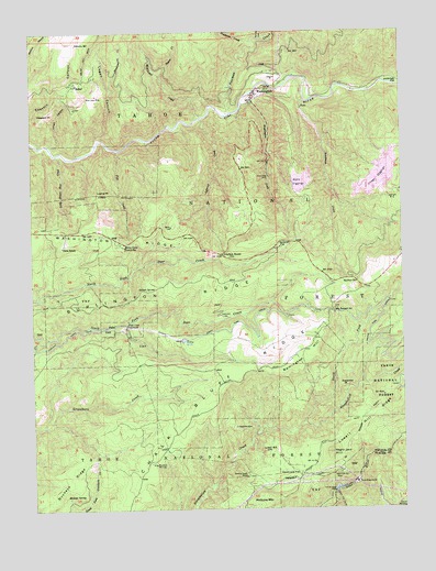
Washington, CA USGS Topographic Map
Click on map above to begin viewing in our Map Viewer.

This topographic map contains these locations and features:
Feature Name Type Latitude Longitude GNIS ID View Map
Alpha (historical)Populated PlaceN39.3305°W120.7824°1682829View Map
Alpha DiggingsMineN39.3355°W120.7872°218162View Map
Big Tunnel SpringSpringN39.3019°W120.7742°219273View Map
Blue Lead MineMineN39.3585°W120.8533°219502View Map
Buckeye SpringSpringN39.2532°W120.8643°220046View Map
Burlington RidgeRidgeN39.3063°W120.8324°220193View Map
Canyon CreekStreamN39.3610°W120.7502°257945View Map
Chalk Bluff RidgeRidgeN39.2566°W120.8411°220883View Map
Dana RanchLocaleN39.3191°W120.8652°222005View Map
Deadman CreekStreamN39.3724°W120.7997°222116View Map
Deadmans FlatFlatN39.2591°W120.7885°222130View Map
Deer Creek Forehay Recreation SiteLocaleN39.2938°W120.8241°1662542View Map
Deer Creek PowerhouseLocaleN39.2982°W120.8441°1654226View Map
Democrat (historical)Populated PlaceN39.2832°W120.7794°1682872View Map
Demory SpringSpringN39.3721°W120.8604°222258View Map
Devils CanyonValleyN39.3735°W120.7974°222290View Map
Drum PowerhouseLocaleN39.2563°W120.7672°1654237View Map
ExcelsiorCliffN39.2827°W120.7708°223306View Map
Fish CreekStreamN39.3443°W120.8463°223527View Map
Giant King MineMineN39.3368°W120.7949°224147View Map
Holbrook FlatFlatN39.3613°W120.7516°225436View Map
Indian SpringSpringN39.3071°W120.8347°234071View Map
Jefferson CreekStreamN39.3524°W120.8177°226164View Map
Junction HousePopulated PlaceN39.3166°W120.8111°252708View Map
King Woolford Mill SiteMineN39.2618°W120.8363°226598View Map
Little Brown Bear CreekStreamN39.3427°W120.8674°227203View Map
Logan CanyonValleyN39.3471°W120.8536°227473View Map
Lowell HillLocaleN39.2657°W120.7960°227756View Map
Lupine PointCliffN39.3338°W120.8536°227843View Map
Mammoth Spring MineMineN39.2588°W120.7738°227997View Map
McGuire MountainSummitN39.2521°W120.7955°1659087View Map
McKilligan CreekStreamN39.3524°W120.8177°228397View Map
Negro Jack HillSummitN39.2649°W120.7758°229455View Map
Nevada CountyCivilN39.3014°W120.7688°1682927View Map
New Drum Afterbay 97-128 DamDamN39.2544°W120.7748°1663685View Map
North Fork Steephollow CreekStreamN39.2724°W120.7847°234376View Map
Omega DiggingsMineN39.3360°W120.7588°230034View Map
Omega Rest AreaLocaleN39.3163°W120.7502°276057View Map
Pineaire CampgroundLocaleN39.3610°W120.8002°277210View Map
Pleasant PointSummitN39.3538°W120.8705°230809View Map
Poorman CreekStreamN39.3530°W120.8097°230936View Map
ReliefPopulated PlaceN39.3613°W120.8608°255032View Map
Remington HillSummitN39.2982°W120.7772°1659498View Map
Remington Hill (historical)Populated PlaceN39.2785°W120.7938°1682953View Map
River Rest CampgroundLocaleN39.3546°W120.7999°277218View Map
Roscoe CreekStreamN39.3632°W120.8308°231878View Map
Rose Mountain MineMineN39.2713°W120.8072°231887View Map
Sardine SpringSpringN39.3093°W120.7663°232583View Map
Scotchman CreekStreamN39.3566°W120.7824°232714View Map
Skillman CampgroundLocaleN39.3182°W120.7902°277209View Map
Skillman FlatFlatN39.3193°W120.7922°233197View Map
Swamp Angel MineMineN39.2582°W120.8047°235867View Map
Thimbleberry CreekStreamN39.3605°W120.8488°236240View Map
Towle Mill SiteLocaleN39.3005°W120.8124°236479View Map
Union CanyonValleyN39.3449°W120.8697°236783View Map
Upper Boardman CanalCanalN39.2557°W120.7544°236873View Map
WashingtonPopulated PlaceN39.3593°W120.7991°1660130View Map
Washington Census Designated PlaceCensusN39.3592°W120.7905°2628797View Map
Washington CreekStreamN39.3557°W120.8038°237273View Map
Washington Elementary SchoolSchoolN39.3582°W120.8000°1682991View Map
Washington Fire DepartmentBuildingN39.3587°W120.8003°2622279View Map
Washington Post OfficePost OfficeN39.3568°W120.8011°2769524View Map
White Cloud CampgroundLocaleN39.3205°W120.8463°277213View Map
White Cloud Guard StationLocaleN39.3182°W120.8444°237637View Map
White Cloud Picnic AreaLocaleN39.3210°W120.8444°277212View Map
Zeibright MineMineN39.3313°W120.7555°238310View Map

Note: Coordinates in the location and feature list above are referenced to NAD83 datum.


Copyright (C) 2008-2025 Ryan Niemi / Sunset Dynamics ... All Rights Reserved