TopoQuest Logo
Do you find TopoQuest useful?
Help keep TopoQuest running and adding new maps/features by donating!
Bitcoin:  19c7KJd3qBynnjoSw5npx9KScwjBe4ifkT
Litecoin:  LXs6TkuXGGXo1vDsWCkWVdjQX94eUKd6ui
Home View Maps Find Maps Find Places Resources & Links


Blue Mounds, Wisconsin Topographic Map

USGS Map Title: Blue Mounds, WI
USGS Map MRC: 43089A7
DRG (GeoTIFF) Download: o43089a7.tif


Neighboring USGS Topographic Map Quads:


  Arena, WI  
43089B8
 

  Mazomanie, WI  
43089B7
 

  Black Earth, WI  
43089B6
 

  Barneveld, WI  
43089A8
 

  Blue Mounds, WI  
43089A7
 

  Cross Plains, WI  
43089A6
 

  Hollandale, WI  
42089H8
 

  Daleyville, WI  
42089H7
 

  Mount Vernon, WI  
42089H6


Map MRC Location:

N44°
W90°
N44°
W89°
H8 H7 H6 H5 H4 H3 H2 H1
G8 G7 G6 G5 G4 G3 G2 G1
F8 F7 F6 F5 F4 F3 F2 F1
E8 E7 E6 E5 E4 E3 E2 E1
D8 D7 D6 D5 D4 D3 D2 D1
C8 C7 C6 C5 C4 C3 C2 C1
B8 B7 B6 B5 B4 B3 B2 B1
A8 A7 A6 A5 A4 A3 A2 A1
N43°
W90°
N43°
W89°

Blue Mounds, WI USGS 1:24K Topographic Map Preview:
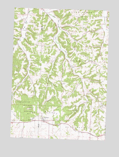
Blue Mounds, WI USGS Topographic Map
Click on map above to begin viewing in our Map Viewer.

This topographic map contains these locations and features:
Feature Name Type Latitude Longitude GNIS ID View Map
BitsedalenValleyN43.1049°W89.7536°1843064View Map
Blue Mound State ParkParkN43.0281°W89.8529°1561949View Map
Blue MoundsSummitN43.0253°W89.8396°1561945View Map
Blue MoundsPopulated PlaceN43.0175°W89.8323°1561946View Map
Blue Mounds Police DepartmentBuildingN43.0185°W89.8337°2759495View Map
Blue Mounds Wastewater Treatment PlantLocaleN43.0119°W89.8356°2709440View Map
Bohn CreekStreamN43.0467°W89.7798°1562024View Map
Brigham ParkParkN43.0281°W89.8176°1562203View Map
Deneen SchoolSchoolN43.0533°W89.8098°1563899View Map
ElversPopulated PlaceN43.0697°W89.7979°1577589View Map
Elvers CreekStreamN43.0925°W89.8196°1564599View Map
Hylee FarmLocaleN43.0500°W89.7644°2629147View Map
Little NorwayPopulated PlaceN43.0269°W89.7896°1568337View Map
Moen CreekStreamN43.0350°W89.7585°1569630View Map
Pleasant ValleyValleyN43.1051°W89.8124°1571636View Map
Pleasure ValleyValleyN43.0521°W89.8219°1571680View Map
Ryan CreekStreamN43.0875°W89.8126°1572764View Map
Saint James Catholic CemeteryCemeteryN43.0563°W89.8096°2781295View Map
Saint James ChurchChurchN43.0564°W89.8110°1572978View Map
Sand RidgeRidgeN43.0717°W89.7590°1573699View Map
Town of VermontCivilN43.0754°W89.7791°1729677View Map
VermontPopulated PlaceN43.0722°W89.7857°1582283View Map
Village of Blue MoundsCivilN43.0178°W89.8269°1582837View Map
Walnut HollowValleyN43.0610°W89.8545°1576179View Map
West Blue Mounds Lutheran CemeteryCemeteryN43.0138°W89.8249°2781308View Map

Note: Coordinates in the location and feature list above are referenced to NAD83 datum.


Copyright (C) 2008-2025 Ryan Niemi / Sunset Dynamics ... All Rights Reserved