TopoQuest Logo
Do you find TopoQuest useful?
Help keep TopoQuest running and adding new maps/features by donating!
Bitcoin:  19c7KJd3qBynnjoSw5npx9KScwjBe4ifkT
Litecoin:  LXs6TkuXGGXo1vDsWCkWVdjQX94eUKd6ui
Home View Maps Find Maps Find Places Resources & Links


Daleyville, Wisconsin Topographic Map

USGS Map Title: Daleyville, WI
USGS Map MRC: 42089H7
DRG (GeoTIFF) Download: o42089h7.tif


Neighboring USGS Topographic Map Quads:


  Barneveld, WI  
43089A8
 

  Blue Mounds, WI  
43089A7
 

  Cross Plains, WI  
43089A6
 

  Hollandale, WI  
42089H8
 

  Daleyville, WI  
42089H7
 

  Mount Vernon, WI  
42089H6
 

  Yellowstone Lake, WI  
42089G8
 

  Blanchardville, WI  
42089G7
 

  New Glarus, WI  
42089G6


Map MRC Location:

N43°
W90°
N43°
W89°
H8 H7 H6 H5 H4 H3 H2 H1
G8 G7 G6 G5 G4 G3 G2 G1
F8 F7 F6 F5 F4 F3 F2 F1
E8 E7 E6 E5 E4 E3 E2 E1
D8 D7 D6 D5 D4 D3 D2 D1
C8 C7 C6 C5 C4 C3 C2 C1
B8 B7 B6 B5 B4 B3 B2 B1
A8 A7 A6 A5 A4 A3 A2 A1
N42°
W90°
N42°
W89°

Daleyville, WI USGS 1:24K Topographic Map Preview:
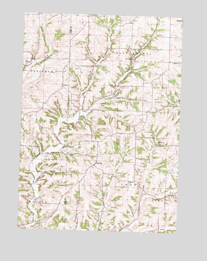
Daleyville, WI USGS Topographic Map
Click on map above to begin viewing in our Map Viewer.

This topographic map contains these locations and features:
Feature Name Type Latitude Longitude GNIS ID View Map
Atkins Ridge AirportAirportN42.9477°W89.8241°1581937View Map
Barber SchoolSchoolN42.9586°W89.8432°1561158View Map
Cardinal Ridge AirportAirportN42.8837°W89.7517°2444186View Map
DaleyvillePopulated PlaceN42.9150°W89.8148°1563674View Map
Docken FieldAirportN42.9911°W89.7535°1582098View Map
Drumon ValleyValleyN42.8758°W89.8314°1564112View Map
ForwardPopulated PlaceN42.8969°W89.7562°1577603View Map
Forward SchoolSchoolN42.8947°W89.7640°1565160View Map
German ValleyValleyN42.9427°W89.8250°1565485View Map
German Valley BranchStreamN42.9417°W89.8307°1577359View Map
German Valley CemeteryCemeteryN42.9807°W89.7891°1565488View Map
German Valley SchoolSchoolN42.9750°W89.7893°1565490View Map
Hauge ChurchChurchN42.9039°W89.7890°1566140View Map
Hauge ChurchChurchN42.9300°W89.8204°1566141View Map
Hauge Log Church CemeteryCemeteryN42.9302°W89.8196°2781264View Map
Hauge Lutheran CemeteryCemeteryN42.9041°W89.7890°2781265View Map
Holy Redeemer CemeteryCemeteryN42.9263°W89.7657°2781267View Map
Holy Redeemer ChurchChurchN42.9264°W89.7665°1566616View Map
Indian Hill RidgeRidgeN42.8781°W89.8007°1566915View Map
Kittleson ValleyValleyN42.8760°W89.7878°1567539View Map
Lukken SchoolSchoolN42.9733°W89.7529°1568800View Map
Perry Lutheran CemeteryCemeteryN42.9135°W89.8184°2781287View Map
Pleasant Valley BranchStreamN42.8761°W89.7876°1571643View Map
Ruste SchoolSchoolN42.9703°W89.8185°1572758View Map
Spring Valley SchoolSchoolN42.9297°W89.7698°1574708View Map
Town of Blue MoundsCivilN42.9861°W89.7816°1582838View Map
Town of PerryCivilN42.9011°W89.7793°1583910View Map

Note: Coordinates in the location and feature list above are referenced to NAD83 datum.


Copyright (C) 2008-2025 Ryan Niemi / Sunset Dynamics ... All Rights Reserved