TopoQuest Logo
Do you find TopoQuest useful?
Help keep TopoQuest running and adding new maps/features by donating!
Bitcoin:  19c7KJd3qBynnjoSw5npx9KScwjBe4ifkT
Litecoin:  LXs6TkuXGGXo1vDsWCkWVdjQX94eUKd6ui
Home View Maps Find Maps Find Places Resources & Links


Long Hollow, Wisconsin Topographic Map

USGS Map Title: Long Hollow, WI
USGS Map MRC: 43090A6
DRG (GeoTIFF) Download: o43090a6.tif


Neighboring USGS Topographic Map Quads:


  Steuben, WI  
43090B7
 

  Boscobel, WI  
43090B6
 

  Blue River, WI  
43090B5
 

  Wauzeka East, WI  
43090A7
 

  Long Hollow, WI  
43090A6
 

  Castle Rock, WI  
43090A5
 

  Mount Hope, WI  
42090H7
 

  Fennimore, WI  
42090H6
 

  Stitzer, WI  
42090H5


Map MRC Location:

N44°
W91°
N44°
W90°
H8 H7 H6 H5 H4 H3 H2 H1
G8 G7 G6 G5 G4 G3 G2 G1
F8 F7 F6 F5 F4 F3 F2 F1
E8 E7 E6 E5 E4 E3 E2 E1
D8 D7 D6 D5 D4 D3 D2 D1
C8 C7 C6 C5 C4 C3 C2 C1
B8 B7 B6 B5 B4 B3 B2 B1
A8 A7 A6 A5 A4 A3 A2 A1
N43°
W91°
N43°
W90°

Long Hollow, WI USGS 1:24K Topographic Map Preview:
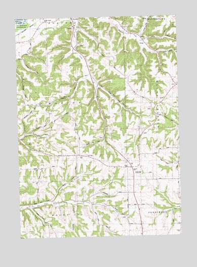
Long Hollow, WI USGS Topographic Map
Click on map above to begin viewing in our Map Viewer.

This topographic map contains these locations and features:
Feature Name Type Latitude Longitude GNIS ID View Map
Adkins RidgeRidgeN43.0033°W90.7393°1560700View Map
Bethel CemeteryCemeteryN43.0394°W90.6657°1561627View Map
Brechler CemeteryCemeteryN43.0758°W90.7335°1562167View Map
Brechler School (historical)SchoolN43.0464°W90.7129°1840561View Map
Breezy Point School (historical)SchoolN43.0497°W90.6260°1840562View Map
Brindley School (historical)SchoolN43.1130°W90.6465°1840563View Map
Butternut HollowValleyN43.0204°W90.6980°1562480View Map
Crooked Creek School (historical)SchoolN43.0953°W90.6937°1840566View Map
Crown Hill CemeteryCemeteryN43.0394°W90.7354°1563574View Map
Fisher HollowValleyN43.0193°W90.7093°1565014View Map
G and M FarmsLocaleN43.0911°W90.6294°2709189View Map
Hickory Grove Country ClubLocaleN43.0361°W90.6598°1840503View Map
Latham FarmsLocaleN43.1106°W90.7397°2709190View Map
Leffler FarmLocaleN43.0100°W90.6764°2709167View Map
Long HollowValleyN43.0209°W90.7263°1568526View Map
Marion ChurchChurchN43.0558°W90.7490°1569044View Map
Martin FarmsLocaleN43.0764°W90.6531°2709192View Map
Meadow Brook FarmLocaleN43.0903°W90.6986°2709196View Map
Munn HollowValleyN43.0234°W90.6938°1570031View Map
Pine KnobSummitN43.0542°W90.7429°1571478View Map
Plum School (historical)SchoolN43.0122°W90.6662°1840574View Map
Plum ValleyValleyN43.0187°W90.6940°1571701View Map
Rogers School (historical)SchoolN43.0214°W90.7112°1840575View Map
Round S DairyLocaleN43.0792°W90.6308°2709191View Map
Salzgeber QuarryMineN43.1100°W90.6986°2634049View Map
Schwitzer School (historical)SchoolN43.0033°W90.6262°1840576View Map
Spring ValleyValleyN43.0174°W90.7418°1574703View Map
Switzer CemeteryCemeteryN43.0025°W90.6268°1575198View Map
T C FarmsLocaleN43.0239°W90.6769°2709171View Map
Town of MarionCivilN43.0753°W90.7247°1583655View Map
Trumm FarmLocaleN43.1103°W90.7197°2709193View Map
Walker CornerLocaleN43.0392°W90.6623°1840578View Map

Note: Coordinates in the location and feature list above are referenced to NAD83 datum.


Copyright (C) 2008-2024 Ryan Niemi / Sunset Dynamics ... All Rights Reserved