TopoQuest Logo
Do you find TopoQuest useful?
Help keep TopoQuest running and adding new maps/features by donating!
Bitcoin:  19c7KJd3qBynnjoSw5npx9KScwjBe4ifkT
Litecoin:  LXs6TkuXGGXo1vDsWCkWVdjQX94eUKd6ui
Home View Maps Find Maps Find Places Resources & Links


Bluff, Alabama Topographic Map

USGS Map Title: Bluff, AL
USGS Map MRC: 33087G8
DRG (GeoTIFF) Download: o33087g8.tif


Neighboring USGS Topographic Map Quads:


  Beaverton, AL  
33088H1
 

  Guin, AL  
33087H8
 

  Winfield, AL  
33087H7
 

  Vernon, AL  
33088G1
 

  Bluff, AL  
33087G8
 

  Winfield SE, AL  
33087G7
 

  Hightogy, AL  
33088F1
 

  Belk, AL  
33087F8
 

  Fayette, AL  
33087F7


Map MRC Location:

N34°
W88°
N34°
W87°
H8 H7 H6 H5 H4 H3 H2 H1
G8 G7 G6 G5 G4 G3 G2 G1
F8 F7 F6 F5 F4 F3 F2 F1
E8 E7 E6 E5 E4 E3 E2 E1
D8 D7 D6 D5 D4 D3 D2 D1
C8 C7 C6 C5 C4 C3 C2 C1
B8 B7 B6 B5 B4 B3 B2 B1
A8 A7 A6 A5 A4 A3 A2 A1
N33°
W88°
N33°
W87°

Bluff, AL USGS 1:24K Topographic Map Preview:
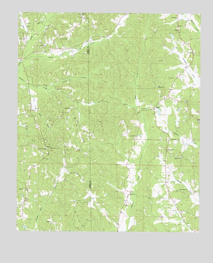
Bluff, AL USGS Topographic Map
Click on map above to begin viewing in our Map Viewer.

This topographic map contains these locations and features:
Feature Name Type Latitude Longitude GNIS ID View Map
Antioch Baptist ChurchChurchN33.8743°W87.9567°113162View Map
Antioch CemeteryCemeteryN33.8743°W87.9572°132763View Map
Bethabara Baptist ChurchChurchN33.7721°W87.9214°113985View Map
Bethabara School (historical)SchoolN33.7723°W87.9217°137696View Map
Bethel ChurchChurchN33.8137°W87.8753°114070View Map
Bethel School (historical)SchoolN33.8132°W87.8753°137698View Map
Blooming GrovePopulated PlaceN33.7937°W87.9786°132766View Map
Blooming Grove CemeteryCemeteryN33.7976°W87.9809°158439View Map
Blooming Grove CemeteryCemeteryN33.7973°W87.9775°114501View Map
Blooming Grove ChurchChurchN33.7973°W87.9803°114502View Map
Blooming Grove Gas FieldOilfieldN33.7740°W87.9306°154904View Map
BlowhornLocaleN33.8346°W87.9928°132767View Map
Blowhorn Creek Gas FieldOilfieldN33.8432°W87.9834°154892View Map
BluffPopulated PlaceN33.8207°W87.9064°114604View Map
Bluff Gas FieldOilfieldN33.8501°W87.8917°154896View Map
Bluff Oil FieldOilfieldN33.8543°W87.9342°154895View Map
Center School (historical)SchoolN33.7654°W87.8889°137707View Map
Central Bluff Oil FieldOilfieldN33.8584°W87.8847°154894View Map
Collier CreekStreamN33.8312°W87.9789°116434View Map
Corinth CemeteryCemeteryN33.7968°W87.9584°116630View Map
Corinth ChurchChurchN33.7968°W87.9586°132769View Map
Corinth Gas FieldOilfieldN33.7848°W87.9764°154851View Map
Crane Neck CreekStreamN33.8326°W87.9942°116814View Map
Dubose DamDamN33.7518°W87.9900°131722View Map
Dubose LakeReservoirN33.7518°W87.9900°131721View Map
Fairview School (historical)SchoolN33.8482°W87.9989°132775View Map
Holliman CemeteryCemeteryN33.8045°W87.9175°158847View Map
KirklandPopulated PlaceN33.8026°W87.8961°158313View Map
Kirkland - Bluff - Wayside Volunteer Fire Department Station 1BuildingN33.8212°W87.9058°2683245View Map
Kirkland - Bluff - Wayside Volunteer Fire Department Station 2BuildingN33.8727°W87.8914°2682969View Map
Kirkland Junior High SchoolSchoolN33.8032°W87.8950°165460View Map
Liberty CemeteryCemeteryN33.7732°W87.9953°158450View Map
Liberty ChurchChurchN33.7737°W87.9953°121555View Map
Little Yellow CreekStreamN33.8576°W87.9936°121913View Map
MansfieldPopulated PlaceN33.8543°W87.9742°132786View Map
Middleton Post Office (historical)Post OfficeN33.7618°W87.8903°137746View Map
Mount Lebanon CemeteryCemeteryN33.7737°W87.8892°158521View Map
Mount Lebanon Missionary Baptist ChurchChurchN33.7737°W87.8886°158879View Map
Mount Olive Church of ChristChurchN33.7971°W87.8967°152466View Map
North Bluff Oil FieldOilfieldN33.8723°W87.9384°154893View Map
Old Antioch CemeteryCemeteryN33.8601°W87.9656°124194View Map
Old Union ChurchChurchN33.8529°W87.8797°152800View Map
Powell CemeteryCemeteryN33.8207°W87.9153°125224View Map
Providence CemeteryCemeteryN33.8207°W87.9631°132798View Map
Providence Methodist ChurchChurchN33.8204°W87.9639°153083View Map
Providence School (historical)SchoolN33.8190°W87.9172°137764View Map
Public School Number 1 (historical)SchoolN33.8526°W87.8795°137765View Map
Rocky Ford CreekStreamN33.8479°W87.9945°125854View Map
Roxanna ChurchChurchN33.8598°W87.9956°126002View Map
Shady Grove CemeteryCemeteryN33.7932°W87.8878°158522View Map
Shady Grove ChurchChurchN33.7926°W87.8878°153389View Map
Shady Grove School (historical)SchoolN33.7923°W87.8875°137772View Map
Sizemore CemeteryCemeteryN33.8690°W87.9872°126923View Map
Spring Hill CemeteryCemeteryN33.8334°W87.9045°158523View Map
Spring Hill ChurchChurchN33.8329°W87.9042°158931View Map
Union CemeteryCemeteryN33.8537°W87.8797°158524View Map
Wayside Junior High SchoolSchoolN33.8729°W87.8911°165574View Map
Wayside Methodist ChurchChurchN33.8651°W87.8906°153908View Map

Note: Coordinates in the location and feature list above are referenced to NAD83 datum.


Copyright (C) 2008-2025 Ryan Niemi / Sunset Dynamics ... All Rights Reserved