TopoQuest Logo
Do you find TopoQuest useful?
Help keep TopoQuest running and adding new maps/features by donating!
Bitcoin:  19c7KJd3qBynnjoSw5npx9KScwjBe4ifkT
Litecoin:  LXs6TkuXGGXo1vDsWCkWVdjQX94eUKd6ui
Home View Maps Find Maps Find Places Resources & Links


Winfield, Alabama Topographic Map

USGS Map Title: Winfield, AL
USGS Map MRC: 33087H7
DRG (GeoTIFF) Download: o33087h7.tif


Neighboring USGS Topographic Map Quads:


  Hamilton SW, AL  
34087A8
 

  Brilliant, AL  
34087A7
 

  Gold Mine, AL  
34087A6
 

  Guin, AL  
33087H8
 

  Winfield, AL  
33087H7
 

  Glen Allen, AL  
33087H6
 

  Bluff, AL  
33087G8
 

  Winfield SE, AL  
33087G7
 

  Hubbertville, AL  
33087G6


Map MRC Location:

N34°
W88°
N34°
W87°
H8 H7 H6 H5 H4 H3 H2 H1
G8 G7 G6 G5 G4 G3 G2 G1
F8 F7 F6 F5 F4 F3 F2 F1
E8 E7 E6 E5 E4 E3 E2 E1
D8 D7 D6 D5 D4 D3 D2 D1
C8 C7 C6 C5 C4 C3 C2 C1
B8 B7 B6 B5 B4 B3 B2 B1
A8 A7 A6 A5 A4 A3 A2 A1
N33°
W88°
N33°
W87°

Winfield, AL USGS 1:24K Topographic Map Preview:
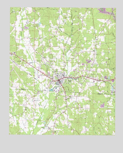
Winfield, AL USGS Topographic Map
Click on map above to begin viewing in our Map Viewer.

This topographic map contains these locations and features:
Feature Name Type Latitude Longitude GNIS ID View Map
Assembly of God ChurchChurchN33.9476°W87.8050°113262View Map
BoboPopulated PlaceN33.8773°W87.8225°114641View Map
Bobo High SchoolSchoolN33.8787°W87.8245°137702View Map
Chapel Hill ChurchChurchN33.9295°W87.7672°115960View Map
City of WinfieldCivilN33.9310°W87.7970°2405765View Map
Coffee CreekStreamN33.8948°W87.8697°116352View Map
Cooper CreekStreamN33.9957°W87.8603°116584View Map
Dickenson CreekStreamN33.9815°W87.8031°117269View Map
Dogwood BranchStreamN33.9709°W87.8031°117347View Map
East Branch Luxapallila CreekStreamN33.9104°W87.8286°117738View Map
Elam CemeteryCemeteryN33.8982°W87.7567°158551View Map
Elm ChurchChurchN33.8982°W87.7570°117954View Map
Estes Hudson StadiumParkN33.9350°W87.8131°2352007View Map
Fairview CemeteryCemeteryN33.9545°W87.7725°137964View Map
Fairview United Methodist ChurchChurchN33.9543°W87.7725°118146View Map
First Baptist ChurchChurchN33.9270°W87.8153°137969View Map
First Methodist ChurchChurchN33.9259°W87.8150°137971View Map
Goodwater CemeteryCemeteryN33.9245°W87.7886°137980View Map
Goodwater ChurchChurchN33.9254°W87.7900°119152View Map
Gu -Win ChurchChurchN33.9512°W87.8664°119449View Map
Happy Hill ChurchChurchN33.9109°W87.8056°119693View Map
Happy Hill Gas FieldOilfieldN33.8945°W87.7667°154891View Map
Harmony Grove Baptist ChurchChurchN33.9143°W87.8181°119764View Map
Harmony Grove CemeteryCemeteryN33.9148°W87.8175°137732View Map
Hillcrest CemeteryCemeteryN33.8801°W87.7978°158552View Map
Hillcrest ChurchChurchN33.8801°W87.7967°137734View Map
Holt DamDamN33.9868°W87.8400°131873View Map
Langley DamDamN33.9684°W87.8117°131858View Map
Langley LakeReservoirN33.9686°W87.8129°131857View Map
Logan CemeteryCemeteryN33.8840°W87.8217°121964View Map
Moss CemeteryCemeteryN33.8818°W87.8297°123115View Map
Moss CreekStreamN33.8809°W87.8447°123117View Map
Mount Calvary ChurchChurchN33.9493°W87.8006°154423View Map
Mount Pisgah United Methodist ChurchChurchN33.9987°W87.7845°152959View Map
Mulberry School (historical)SchoolN33.9032°W87.8061°137749View Map
Musgrove CemeteryCemeteryN33.8812°W87.8334°158553View Map
Musgrove ChapelChurchN33.8809°W87.8342°152576View Map
New HopePopulated PlaceN33.9807°W87.8184°123783View Map
New Hope Baptist ChurchChurchN33.9815°W87.8175°138031View Map
New Hope CemeteryCemeteryN33.9807°W87.8200°138028View Map
New Hope Church of ChristChurchN33.9951°W87.8720°152648View Map
Northwest Medical CenterHospitalN33.9300°W87.8246°148904View Map
Riley Baccus Family CemeteryCemeteryN33.9448°W87.7756°138057View Map
Scuffle Grit CemeteryCemeteryN33.9951°W87.8706°138062View Map
Siloam Baptist ChurchChurchN33.8993°W87.8567°153445View Map
Siloam CemeteryCemeteryN33.8998°W87.8567°158554View Map
Town of Gu-WinCivilN33.9443°W87.8704°2406632View Map
Town of TwinCivilN33.9894°W87.8509°2424938View Map
TuckerPopulated PlaceN33.9709°W87.7736°128101View Map
Union Chapel CemeteryCemeteryN33.9395°W87.7514°138080View Map
Union Chapel Freewill Baptist ChurchChurchN33.9401°W87.7511°153759View Map
Vaughn CemeteryCemeteryN33.9790°W87.7939°138083View Map
W72A-TV (Winfield)TowerN33.9193°W87.8050°161267View Map
West Alabama Memorial GardensCemeteryN33.9482°W87.8611°152226View Map
WEZQ-AM (Winfield)TowerN33.9312°W87.8100°161044View Map
WinfieldPopulated PlaceN33.9290°W87.8172°154009View Map
Winfield Church of ChristChurchN33.9298°W87.8159°138089View Map
Winfield City CemeteryCemeteryN33.9358°W87.8142°138090View Map
Winfield DivisionCivilN33.9541°W87.7552°165883View Map
Winfield Elementary SchoolSchoolN33.9329°W87.8186°138091View Map
Winfield Fire and RescueBuildingN33.9329°W87.8184°2682700View Map
Winfield Freewill Baptist ChurchChurchN33.9304°W87.8256°148905View Map
Winfield High SchoolSchoolN33.9329°W87.8120°138092View Map
Winfield Police DepartmentBuildingN33.9298°W87.8169°2751757View Map
Winfield Post OfficePost OfficeN33.9334°W87.8180°167767View Map
Winfield Public LibraryBuildingN33.9311°W87.8156°2740678View Map
Zion Baptist ChurchChurchN33.9512°W87.8345°154062View Map
Zion CemeteryCemeteryN33.9501°W87.8325°138093View Map
Zion Church (historical)ChurchN33.8782°W87.8322°137787View Map

Note: Coordinates in the location and feature list above are referenced to NAD83 datum.


Copyright (C) 2008-2025 Ryan Niemi / Sunset Dynamics ... All Rights Reserved