TopoQuest Logo
Do you find TopoQuest useful?
Help keep TopoQuest running and adding new maps/features by donating!
Bitcoin:  19c7KJd3qBynnjoSw5npx9KScwjBe4ifkT
Litecoin:  LXs6TkuXGGXo1vDsWCkWVdjQX94eUKd6ui
Home View Maps Find Maps Find Places Resources & Links


Klondike, Georgia Topographic Map

USGS Map Title: Klondike, GA
USGS Map MRC: 32083C5
DRG (GeoTIFF) Download: o32083c5.tif


Neighboring USGS Topographic Map Quads:


  Perry East, GA  
32083D6
 

  Hayneville, GA  
32083D5
 

  Westlake, GA  
32083D4
 

  Unadilla, GA  
32083C6
 

  Klondike, GA  
32083C5
 

  Hawkinsville, GA  
32083C4
 

  Pineview NW, GA  
32083B6
 

  Finleyson West, GA  
32083B5
 

  Finleyson East, GA  
32083B4


Map MRC Location:

N33°
W84°
N33°
W83°
H8 H7 H6 H5 H4 H3 H2 H1
G8 G7 G6 G5 G4 G3 G2 G1
F8 F7 F6 F5 F4 F3 F2 F1
E8 E7 E6 E5 E4 E3 E2 E1
D8 D7 D6 D5 D4 D3 D2 D1
C8 C7 C6 C5 C4 C3 C2 C1
B8 B7 B6 B5 B4 B3 B2 B1
A8 A7 A6 A5 A4 A3 A2 A1
N32°
W84°
N32°
W83°

Klondike, GA USGS 1:24K Topographic Map Preview:
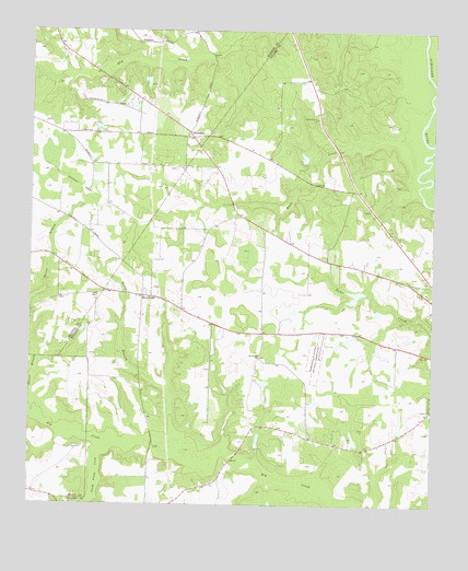
Klondike, GA USGS Topographic Map
Click on map above to begin viewing in our Map Viewer.

This topographic map contains these locations and features:
Feature Name Type Latitude Longitude GNIS ID View Map
Anderson LakeReservoirN32.2944°W83.5256°341126View Map
Anderson Lake DamDamN32.2952°W83.5249°341125View Map
Babbs ChurchChurchN32.2754°W83.5002°354424View Map
BrowndalePopulated PlaceN32.3052°W83.5874°331256View Map
Browndale ChurchChurchN32.3049°W83.5921°334884View Map
Buck CreekStreamN32.3477°W83.5074°354894View Map
Chandler MineMineN32.2507°W83.6085°1705047View Map
Hawkinsville DivisionCivilN32.2977°W83.5195°1936309View Map
KlondikePopulated PlaceN32.3482°W83.5760°332157View Map
Lawson LakeReservoirN32.2674°W83.5538°336194View Map
Lawson Lake DamDamN32.2652°W83.5532°336193View Map
Macedonia ChurchChurchN32.2896°W83.5535°317541View Map
Miller PondReservoirN32.3617°W83.5890°341244View Map
Miller Pond DamDamN32.3618°W83.5882°341243View Map
Nelson LakeReservoirN32.3060°W83.5230°341124View Map
Nelson Lake DamDamN32.3068°W83.5216°341123View Map
Pleasant Grove ChurchChurchN32.3521°W83.5363°320815View Map
Rocky BranchStreamN32.2682°W83.5793°321784View Map
Seville LakeReservoirN32.3417°W83.5402°336192View Map
Seville Lake DamDamN32.3418°W83.5382°336191View Map
Shiver BranchStreamN32.2771°W83.6235°322917View Map
South Prong CreekStreamN32.2652°W83.6018°323274View Map

Note: Coordinates in the location and feature list above are referenced to NAD83 datum.


Copyright (C) 2008-2024 Ryan Niemi / Sunset Dynamics ... All Rights Reserved