TopoQuest Logo
Do you find TopoQuest useful?
Help keep TopoQuest running and adding new maps/features by donating!
Bitcoin:  19c7KJd3qBynnjoSw5npx9KScwjBe4ifkT
Litecoin:  LXs6TkuXGGXo1vDsWCkWVdjQX94eUKd6ui
Home View Maps Find Maps Find Places Resources & Links


Uniontown East, Alabama Topographic Map

USGS Map Title: Uniontown East, AL
USGS Map MRC: 32087D4
DRG (GeoTIFF) Download: o32087d4.tif


Neighboring USGS Topographic Map Quads:


  Newbern, AL  
32087E5
 

  Scott Station, AL  
32087E4
 

  Marion South, AL  
32087E3
 

  Uniontown West, AL  
32087D5
 

  Uniontown East, AL  
32087D4
 

  Browns, AL  
32087D3
 

  Thomaston East, AL  
32087C5
 

  Central Mills, AL  
32087C4
 

  Safford, AL  
32087C3


Map MRC Location:

N33°
W88°
N33°
W87°
H8 H7 H6 H5 H4 H3 H2 H1
G8 G7 G6 G5 G4 G3 G2 G1
F8 F7 F6 F5 F4 F3 F2 F1
E8 E7 E6 E5 E4 E3 E2 E1
D8 D7 D6 D5 D4 D3 D2 D1
C8 C7 C6 C5 C4 C3 C2 C1
B8 B7 B6 B5 B4 B3 B2 B1
A8 A7 A6 A5 A4 A3 A2 A1
N32°
W88°
N32°
W87°

Uniontown East, AL USGS 1:24K Topographic Map Preview:
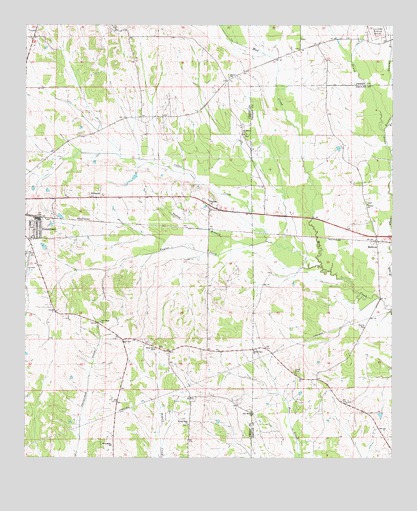
Uniontown East, AL USGS Topographic Map
Click on map above to begin viewing in our Map Viewer.

This topographic map contains these locations and features:
Feature Name Type Latitude Longitude GNIS ID View Map
Antioch Church (historical)ChurchN32.4062°W87.4514°146266View Map
Asbury CemeteryCemeteryN32.4065°W87.4558°149868View Map
Asbury Methodist Church (historical)ChurchN32.4068°W87.4561°149867View Map
BellevuePopulated PlaceN32.4376°W87.3803°113885View Map
Coffee CreekStreamN32.4376°W87.4175°116350View Map
Duncan BranchStreamN32.4696°W87.3775°117660View Map
EllawhitePopulated PlaceN32.4382°W87.4992°146271View Map
Ellawhite CemeteryCemeteryN32.4412°W87.4986°149797View Map
Ellawhite Elementary School (historical)SchoolN32.4426°W87.4953°149795View Map
Fairhope Plantation (historical)LocaleN32.4454°W87.4908°149794View Map
Flatwood (historical)LocaleN32.4404°W87.4533°146274View Map
Friendship Baptist ChurchChurchN32.3785°W87.4703°118683View Map
Friendship CemeteryCemeteryN32.3785°W87.4369°1805713View Map
Henton (historical)LocaleN32.4829°W87.4311°146279View Map
HillcrestPopulated PlaceN32.4515°W87.4747°156474View Map
Hinton SchoolSchoolN32.4851°W87.4314°120151View Map
Little Union ChurchChurchN32.4062°W87.4222°121900View Map
Living Hope Baptist ChurchChurchN32.3846°W87.4442°121926View Map
Living Hope CemeteryCemeteryN32.3846°W87.4447°1805723View Map
Long CemeteryCemeteryN32.3996°W87.4078°122000View Map
Marion Weissinger Lake Dam Number 1DamN32.3968°W87.3850°130527View Map
Marion Weissinger Lake Number OneReservoirN32.3968°W87.3850°130526View Map
New Hope (historical)LocaleN32.4149°W87.4750°146285View Map
New Hope ChurchChurchN32.4143°W87.4744°123817View Map
Oak Grove ChurchChurchN32.4960°W87.4978°146286View Map
Pickens CemeteryCemeteryN32.4682°W87.4817°146289View Map
Providence (historical)LocaleN32.4960°W87.3861°146292View Map
Rural Hill Plantation (historical)LocaleN32.4132°W87.4739°149866View Map
Saint Marys Baptist ChurchChurchN32.4687°W87.4261°126165View Map
Second Baptist ChurchChurchN32.4385°W87.4978°149798View Map
Smiths BranchStreamN32.4346°W87.4528°144686View Map
Star Bethel ChurchChurchN32.4482°W87.4375°146294View Map
Star Bethel ChurchChurchN32.3876°W87.4222°127313View Map
TayloePopulated PlaceN32.4482°W87.4381°157143View Map
Tayloe BranchStreamN32.4362°W87.4231°127716View Map
Tayloe CreekStreamN32.4304°W87.3989°127717View Map
Taylor Station (historical)LocaleN32.4404°W87.4386°146295View Map
The VillagePopulated PlaceN32.4418°W87.4953°149796View Map
Town of UniontownCivilN32.4489°W87.4958°2406779View Map
TrinityPopulated PlaceN32.4468°W87.3828°146090View Map
Trinity ChurchChurchN32.4485°W87.3833°128074View Map
Uniontown Church of GodChurchN32.4429°W87.4944°149793View Map
Uniontown DivisionCivilN32.4584°W87.4649°165921View Map
Uniontown Municipal Airport (historical)AirportN32.4315°W87.4992°129431View Map
Wares Grove (historical)LocaleN32.4507°W87.4736°149865View Map
White Hill SchoolSchoolN32.4062°W87.4558°128873View Map

Note: Coordinates in the location and feature list above are referenced to NAD83 datum.


Copyright (C) 2008-2024 Ryan Niemi / Sunset Dynamics ... All Rights Reserved