TopoQuest Logo
Do you find TopoQuest useful?
Help keep TopoQuest running and adding new maps/features by donating!
Bitcoin:  19c7KJd3qBynnjoSw5npx9KScwjBe4ifkT
Litecoin:  LXs6TkuXGGXo1vDsWCkWVdjQX94eUKd6ui
Home View Maps Find Maps Find Places Resources & Links


Valton, Wisconsin Topographic Map

USGS Map Title: Valton, WI
USGS Map MRC: 43090E3
DRG (GeoTIFF) Download: o43090e3.tif


Neighboring USGS Topographic Map Quads:


  Trippville, WI  
43090F4
 

  Hillsboro, WI  
43090F3
 

  Wonewoc, WI  
43090F2
 

  Yuba, WI  
43090E4
 

  Valton, WI  
43090E3
 

  La Valle, WI  
43090E2
 

  Gillingham, WI  
43090D4
 

  Rockbridge, WI  
43090D3
 

  Lime Ridge, WI  
43090D2


Map MRC Location:

N44°
W91°
N44°
W90°
H8 H7 H6 H5 H4 H3 H2 H1
G8 G7 G6 G5 G4 G3 G2 G1
F8 F7 F6 F5 F4 F3 F2 F1
E8 E7 E6 E5 E4 E3 E2 E1
D8 D7 D6 D5 D4 D3 D2 D1
C8 C7 C6 C5 C4 C3 C2 C1
B8 B7 B6 B5 B4 B3 B2 B1
A8 A7 A6 A5 A4 A3 A2 A1
N43°
W91°
N43°
W90°

Valton, WI USGS 1:24K Topographic Map Preview:
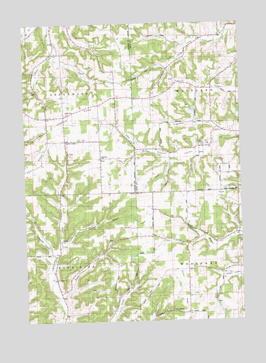
Valton, WI USGS Topographic Map
Click on map above to begin viewing in our Map Viewer.

This topographic map contains these locations and features:
Feature Name Type Latitude Longitude GNIS ID View Map
0.5 ReservoirReservoirN43.5866°W90.2768°1792545View Map
Benders CornersLocaleN43.5755°W90.3529°1561555View Map
Big Spring Stock and Dairy FarmLocaleN43.5172°W90.2660°1957068View Map
Cold Spring FarmLocaleN43.5119°W90.2673°1957070View Map
Corwin (historical)Populated PlaceN43.5033°W90.2815°1957774View Map
Corwin RidgeRidgeN43.5161°W90.2812°1563419View Map
County Corners School (historical)SchoolN43.5864°W90.3529°1563445View Map
Debello CemeteryCemeteryN43.5883°W90.3479°1563791View Map
Debello RidgeRidgeN43.5903°W90.3374°1563792View Map
Echo Glen Stock FarmLocaleN43.5178°W90.3176°1958625View Map
Edgewood FarmLocaleN43.5194°W90.3235°1957216View Map
Fern Dale FarmLocaleN43.5300°W90.2651°1957074View Map
Fox RidgeRidgeN43.5650°W90.3726°1565229View Map
Green Valley Stock FarmLocaleN43.5064°W90.3198°1958643View Map
Greenwood CemeteryCemeteryN43.5689°W90.3307°1834460View Map
Grimes ValleyValleyN43.5345°W90.2730°1565904View Map
Grinsell BranchStreamN43.5322°W90.3546°1565911View Map
Hanzel CreekStreamN43.5094°W90.3557°1566053View Map
Hickory RidgeRidgeN43.5994°W90.2810°1566363View Map
Jones ValleyValleyN43.5668°W90.2911°1567278View Map
Keystone Stock FarmLocaleN43.5247°W90.3149°1958646View Map
Lebansky CreekStreamN43.5272°W90.3590°1567919View Map
Maple Grove FarmLocaleN43.5222°W90.2598°1957117View Map
Maple View Stock FarmLocaleN43.5061°W90.2676°1958652View Map
Marble RidgeRidgeN43.5439°W90.3079°1569017View Map
Mortimer ValleyValleyN43.5832°W90.2673°1569764View Map
Pleasant PlaceLocaleN43.5283°W90.3674°1958674View Map
Polk 3SD78806 DamDamN43.6100°W90.2935°1793235View Map
Ryan RidgeRidgeN43.5153°W90.3001°1572769View Map
Saint Patrick Lutheran CemeteryCemeteryN43.5183°W90.3571°1834420View Map
Saint Patricks ChurchChurchN43.5178°W90.3582°1573412View Map
Satterlee G5136 DamDamN43.5866°W90.2768°1792544View Map
School Number 4 (historical)SchoolN43.5180°W90.3576°1956952View Map
School Number 6 (historical)SchoolN43.5325°W90.2846°1956957View Map
Shreve CemeteryCemeteryN43.5961°W90.3704°1574079View Map
Silver Maple FarmLocaleN43.5211°W90.2551°1957130View Map
Slaney Home Stock FarmLocaleN43.5041°W90.3585°1958690View Map
Spring Brook Stock and Dairy FarmLocaleN43.5347°W90.2596°1957131View Map
Spring Falls Dairy FarmLocaleN43.5147°W90.3599°1958695View Map
Town of GreenwoodCivilN43.5969°W90.3717°1583325View Map
Town of HenriettaCivilN43.5103°W90.3702°1583378View Map
Town of WestfordCivilN43.5104°W90.2527°1584407View Map
Town of WoodlandCivilN43.5981°W90.2519°1584474View Map
ValtonPopulated PlaceN43.5730°W90.2743°1576027View Map
Willowdale Stock and Dairy FarmLocaleN43.5103°W90.3207°1958746View Map
WoodLocaleN43.5686°W90.3318°1576956View Map

Note: Coordinates in the location and feature list above are referenced to NAD83 datum.


Copyright (C) 2008-2025 Ryan Niemi / Sunset Dynamics ... All Rights Reserved