TopoQuest Logo
Do you find TopoQuest useful?
Help keep TopoQuest running and adding new maps/features by donating!
Bitcoin:  19c7KJd3qBynnjoSw5npx9KScwjBe4ifkT
Litecoin:  LXs6TkuXGGXo1vDsWCkWVdjQX94eUKd6ui
Home View Maps Find Maps Find Places Resources & Links


Trippville, Wisconsin Topographic Map

USGS Map Title: Trippville, WI
USGS Map MRC: 43090F4
DRG (GeoTIFF) Download: o43090f4.tif


Neighboring USGS Topographic Map Quads:


  Wilton, WI  
43090G5
 

  Kendall West, WI  
43090G4
 

  Kendall East, WI  
43090G3
 

  Ontario, WI  
43090F5
 

  Trippville, WI  
43090F4
 

  Hillsboro, WI  
43090F3
 

  West Lima, WI  
43090E5
 

  Yuba, WI  
43090E4
 

  Valton, WI  
43090E3


Map MRC Location:

N44°
W91°
N44°
W90°
H8 H7 H6 H5 H4 H3 H2 H1
G8 G7 G6 G5 G4 G3 G2 G1
F8 F7 F6 F5 F4 F3 F2 F1
E8 E7 E6 E5 E4 E3 E2 E1
D8 D7 D6 D5 D4 D3 D2 D1
C8 C7 C6 C5 C4 C3 C2 C1
B8 B7 B6 B5 B4 B3 B2 B1
A8 A7 A6 A5 A4 A3 A2 A1
N43°
W91°
N43°
W90°

Trippville, WI USGS 1:24K Topographic Map Preview:
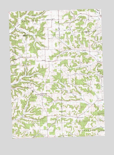
Trippville, WI USGS Topographic Map
Click on map above to begin viewing in our Map Viewer.

This topographic map contains these locations and features:
Feature Name Type Latitude Longitude GNIS ID View Map
Barton HollowValleyN43.6821°W90.4871°1561213View Map
Bartons CornersLocaleN43.6675°W90.4596°1561215View Map
Bohemian Brotherhood CemeteryCemeteryN43.6444°W90.4148°1562015View Map
Buff ChurchChurchN43.6683°W90.4626°1562358View Map
Burr Wesleyan ChurchChurchN43.6669°W90.4582°1834443View Map
Cox ValleyValleyN43.7111°W90.4158°1563469View Map
DillyPopulated PlaceN43.6422°W90.4401°1577573View Map
Dilly CreekStreamN43.6564°W90.3940°1577215View Map
Durkee ValleyValleyN43.6991°W90.3834°1564200View Map
Fairview CemeteryCemeteryN43.7050°W90.4882°1564814View Map
Forest-Burr CemeteryCemeteryN43.6675°W90.4623°1565145View Map
Knowlton RidgeRidgeN43.6864°W90.4115°1567583View Map
Mount TaborPopulated PlaceN43.7005°W90.4543°1577736View Map
Mount Tabor CemeteryCemeteryN43.7116°W90.4535°1569849View Map
Newman ValleyValleyN43.6870°W90.4800°1570257View Map
Revels CemeteryCemeteryN43.6733°W90.4943°1572223View Map
Saint Joseph CemeteryCemeteryN43.6997°W90.4515°1573149View Map
Schumann ValleyValleyN43.7412°W90.3806°1573823View Map
Stelting RidgeRidgeN43.7172°W90.4796°1574857View Map
Sutcliffe CornersLocaleN43.7405°W90.4443°1575138View Map
Town of ForestCivilN43.6824°W90.4924°1583216View Map
TrippvillePopulated PlaceN43.7091°W90.4043°1577857View Map
Trippville ValleyValleyN43.7029°W90.3837°1575656View Map
Walters ValleyValleyN43.7432°W90.3796°1576185View Map
Wesleyan CampLocaleN43.6722°W90.4701°1576435View Map
Winchell ValleyValleyN43.7338°W90.4911°2772263View Map

Note: Coordinates in the location and feature list above are referenced to NAD83 datum.


Copyright (C) 2008-2025 Ryan Niemi / Sunset Dynamics ... All Rights Reserved