TopoQuest Logo
Do you find TopoQuest useful?
Help keep TopoQuest running and adding new maps/features by donating!
Bitcoin:  19c7KJd3qBynnjoSw5npx9KScwjBe4ifkT
Litecoin:  LXs6TkuXGGXo1vDsWCkWVdjQX94eUKd6ui
Home View Maps Find Maps Find Places Resources & Links


La Valle, Wisconsin Topographic Map

USGS Map Title: La Valle, WI
USGS Map MRC: 43090E2
DRG (GeoTIFF) Download: o43090e2.tif


Neighboring USGS Topographic Map Quads:


  Hillsboro, WI  
43090F3
 

  Wonewoc, WI  
43090F2
 

  Potato Hill, WI  
43090F1
 

  Valton, WI  
43090E3
 

  La Valle, WI  
43090E2
 

  Reedsburg West, WI  
43090E1
 

  Rockbridge, WI  
43090D3
 

  Lime Ridge, WI  
43090D2
 

  Loganville, WI  
43090D1


Map MRC Location:

N44°
W91°
N44°
W90°
H8 H7 H6 H5 H4 H3 H2 H1
G8 G7 G6 G5 G4 G3 G2 G1
F8 F7 F6 F5 F4 F3 F2 F1
E8 E7 E6 E5 E4 E3 E2 E1
D8 D7 D6 D5 D4 D3 D2 D1
C8 C7 C6 C5 C4 C3 C2 C1
B8 B7 B6 B5 B4 B3 B2 B1
A8 A7 A6 A5 A4 A3 A2 A1
N43°
W91°
N43°
W90°

La Valle, WI USGS 1:24K Topographic Map Preview:
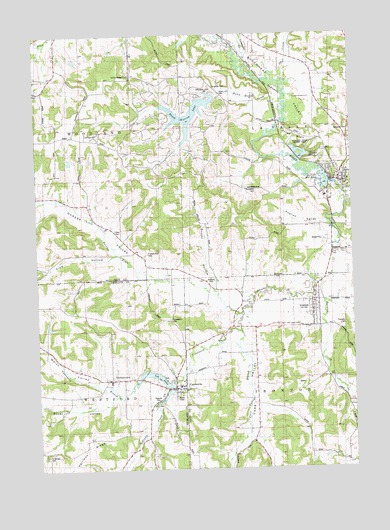
La Valle, WI USGS Topographic Map
Click on map above to begin viewing in our Map Viewer.

This topographic map contains these locations and features:
Feature Name Type Latitude Longitude GNIS ID View Map
0.3 ReservoirReservoirN43.5886°W90.2365°1793354View Map
0.37 ReservoirReservoirN43.6176°W90.2337°1792473View Map
Baraboo Valley Stock and Dairy FarmLocaleN43.5144°W90.2362°1957067View Map
Bauer ValleyValleyN43.5207°W90.2206°1561313View Map
Bethel School (historical)SchoolN43.5541°W90.1835°1846807View Map
Buckwheat ValleyValleyN43.5994°W90.1521°1562346View Map
Bundy HollowValleyN43.5522°W90.1801°1562406View Map
Carr ValleyValleyN43.5361°W90.1708°1562739View Map
Carr Valley BranchStreamN43.5394°W90.1701°1562740View Map
CazenoviaPopulated PlaceN43.5230°W90.1962°1562828View Map
Cazenovia Area Volunteer Fire Department and Rescue SquadBuildingN43.5261°W90.1965°2697849View Map
Cazenovia BranchStreamN43.5447°W90.1690°1562829View Map
Cazenovia CemeteryCemeteryN43.5200°W90.1962°1834360View Map
Cazenovia DamDamN43.5250°W90.1968°1791760View Map
Crossman CreekStreamN43.6191°W90.1657°1563561View Map
Dutch Hollow CreekStreamN43.6041°W90.1518°1564212View Map
Dutch Hollow LakeReservoirN43.6021°W90.1888°1564213View Map
Dutch Hollow Lake 3WR745 DamDamN43.6072°W90.1793°1792028View Map
Elm Grove FarmLocaleN43.5219°W90.2496°1957072View Map
English ValleyValleyN43.5700°W90.1345°1564669View Map
Evergreen CemeteryCemeteryN43.5969°W90.1254°1564746View Map
Friendswood CemeteryCemeteryN43.5619°W90.2065°1565336View Map
Frog HollowValleyN43.5606°W90.2194°1565347View Map
Furnace CreekStreamN43.5536°W90.1401°1565372View Map
GermantownPopulated PlaceN43.5258°W90.2215°1565496View Map
Harrison RidgeRidgeN43.5044°W90.2310°1566096View Map
Hemlock 2WP1932 DamDamN43.5866°W90.1418°1793465View Map
Hemlock SloughLakeN43.5893°W90.1453°1566292View Map
Hemlock Slough .37ReservoirN43.5866°W90.1418°1793466View Map
Hemlock-Sauk County ParkParkN43.5919°W90.1415°1566294View Map
Horse BluffCliffN43.5955°W90.1465°1566707View Map
IrontonPopulated PlaceN43.5461°W90.1412°1566977View Map
Ironton - La Valle Elementary SchoolSchoolN43.5780°W90.1356°1846857View Map
Karstetter CemeteryCemeteryN43.5800°W90.1632°1567349View Map
La VallePopulated PlaceN43.5822°W90.1282°1567700View Map
La Valle DamDamN43.5819°W90.1329°1792238View Map
La Valle Fire DepartmentBuildingN43.5819°W90.1299°2697625View Map
La Valle Mill Pond 243ReservoirN43.5824°W90.1361°1792239View Map
La Valle Police DepartmentBuildingN43.5864°W90.1291°2759945View Map
LaValle Mill PondReservoirN43.5821°W90.1327°1567701View Map
Lee LakeReservoirN43.5247°W90.1973°1567925View Map
Lee Lake 20ReservoirN43.5274°W90.2057°1791761View Map
Little Baraboo RiverStreamN43.5755°W90.1265°1568170View Map
Little Baraboo Valley Stock and Dairy FarmLocaleN43.5194°W90.2293°1957115View Map
Little Valley Dairy and Stock FarmLocaleN43.5297°W90.2465°1957116View Map
Litz School (historical)SchoolN43.6058°W90.1721°1846864View Map
Lone Pine Stock FarmLocaleN43.5291°W90.2337°1958651View Map
Magruder G5279 DamDamN43.6183°W90.2351°1792472View Map
McGlynn CreekStreamN43.5194°W90.2026°1578602View Map
Norwegian CemeteryCemeteryN43.5430°W90.1976°1570554View Map
Oak Lawn CemeteryCemeteryN43.5914°W90.1357°1846883View Map
Oaks CemeteryCemeteryN43.5689°W90.2193°1570712View Map
Oaks School (historical)SchoolN43.5669°W90.2168°1846885View Map
Ox CreekStreamN43.6111°W90.1529°1570971View Map
Pine Grove FarmLocaleN43.5214°W90.2446°1957122View Map
Plum Valley School (historical)SchoolN43.6247°W90.2410°1846898View Map
Quaker ValleyValleyN43.5495°W90.1834°1571988View Map
Saint Anthony CemeteryCemeteryN43.5261°W90.2208°2573554View Map
Saint Anthony CemeteryCemeteryN43.5261°W90.2210°1834412View Map
Saint Anthony De PaduaChurchN43.5256°W90.2208°2573553View Map
Saint Anthony's Elementary SchoolSchoolN43.5256°W90.2208°2573552View Map
Saint Bridget CemeteryCemeteryN43.5039°W90.2473°1572869View Map
School Number 4 (historical)SchoolN43.5258°W90.2218°1956951View Map
Sensnovis G 9115 DamDamN43.5900°W90.2351°1793353View Map
Simon Hill CemeteryCemeteryN43.6072°W90.1768°1574178View Map
Solchenberger CemeteryCemeteryN43.6133°W90.2121°1574363View Map
Thornton CemeteryCemeteryN43.5408°W90.1282°1575403View Map
Town of IrontonCivilN43.5115°W90.1321°1583436View Map
Town of La ValleCivilN43.5988°W90.1327°1583533View Map
Universal CemeteryCemeteryN43.6097°W90.1793°1575930View Map
Village of CazenoviaCivilN43.5237°W90.1991°1582934View Map
Village of IrontonCivilN43.5453°W90.1437°1583435View Map
Village of La ValleCivilN43.5830°W90.1303°1583532View Map
Village View Stock FarmLocaleN43.5130°W90.2098°1957123View Map
Voorhes School (historical)SchoolN43.5961°W90.2348°1846968View Map
Welch ValleyValleyN43.5233°W90.2221°1576412View Map

Note: Coordinates in the location and feature list above are referenced to NAD83 datum.


Copyright (C) 2008-2024 Ryan Niemi / Sunset Dynamics ... All Rights Reserved