TopoQuest Logo
Do you find TopoQuest useful?
Help keep TopoQuest running and adding new maps/features by donating!
Bitcoin:  19c7KJd3qBynnjoSw5npx9KScwjBe4ifkT
Litecoin:  LXs6TkuXGGXo1vDsWCkWVdjQX94eUKd6ui
Home View Maps Find Maps Find Places Resources & Links


Vanduser, Missouri Topographic Map

USGS Map Title: Vanduser, MO
USGS Map MRC: 36089H6
DRG (GeoTIFF) Download: o36089h6.tif


Neighboring USGS Topographic Map Quads:


  Bell City, MO  
37089A7
 

  Oran, MO  
37089A6
 

  Morley, MO  
37089A5
 

  Clines Island, MO  
36089H7
 

  Vanduser, MO  
36089H6
 

  Sikeston North, MO  
36089H5
 

  Essex, MO  
36089G7
 

  Morehouse, MO  
36089G6
 

  Sikeston South, MO  
36089G5


Map MRC Location:

N37°
W90°
N37°
W89°
H8 H7 H6 H5 H4 H3 H2 H1
G8 G7 G6 G5 G4 G3 G2 G1
F8 F7 F6 F5 F4 F3 F2 F1
E8 E7 E6 E5 E4 E3 E2 E1
D8 D7 D6 D5 D4 D3 D2 D1
C8 C7 C6 C5 C4 C3 C2 C1
B8 B7 B6 B5 B4 B3 B2 B1
A8 A7 A6 A5 A4 A3 A2 A1
N36°
W90°
N36°
W89°

Vanduser, MO USGS 1:24K Topographic Map Preview:
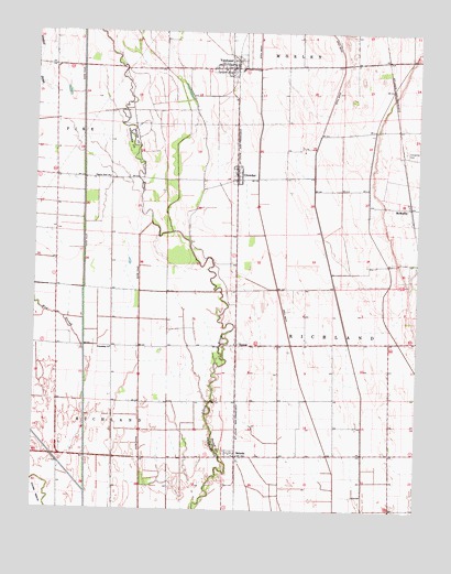
Vanduser, MO USGS Topographic Map
Click on map above to begin viewing in our Map Viewer.

This topographic map contains these locations and features:
Feature Name Type Latitude Longitude GNIS ID View Map
Baker School (historical)SchoolN36.8892°W89.6873°730419View Map
Bridwell (historical)LocaleN36.9781°W89.7340°747700View Map
Carpenter CemeteryCemeteryN36.9692°W89.6292°715414View Map
Crooked SloughStreamN36.9842°W89.7454°716524View Map
CrowderPopulated PlaceN36.9626°W89.6834°716547View Map
Crowder School (historical)SchoolN36.9434°W89.6748°730420View Map
Ditch Number 37CanalN36.9267°W89.7159°737842View Map
Friendship ChurchChurchN36.9173°W89.7245°718235View Map
Harbinson (historical)LocaleN36.9314°W89.6840°740581View Map
Hunter School (historical)SchoolN36.9181°W89.6517°730421View Map
Lorimer School (historical)SchoolN36.9173°W89.7242°747701View Map
Mud SloughStreamN36.9164°W89.7337°723022View Map
Pilgrim Rest ChurchChurchN36.9617°W89.7256°724341View Map
SalcedoPopulated PlaceN36.8889°W89.6834°725918View Map
Stringer SchoolSchoolN36.8901°W89.6512°747703View Map
TannerPopulated PlaceN36.9181°W89.6834°727449View Map
Tanner SchoolSchoolN36.8887°W89.7145°747702View Map
Township of RootwadCivilN36.9316°W89.6423°2397864View Map
VanduserPopulated PlaceN36.9906°W89.6856°728142View Map
Vanduser Fire and RescueBuildingN36.9909°W89.6848°2621768View Map
Vanduser Post OfficePost OfficeN36.9908°W89.6860°2783210View Map
Village of VanduserCivilN36.9910°W89.6865°2400047View Map

Note: Coordinates in the location and feature list above are referenced to NAD83 datum.


Copyright (C) 2008-2025 Ryan Niemi / Sunset Dynamics ... All Rights Reserved