TopoQuest Logo
Do you find TopoQuest useful?
Help keep TopoQuest running and adding new maps/features by donating!
Bitcoin:  19c7KJd3qBynnjoSw5npx9KScwjBe4ifkT
Litecoin:  LXs6TkuXGGXo1vDsWCkWVdjQX94eUKd6ui
Home View Maps Find Maps Find Places Resources & Links


Morehouse, Missouri Topographic Map

USGS Map Title: Morehouse, MO
USGS Map MRC: 36089G6
DRG (GeoTIFF) Download: o36089g6.tif


Neighboring USGS Topographic Map Quads:


  Clines Island, MO  
36089H7
 

  Vanduser, MO  
36089H6
 

  Sikeston North, MO  
36089H5
 

  Essex, MO  
36089G7
 

  Morehouse, MO  
36089G6
 

  Sikeston South, MO  
36089G5
 

  Hills Store, MO  
36089F7
 

  Charter Oak, MO  
36089F6
 

  Kewanee, MO  
36089F5


Map MRC Location:

N37°
W90°
N37°
W89°
H8 H7 H6 H5 H4 H3 H2 H1
G8 G7 G6 G5 G4 G3 G2 G1
F8 F7 F6 F5 F4 F3 F2 F1
E8 E7 E6 E5 E4 E3 E2 E1
D8 D7 D6 D5 D4 D3 D2 D1
C8 C7 C6 C5 C4 C3 C2 C1
B8 B7 B6 B5 B4 B3 B2 B1
A8 A7 A6 A5 A4 A3 A2 A1
N36°
W90°
N36°
W89°

Morehouse, MO USGS 1:24K Topographic Map Preview:
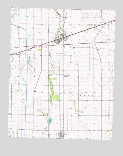
Morehouse, MO USGS Topographic Map
Click on map above to begin viewing in our Map Viewer.

This topographic map contains these locations and features:
Feature Name Type Latitude Longitude GNIS ID View Map
BrownsPopulated PlaceN36.8626°W89.6329°740699View Map
BuffingtonPopulated PlaceN36.8306°W89.7431°715015View Map
CanalouPopulated PlaceN36.7551°W89.6870°731548View Map
Canalou Volunteer Fire DepartmentBuildingN36.7518°W89.6859°2621533View Map
City of CanalouCivilN36.7540°W89.6865°2393727View Map
City of MorehouseCivilN36.8464°W89.6909°2395399View Map
Cline SchoolSchoolN36.8381°W89.6642°747717View Map
Crossroad School (historical)SchoolN36.8370°W89.6320°747716View Map
DelmoPopulated PlaceN36.8103°W89.6812°716831View Map
Greer School (historical)SchoolN36.8676°W89.6501°747715View Map
Hale SchoolSchoolN36.7748°W89.7284°747714View Map
King LakeLakeN36.8206°W89.7258°720614View Map
Landers Ridge SchoolSchoolN36.7939°W89.6665°747719View Map
Little RiverPopulated PlaceN36.8545°W89.6634°740478View Map
Longs DamDamN36.8334°W89.7451°765543View Map
Longs PondReservoirN36.8334°W89.7451°765544View Map
Macedonia Church (historical)ChurchN36.7945°W89.6534°747718View Map
MorehousePopulated PlaceN36.8473°W89.6854°722600View Map
Morehouse Fire and RescueBuildingN36.8454°W89.6900°2621764View Map
Morehouse Post OfficePost OfficeN36.8447°W89.6934°2783152View Map
New Bethel ChurchChurchN36.7942°W89.6662°723181View Map
Township of WestCivilN36.7866°W89.6712°767069View Map
Tram SwitchLocaleN36.7934°W89.6892°740082View Map
Warner School (historical)SchoolN36.7584°W89.6370°747720View Map
Whitten LakeReservoirN36.7642°W89.6998°728806View Map
Whitten Lake DamDamN36.7645°W89.6998°765521View Map

Note: Coordinates in the location and feature list above are referenced to NAD83 datum.


Copyright (C) 2008-2024 Ryan Niemi / Sunset Dynamics ... All Rights Reserved