TopoQuest Logo
Do you find TopoQuest useful?
Help keep TopoQuest running and adding new maps/features by donating!
Bitcoin:  19c7KJd3qBynnjoSw5npx9KScwjBe4ifkT
Litecoin:  LXs6TkuXGGXo1vDsWCkWVdjQX94eUKd6ui
Home View Maps Find Maps Find Places Resources & Links


Sikeston North, Missouri Topographic Map

USGS Map Title: Sikeston North, MO
USGS Map MRC: 36089H5
DRG (GeoTIFF) Download: o36089h5.tif


Neighboring USGS Topographic Map Quads:


  Oran, MO  
37089A6
 

  Morley, MO  
37089A5
 

  Thebes SW, MO  
37089A4
 

  Vanduser, MO  
36089H6
 

  Sikeston North, MO  
36089H5
 

  Bertrand, MO  
36089H4
 

  Morehouse, MO  
36089G6
 

  Sikeston South, MO  
36089G5
 

  East Prairie, MO  
36089G4


Map MRC Location:

N37°
W90°
N37°
W89°
H8 H7 H6 H5 H4 H3 H2 H1
G8 G7 G6 G5 G4 G3 G2 G1
F8 F7 F6 F5 F4 F3 F2 F1
E8 E7 E6 E5 E4 E3 E2 E1
D8 D7 D6 D5 D4 D3 D2 D1
C8 C7 C6 C5 C4 C3 C2 C1
B8 B7 B6 B5 B4 B3 B2 B1
A8 A7 A6 A5 A4 A3 A2 A1
N36°
W90°
N36°
W89°

Sikeston North, MO USGS 1:24K Topographic Map Preview:
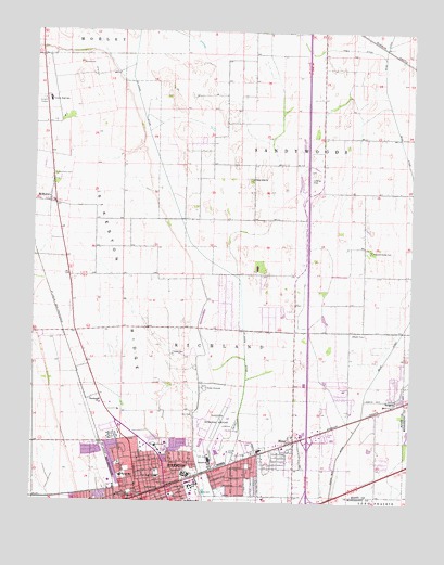
Sikeston North, MO USGS Topographic Map
Click on map above to begin viewing in our Map Viewer.

This topographic map contains these locations and features:
Feature Name Type Latitude Longitude GNIS ID View Map
Airport SchoolSchoolN36.8856°W89.5659°713177View Map
Bennifield CemeteryCemeteryN36.9620°W89.6184°713960View Map
Blodgett School (historical)SchoolN36.9842°W89.5523°730424View Map
Boardman School (historical)SchoolN36.9281°W89.5334°747710View Map
Bright Prospect Church (historical)ChurchN36.8842°W89.5354°747713View Map
Chaney SchoolSchoolN36.9220°W89.5837°747707View Map
City of MinerCivilN36.8973°W89.5353°2395343View Map
City of SikestonCivilN36.8875°W89.5870°2395885View Map
Cobb CemeteryCemeteryN36.9145°W89.5787°716050View Map
Dunver SchoolSchoolN36.8981°W89.5112°747711View Map
Hart CemeteryCemeteryN36.8987°W89.5720°719171View Map
Hunter CemeteryCemeteryN36.9914°W89.6104°720009View Map
Hunter SchoolSchoolN36.8817°W89.5954°720019View Map
Hunter School (historical)SchoolN36.9251°W89.6148°747708View Map
Lennox School (historical)SchoolN36.9498°W89.6051°747706View Map
Malone ParkParkN36.8776°W89.5923°721778View Map
Matthews SchoolSchoolN36.8751°W89.5737°721982View Map
McMullinPopulated PlaceN36.9542°W89.6204°722163View Map
MelonLocaleN36.9939°W89.5051°740087View Map
MinerPopulated PlaceN36.8914°W89.5384°731619View Map
Miner Fire StationBuildingN36.8917°W89.5383°2621030View Map
Miner Police DepartmentBuildingN36.8921°W89.5383°2752443View Map
Miner SchoolSchoolN36.8920°W89.5384°747712View Map
Missouri Delta HeliportAirportN36.8898°W89.5837°758940View Map
Missouri Delta Medical CenterHospitalN36.8896°W89.5835°2655119View Map
Northside ChurchChurchN36.9017°W89.6029°723516View Map
Pleasant Valley CemeteryCemeteryN36.9420°W89.5134°724613View Map
Pleasant Valley Church (historical)ChurchN36.9428°W89.5131°747709View Map
Saint Francis SchoolSchoolN36.8764°W89.5923°725747View Map
Saint Francis Xavier ChurchChurchN36.8762°W89.5920°730423View Map
Sand Prairie School (historical)SchoolN36.9756°W89.6162°747705View Map
SargentPopulated PlaceN36.9009°W89.5059°741242View Map
Shady Grove SchoolSchoolN36.9828°W89.6181°747704View Map
SikestonPopulated PlaceN36.8767°W89.5879°726435View Map
Sikeston Department of Public Safety Fire Division Station 2BuildingN36.8830°W89.5802°2621075View Map
Sikeston Department of Public Safety Fire Division Station 3BuildingN36.8765°W89.5529°2621765View Map
Sikeston Memorial Municipal AirportAirportN36.8957°W89.5635°758939View Map
Sikeston Police DepartmentBuildingN36.8757°W89.5876°2752212View Map
Sikeston Post OfficePost OfficeN36.8791°W89.5893°2782655View Map
Sikeston Public Safety Fire Division Station 1BuildingN36.8786°W89.5997°2621051View Map
Sikeston RidgeRidgeN36.8951°W89.5879°726436View Map
Silent Hill ChurchChurchN36.9609°W89.5531°726438View Map
Town DitchCanalN36.9967°W89.5365°727738View Map
Township of RichlandCivilN36.8935°W89.5568°767389View Map
Township of SandywoodsCivilN36.9800°W89.5136°767390View Map

Note: Coordinates in the location and feature list above are referenced to NAD83 datum.


Copyright (C) 2008-2025 Ryan Niemi / Sunset Dynamics ... All Rights Reserved