TopoQuest Logo
Do you find TopoQuest useful?
Help keep TopoQuest running and adding new maps/features by donating!
Bitcoin:  19c7KJd3qBynnjoSw5npx9KScwjBe4ifkT
Litecoin:  LXs6TkuXGGXo1vDsWCkWVdjQX94eUKd6ui
Home View Maps Find Maps Find Places Resources & Links


Sikeston South, Missouri Topographic Map

USGS Map Title: Sikeston South, MO
USGS Map MRC: 36089G5
DRG (GeoTIFF) Download: o36089g5.tif


Neighboring USGS Topographic Map Quads:


  Vanduser, MO  
36089H6
 

  Sikeston North, MO  
36089H5
 

  Bertrand, MO  
36089H4
 

  Morehouse, MO  
36089G6
 

  Sikeston South, MO  
36089G5
 

  East Prairie, MO  
36089G4
 

  Charter Oak, MO  
36089F6
 

  Kewanee, MO  
36089F5
 

  Henderson Mound, MO  
36089F4


Map MRC Location:

N37°
W90°
N37°
W89°
H8 H7 H6 H5 H4 H3 H2 H1
G8 G7 G6 G5 G4 G3 G2 G1
F8 F7 F6 F5 F4 F3 F2 F1
E8 E7 E6 E5 E4 E3 E2 E1
D8 D7 D6 D5 D4 D3 D2 D1
C8 C7 C6 C5 C4 C3 C2 C1
B8 B7 B6 B5 B4 B3 B2 B1
A8 A7 A6 A5 A4 A3 A2 A1
N36°
W90°
N36°
W89°

Sikeston South, MO USGS 1:24K Topographic Map Preview:
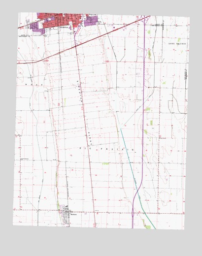
Sikeston South, MO USGS Topographic Map
Click on map above to begin viewing in our Map Viewer.

This topographic map contains these locations and features:
Feature Name Type Latitude Longitude GNIS ID View Map
BowmanLocaleN36.8070°W89.5898°740079View Map
Bowman SchoolSchoolN36.8445°W89.5381°747722View Map
ChampionPopulated PlaceN36.7881°W89.5879°739877View Map
City CemeteryCemeteryN36.8696°W89.5867°2702946View Map
City of MatthewsCivilN36.7584°W89.5690°2395045View Map
Clayton ParkParkN36.8620°W89.6065°715919View Map
Conay School (historical)SchoolN36.7814°W89.5198°747724View Map
East LakePopulated PlaceN36.8070°W89.5204°740556View Map
Fairview SchoolSchoolN36.8401°W89.5804°747721View Map
Garden of MemoriesCemeteryN36.8650°W89.6037°718335View Map
Juanita (historical)Populated PlaceN36.8203°W89.5912°740126View Map
Kingsway MallLocaleN36.8670°W89.5870°742500View Map
KMPL-AM (Sikeston)TowerN36.8237°W89.5959°754306View Map
KSIM-AM (Sikeston)TowerN36.8671°W89.6171°759245View Map
KSTG-FM (Sikeston)TowerN36.8234°W89.5967°754238View Map
Lincoln SchoolSchoolN36.8745°W89.6051°721083View Map
Little Vine ChurchChurchN36.8034°W89.5198°721350View Map
MatthewsPopulated PlaceN36.7592°W89.5867°721977View Map
Matthews Police DepartmentBuildingN36.7589°W89.5855°2752474View Map
Matthews Post OfficePost OfficeN36.7590°W89.5859°2783006View Map
Matthews Volunteer Fire DepartmentBuildingN36.7594°W89.5855°2621534View Map
Memorial Park CemeteryCemeteryN36.8631°W89.5867°722222View Map
Pharris Ridge SchoolSchoolN36.7887°W89.6204°724276View Map
Saint Johns DitchCanalN36.8478°W89.5523°725787View Map
South SchoolSchoolN36.8745°W89.5920°726785View Map
Township of Big PrairieCivilN36.7819°W89.5576°767060View Map
West End ParkParkN36.8717°W89.6062°728549View Map
Wilber School (historical)SchoolN36.7837°W89.5204°747725View Map
York School (historical)SchoolN36.8189°W89.5209°747723View Map

Note: Coordinates in the location and feature list above are referenced to NAD83 datum.


Copyright (C) 2008-2024 Ryan Niemi / Sunset Dynamics ... All Rights Reserved