TopoQuest Logo
Do you find TopoQuest useful?
Help keep TopoQuest running and adding new maps/features by donating!
Bitcoin:  19c7KJd3qBynnjoSw5npx9KScwjBe4ifkT
Litecoin:  LXs6TkuXGGXo1vDsWCkWVdjQX94eUKd6ui
Home View Maps Find Maps Find Places Resources & Links


Florence, Missouri Topographic Map

USGS Map Title: Florence, MO
USGS Map MRC: 38092E8
DRG (GeoTIFF) Download: o38092e8.tif


Neighboring USGS Topographic Map Quads:


  Otterville West, MO  
38093F1
 

  Otterville East, MO  
38092F8
 

  Tipton, MO  
38092F7
 

  Pyrmont, MO  
38093E1
 

  Florence, MO  
38092E8
 

  Fortuna, MO  
38092E7
 

  Crockerville, MO  
38093D1
 

  Stover, MO  
38092D8
 

  Versailles, MO  
38092D7


Map MRC Location:

N39°
W93°
N39°
W92°
H8 H7 H6 H5 H4 H3 H2 H1
G8 G7 G6 G5 G4 G3 G2 G1
F8 F7 F6 F5 F4 F3 F2 F1
E8 E7 E6 E5 E4 E3 E2 E1
D8 D7 D6 D5 D4 D3 D2 D1
C8 C7 C6 C5 C4 C3 C2 C1
B8 B7 B6 B5 B4 B3 B2 B1
A8 A7 A6 A5 A4 A3 A2 A1
N38°
W93°
N38°
W92°

Florence, MO USGS 1:24K Topographic Map Preview:
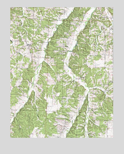
Florence, MO USGS Topographic Map
Click on map above to begin viewing in our Map Viewer.

This topographic map contains these locations and features:
Feature Name Type Latitude Longitude GNIS ID View Map
Bethlehem CemeteryCemeteryN38.5002°W92.9429°714089View Map
Bethlehem ChurchChurchN38.5000°W92.9433°714099View Map
Big BranchStreamN38.6056°W92.8783°714135View Map
Bluhm SchoolSchoolN38.5489°W92.9902°714450View Map
Buck BranchStreamN38.5000°W92.9666°714951View Map
Ebenezer CemeteryCemeteryN38.5872°W92.9432°717376View Map
FlorencePopulated PlaceN38.5889°W92.9791°729740View Map
Florence Community Fire DepartmentBuildingN38.5910°W92.9812°2621653View Map
Florence Post OfficePost OfficeN38.5900°W92.9766°2783213View Map
Florence Union CemeteryCemeteryN38.5876°W92.9778°2702488View Map
Lemler SchoolSchoolN38.5872°W92.9341°720905View Map
Little BranchStreamN38.5906°W92.9974°721168View Map
Lone Oak School (historical)SchoolN38.5895°W92.8780°745292View Map
Lone Star SchoolSchoolN38.5536°W92.8758°729769View Map
Methodist CemeteryCemeteryN38.5867°W92.9772°2702487View Map
Middle Richland CreekStreamN38.5425°W92.9058°722286View Map
Mount Carmel Baptist ChurchChurchN38.5831°W92.8838°722734View Map
Mount Carmel Baptist Church CemeteryCemeteryN38.5834°W92.8838°2702558View Map
Number 742 DamDamN38.6017°W92.9435°763907View Map
Rocky Point SchoolLocaleN38.5575°W92.9144°725526View Map
Self Chapel SchoolSchoolN38.5220°W92.9316°726187View Map
Township of Mill CreekCivilN38.5977°W92.8804°767055View Map
Township of RichlandCivilN38.6079°W92.9996°767058View Map
United Church Of Christ CemeteryCemeteryN38.5863°W92.9770°2702486View Map

Note: Coordinates in the location and feature list above are referenced to NAD83 datum.


Copyright (C) 2008-2025 Ryan Niemi / Sunset Dynamics ... All Rights Reserved