TopoQuest Logo
Do you find TopoQuest useful?
Help keep TopoQuest running and adding new maps/features by donating!
Bitcoin:  19c7KJd3qBynnjoSw5npx9KScwjBe4ifkT
Litecoin:  LXs6TkuXGGXo1vDsWCkWVdjQX94eUKd6ui
Home View Maps Find Maps Find Places Resources & Links


Wabasha South, Minnesota Topographic Map

USGS Map Title: Wabasha South, MN
USGS Map MRC: 44092C1
DRG (GeoTIFF) Download: o44092c1.tif


Neighboring USGS Topographic Map Quads:


  Pepin, WI  
44092D2
 

  Wabasha North, MN  
44092D1
 

  Urne, WI  
44091D8
 

  Theilman, MN  
44092C2
 

  Wabasha South, MN  
44092C1
 

  Alma, WI  
44091C8
 

  Plainview, MN  
44092B2
 

  Beaver, MN  
44092B1
 

  Weaver, MN  
44091B8


Map MRC Location:

N45°
W93°
N45°
W92°
H8 H7 H6 H5 H4 H3 H2 H1
G8 G7 G6 G5 G4 G3 G2 G1
F8 F7 F6 F5 F4 F3 F2 F1
E8 E7 E6 E5 E4 E3 E2 E1
D8 D7 D6 D5 D4 D3 D2 D1
C8 C7 C6 C5 C4 C3 C2 C1
B8 B7 B6 B5 B4 B3 B2 B1
A8 A7 A6 A5 A4 A3 A2 A1
N44°
W93°
N44°
W92°

Wabasha South, MN USGS 1:24K Topographic Map Preview:
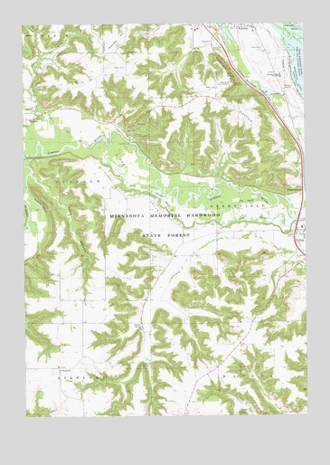
Wabasha South, MN USGS Topographic Map
Click on map above to begin viewing in our Map Viewer.

This topographic map contains these locations and features:
Feature Name Type Latitude Longitude GNIS ID View Map
Albertson SloughGutN44.3186°W92.0635°639252View Map
Arrowhead Bluffs MuseumBuildingN44.3550°W92.0489°2064722View Map
C Jordan DamDamN44.3083°W92.0885°1776597View Map
Canfield SpringSpringN44.2672°W92.0721°640868View Map
City of WabashaCivilN44.3706°W92.0420°2397156View Map
Coffee Mill Country ClubLocaleN44.3547°W92.0349°659811View Map
Coffee Mill Ski AreaLocaleN44.3556°W92.0292°2064723View Map
ConceptionPopulated PlaceN44.2655°W92.1099°654652View Map
Conception CemeteryCemeteryN44.2644°W92.1097°2064636View Map
Conception Post Office (historical)Post OfficeN44.2656°W92.1097°2064606View Map
Cook ValleyFlatN44.3208°W92.0718°641460View Map
Costello SpringSpringN44.2780°W92.0741°641520View Map
DumfriesPopulated PlaceN44.3450°W92.1202°654682View Map
Dumfries Post Office (historical)Post OfficeN44.3450°W92.1200°2064604View Map
Fry SloughGutN44.3177°W92.0274°643980View Map
Greenfield CemeteryCemeteryN44.3108°W92.0396°644437View Map
Greenfield HillSummitN44.3458°W92.0260°644438View Map
Hope CouleeValleyN44.3594°W92.1212°645176View Map
Kruger CampgroundLocaleN44.3394°W92.0763°646267View Map
KWMB-FM (Wabasha)TowerN44.3680°W92.0810°663130View Map
Marx CouleeValleyN44.3729°W92.1204°647583View Map
Midland JunctionPopulated PlaceN44.3211°W92.0016°654827View Map
Our Redeemer's Lutheran ChurchChurchN44.3739°W92.0278°2064705View Map
Peter Drysdale DamDamN44.2683°W92.0652°1777297View Map
Pine SloughGutN44.3122°W92.0229°649496View Map
Ryan CouleeValleyN44.3662°W92.1158°650439View Map
Saint Agnes Catholic ChurchChurchN44.3072°W92.0006°2064734View Map
Saint Agnes CemeteryCemeteryN44.3005°W92.0052°650478View Map
Sand CouleeValleyN44.3274°W92.1220°651134View Map
Schouweiller-Speedling DamDamN44.2866°W92.0985°1777253View Map
Sheehan-Stork DamDamN44.2550°W92.0352°1776595View Map
Trout BrookStreamN44.3369°W92.1002°653343View Map
Tushaus SloughGutN44.3169°W92.1177°653387View Map
Wabasha - Kellogg High SchoolSchoolN44.3584°W92.0112°653698View Map
Wabasha County JailBuildingN44.3676°W92.0242°2758762View Map
Wabasha County Sheriff's OfficeBuildingN44.3676°W92.0238°2064721View Map
Wabasha HillSummitN44.3689°W92.0832°653697View Map
Wabasha OverlookParkN44.3556°W92.0303°2064733View Map

Note: Coordinates in the location and feature list above are referenced to NAD83 datum.


Copyright (C) 2008-2024 Ryan Niemi / Sunset Dynamics ... All Rights Reserved