TopoQuest Logo
Do you find TopoQuest useful?
Help keep TopoQuest running and adding new maps/features by donating!
Bitcoin:  19c7KJd3qBynnjoSw5npx9KScwjBe4ifkT
Litecoin:  LXs6TkuXGGXo1vDsWCkWVdjQX94eUKd6ui
Home View Maps Find Maps Find Places Resources & Links


Bolckow, Missouri Topographic Map

USGS Map Title: Bolckow, MO
USGS Map MRC: 40094A7
DRG (GeoTIFF) Download: o40094a7.tif


Neighboring USGS Topographic Map Quads:


  Bolckow NW, MO  
40094B8
 

  Barnard, MO  
40094B7
 

  Guilford, MO  
40094B6
 

  Fillmore, MO  
40094A8
 

  Bolckow, MO  
40094A7
 

  Whitesville, MO  
40094A6
 

  Amazonia, MO  
39094H8
 

  Savannah, MO  
39094H7
 

  Helena, MO  
39094H6


Map MRC Location:

N41°
W95°
N41°
W94°
H8 H7 H6 H5 H4 H3 H2 H1
G8 G7 G6 G5 G4 G3 G2 G1
F8 F7 F6 F5 F4 F3 F2 F1
E8 E7 E6 E5 E4 E3 E2 E1
D8 D7 D6 D5 D4 D3 D2 D1
C8 C7 C6 C5 C4 C3 C2 C1
B8 B7 B6 B5 B4 B3 B2 B1
A8 A7 A6 A5 A4 A3 A2 A1
N40°
W95°
N40°
W94°

Bolckow, MO USGS 1:24K Topographic Map Preview:
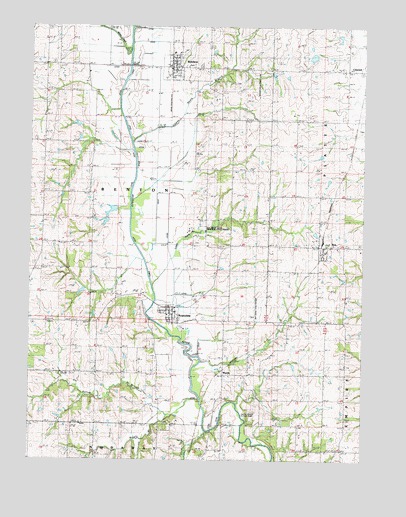
Bolckow, MO USGS Topographic Map
Click on map above to begin viewing in our Map Viewer.

This topographic map contains these locations and features:
Feature Name Type Latitude Longitude GNIS ID View Map
BolckowPopulated PlaceN40.1130°W94.8222°714496View Map
Bolckow CemeteryCemeteryN40.1137°W94.8142°2681277View Map
Bolckow Fire Protection DistrictBuildingN40.1129°W94.8224°2621476View Map
Bolckow Post OfficePost OfficeN40.1128°W94.8225°2782641View Map
City of BolckowCivilN40.1152°W94.8212°2394215View Map
City of ReaCivilN40.0616°W94.7645°2396330View Map
City of RosendaleCivilN40.0407°W94.8234°2396434View Map
Eva Neely Davis Memorial State ForestForestN40.0683°W94.8083°741836View Map
Fairview ChurchChurchN40.0092°W94.8252°717796View Map
Glenwood School (historical)SchoolN40.0247°W94.7939°718527View Map
Hadorn Bridge Access AreaLocaleN40.0130°W94.7955°741835View Map
Hickory Point School (historical)SchoolN40.0633°W94.8514°719490View Map
Housman SchoolSchoolN40.0911°W94.8686°719895View Map
Kellog BranchStreamN40.0133°W94.8214°720506View Map
Lake La VerneReservoirN40.1164°W94.7695°760327View Map
Lake La Verne DamDamN40.1167°W94.7669°760326View Map
Lower Neely BranchStreamN40.0550°W94.8272°721643View Map
Lower Neely School (historical)SchoolN40.0680°W94.8094°721644View Map
MidwayPopulated PlaceN40.1139°W94.8697°737890View Map
Montgomery School (historical)SchoolN40.1133°W94.8700°722545View Map
Mount Calvary SchoolSchoolN40.0180°W94.8269°722725View Map
Oak Grove School (historical)SchoolN40.0222°W94.8505°723612View Map
Parker SchoolSchoolN40.0400°W94.7564°724037View Map
Radical School (historical)SchoolN40.1055°W94.7572°725057View Map
ReaPopulated PlaceN40.0619°W94.7647°730189View Map
Rea Post OfficePost OfficeN40.0616°W94.7649°2782670View Map
Riggin BranchStreamN40.0183°W94.8108°725302View Map
RosendalePopulated PlaceN40.0444°W94.8208°730201View Map
Rosendale Fire Protection District Station 1BuildingN40.0437°W94.8238°2621557View Map
Rosendale Fire Protection District Station 2BuildingN40.0603°W94.7643°2620606View Map
Rosendale Post OfficePost OfficeN40.0481°W94.8337°2782598View Map
Sybert Lake - LowerReservoirN40.0719°W94.8446°762754View Map
Sybert Lake - UpperReservoirN40.0685°W94.8469°762748View Map
Sybert Lake Dam - LowerDamN40.0717°W94.8419°762753View Map
Sybert Lake Dam - UpperDamN40.0700°W94.8469°762747View Map
Township of BentonCivilN40.0673°W94.8356°766220View Map
Upper Neely BranchStreamN40.0886°W94.8352°728072View Map
Upper Neely School (historical)SchoolN40.1058°W94.8039°728073View Map
Vernon Church (historical)ChurchN40.0775°W94.8558°728173View Map
White Cloud CreekStreamN40.1178°W94.8380°728729View Map
WyethPopulated PlaceN40.0250°W94.8022°730255View Map

Note: Coordinates in the location and feature list above are referenced to NAD83 datum.


Copyright (C) 2008-2025 Ryan Niemi / Sunset Dynamics ... All Rights Reserved