TopoQuest Logo
Do you find TopoQuest useful?
Help keep TopoQuest running and adding new maps/features by donating!
Bitcoin:  19c7KJd3qBynnjoSw5npx9KScwjBe4ifkT
Litecoin:  LXs6TkuXGGXo1vDsWCkWVdjQX94eUKd6ui
Home View Maps Find Maps Find Places Resources & Links


Wattis, Utah Topographic Map

USGS Map Title: Wattis, UT
USGS Map MRC: 39111E1
DRG (GeoTIFF) Download: o39111e1.tif


Neighboring USGS Topographic Map Quads:


  Scofield, UT  
39111F2
 

  Jump Creek, UT  
39111F1
 

  Standardville, UT  
39110F8
 

  Candland Mountain, UT  
39111E2
 

  Wattis, UT  
39111E1
 

  Pinnacle Peak, UT  
39110E8
 

  Rilda Canyon, UT  
39111D2
 

  Hiawatha, UT  
39111D1
 

  Poison Spring Bench, UT  
39110D8


Map MRC Location:

N40°
W112°
N40°
W111°
H8 H7 H6 H5 H4 H3 H2 H1
G8 G7 G6 G5 G4 G3 G2 G1
F8 F7 F6 F5 F4 F3 F2 F1
E8 E7 E6 E5 E4 E3 E2 E1
D8 D7 D6 D5 D4 D3 D2 D1
C8 C7 C6 C5 C4 C3 C2 C1
B8 B7 B6 B5 B4 B3 B2 B1
A8 A7 A6 A5 A4 A3 A2 A1
N39°
W112°
N39°
W111°

Wattis, UT USGS 1:24K Topographic Map Preview:
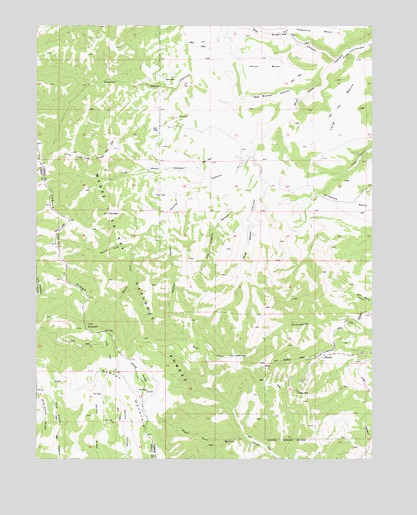
Wattis, UT USGS Topographic Map
Click on map above to begin viewing in our Map Viewer.

This topographic map contains these locations and features:
Feature Name Type Latitude Longitude GNIS ID View Map
Bob Bishop CanyonValleyN39.6039°W111.0282°1438980View Map
Bob Wright CanyonValleyN39.6155°W111.0121°1438983View Map
Castle Valley RidgeRidgeN39.5619°W111.1166°1439523View Map
Corner CanyonValleyN39.5908°W111.0446°1439955View Map
First Water CanyonValleyN39.5816°W111.0604°1441065View Map
Gentry MountainSummitN39.5247°W111.1068°1441299View Map
Gentry RidgeRidgeN39.5061°W111.1063°1441300View Map
Hoag RidgeRidgeN39.5252°W111.0879°1441784View Map
Horse BenchBenchN39.6133°W111.0416°1441859View Map
Little ParkFlatN39.5316°W111.0991°1442755View Map
Lone Pine Tree RidgeRidgeN39.5866°W111.1068°1442880View Map
Long BenchBenchN39.6008°W111.0129°1442889View Map
Los Angeles CanyonValleyN39.5730°W111.0468°1442952View Map
Mud Water CanyonValleyN39.6155°W111.0121°1443722View Map
North Fork Corner CanyonValleyN39.5619°W111.0893°1443896View Map
Plateau MineMineN39.5197°W111.0291°1444473View Map
Second Water CanyonValleyN39.6036°W111.0504°1445412View Map
Seeley CanyonValleyN39.5719°W111.0741°1445419View Map
South Fork Corner CanyonValleyN39.5619°W111.0896°1445834View Map
Star PointSummitN39.5308°W111.0624°1446095View Map
Star Point MineMineN39.5275°W111.0404°1450012View Map
The SteepsCliffN39.5386°W111.1068°1446506View Map
WattisPopulated PlaceN39.5302°W111.0171°1447080View Map
Wild Cattle RidgeRidgeN39.5094°W111.1235°1447342View Map
Wiregrass BenchBenchN39.5725°W111.0071°1447491View Map

Note: Coordinates in the location and feature list above are referenced to NAD83 datum.


Copyright (C) 2008-2025 Ryan Niemi / Sunset Dynamics ... All Rights Reserved