TopoQuest Logo
Do you find TopoQuest useful?
Help keep TopoQuest running and adding new maps/features by donating!
Bitcoin:  19c7KJd3qBynnjoSw5npx9KScwjBe4ifkT
Litecoin:  LXs6TkuXGGXo1vDsWCkWVdjQX94eUKd6ui
Home View Maps Find Maps Find Places Resources & Links


Hiawatha, Utah Topographic Map

USGS Map Title: Hiawatha, UT
USGS Map MRC: 39111D1
DRG (GeoTIFF) Download: o39111d1.tif


Neighboring USGS Topographic Map Quads:


  Candland Mountain, UT  
39111E2
 

  Wattis, UT  
39111E1
 

  Pinnacle Peak, UT  
39110E8
 

  Rilda Canyon, UT  
39111D2
 

  Hiawatha, UT  
39111D1
 

  Poison Spring Bench, UT  
39110D8
 

  Mahogany Point, UT  
39111C2
 

  Red Point, UT  
39111C1
 

  Huntington, UT  
39110C8


Map MRC Location:

N40°
W112°
N40°
W111°
H8 H7 H6 H5 H4 H3 H2 H1
G8 G7 G6 G5 G4 G3 G2 G1
F8 F7 F6 F5 F4 F3 F2 F1
E8 E7 E6 E5 E4 E3 E2 E1
D8 D7 D6 D5 D4 D3 D2 D1
C8 C7 C6 C5 C4 C3 C2 C1
B8 B7 B6 B5 B4 B3 B2 B1
A8 A7 A6 A5 A4 A3 A2 A1
N39°
W112°
N39°
W111°

Hiawatha, UT USGS 1:24K Topographic Map Preview:
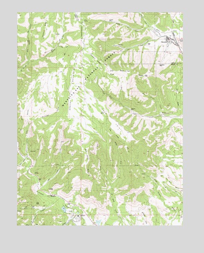
Hiawatha, UT USGS Topographic Map
Click on map above to begin viewing in our Map Viewer.

This topographic map contains these locations and features:
Feature Name Type Latitude Longitude GNIS ID View Map
Bald RidgeRidgeN39.4647°W111.0396°1425261View Map
Bear Creek CampgroundLocaleN39.3927°W111.1004°1437865View Map
Bear Creek CanyonValleyN39.3989°W111.1107°1425347View Map
Ben Johnson CanyonValleyN39.4402°W111.0174°1425417View Map
Birch SpringSpringN39.4058°W111.1123°1425617View Map
Blackhawk MineMineN39.4691°W111.0182°1425742View Map
Chris Otteson TrailTrailN39.4325°W111.0566°1426620View Map
Co-op MineMineN39.4183°W111.1157°1426742View Map
Deer CreekStreamN39.3858°W111.0813°1440370View Map
Fiddlers GreenFlatN39.4722°W111.0660°1427915View Map
Gentry HollowValleyN39.4702°W111.1174°1441298View Map
HiawathaPopulated PlaceN39.4844°W111.0116°1428681View Map
Hiawatha CemeteryCemeteryN39.4862°W111.0113°2769395View Map
Hiawatha MineMineN39.4947°W111.0560°1428682View Map
Huntington CanyonValleyN39.4416°W111.0299°1448499View Map
Huntington DamDamN39.3816°W111.0791°1434743View Map
Huntington ReservoirReservoirN39.3825°W111.0798°1434742View Map
Jacks HoleValleyN39.4802°W111.0949°1429095View Map
King MineMineN39.4808°W111.0491°1437877View Map
King Number Four and Number Five MineMineN39.4947°W111.0604°1449997View Map
King Number Two MineMineN39.4411°W111.0363°1449993View Map
Left Fork Cedar CreekStreamN39.4477°W111.0488°1429530View Map
Left Fork Fish CreekStreamN39.3966°W111.0541°1429536View Map
Left Fork Miller CreekStreamN39.4880°W111.0135°1429539View Map
Long PointCapeN39.4391°W111.0568°1429912View Map
McCadden HollowValleyN39.4344°W111.1163°1430158View Map
Meetinghouse CanyonValleyN39.3914°W111.0968°1443299View Map
Middle Fork Miller CreekStreamN39.4914°W111.0254°1430276View Map
MohrlandPopulated PlaceN39.4402°W111.0152°1437639View Map
Mohrland MineMineN39.4430°W111.0402°1430401View Map
Mud SpringSpringN39.4410°W111.0603°1430566View Map
North Fork Meetinghouse CanyonValleyN39.3839°W111.1082°1443917View Map
Oil Well BenchBenchN39.3955°W111.0027°1430959View Map
Pine SpringSpringN39.4951°W111.0758°1431271View Map
Right Fork Cedar CreekStreamN39.4475°W111.0488°1431792View Map
Right Fork Fish CreekStreamN39.3964°W111.0541°1431799View Map
Right Fork Miller CreekStreamN39.4914°W111.0254°1444943View Map
Rilda CanyonValleyN39.4141°W111.1193°1444983View Map
Trail CanyonValleyN39.4152°W111.1174°1433626View Map
Wild Cattle HollowValleyN39.4700°W111.1174°1447341View Map
Wild Horse RidgeRidgeN39.4116°W111.0727°1434261View Map

Note: Coordinates in the location and feature list above are referenced to NAD83 datum.


Copyright (C) 2008-2024 Ryan Niemi / Sunset Dynamics ... All Rights Reserved