TopoQuest Logo
Do you find TopoQuest useful?
Help keep TopoQuest running and adding new maps/features by donating!
Bitcoin:  19c7KJd3qBynnjoSw5npx9KScwjBe4ifkT
Litecoin:  LXs6TkuXGGXo1vDsWCkWVdjQX94eUKd6ui
Home View Maps Find Maps Find Places Resources & Links


Candland Mountain, Utah Topographic Map

USGS Map Title: Candland Mountain, UT
USGS Map MRC: 39111E2
DRG (GeoTIFF) Download: o39111e2.tif


Neighboring USGS Topographic Map Quads:


  Fairview Lakes, UT  
39111F3
 

  Scofield, UT  
39111F2
 

  Jump Creek, UT  
39111F1
 

  Huntington Reservoir, UT  
39111E3
 

  Candland Mountain, UT  
39111E2
 

  Wattis, UT  
39111E1
 

  South Tent Mountain, UT  
39111D3
 

  Rilda Canyon, UT  
39111D2
 

  Hiawatha, UT  
39111D1


Map MRC Location:

N40°
W112°
N40°
W111°
H8 H7 H6 H5 H4 H3 H2 H1
G8 G7 G6 G5 G4 G3 G2 G1
F8 F7 F6 F5 F4 F3 F2 F1
E8 E7 E6 E5 E4 E3 E2 E1
D8 D7 D6 D5 D4 D3 D2 D1
C8 C7 C6 C5 C4 C3 C2 C1
B8 B7 B6 B5 B4 B3 B2 B1
A8 A7 A6 A5 A4 A3 A2 A1
N39°
W112°
N39°
W111°

Candland Mountain, UT USGS 1:24K Topographic Map Preview:
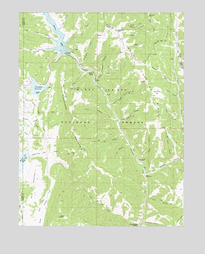
Candland Mountain, UT USGS Topographic Map
Click on map above to begin viewing in our Map Viewer.

This topographic map contains these locations and features:
Feature Name Type Latitude Longitude GNIS ID View Map
Bald MountainSummitN39.5261°W111.2380°1438356View Map
Bear CanyonValleyN39.6055°W111.2205°1438454View Map
Candland MountainSummitN39.5644°W111.2093°1439462View Map
Cleveland DamDamN39.5783°W111.2391°1447800View Map
Cleveland ReservoirReservoirN39.5806°W111.2367°1439809View Map
Coal CanyonValleyN39.6147°W111.2221°1439833View Map
Corral CanyonValleyN39.5380°W111.1607°1439961View Map
Cox CanyonValleyN39.6072°W111.2188°1440103View Map
Day CanyonValleyN39.5497°W111.1704°1448325View Map
Electric LakeReservoirN39.6171°W111.2247°1447801View Map
Electric Lake DamDamN39.6033°W111.2157°1447802View Map
Engineer CanyonValleyN39.5608°W111.1754°1448377View Map
Fireside MineMineN39.6233°W111.1532°1441047View Map
First CanyonValleyN39.5616°W111.1277°1448399View Map
Flood CanyonValleyN39.5611°W111.1777°1441145View Map
Forks of Huntington CampgroundLocaleN39.5008°W111.1602°1448414View Map
Hog FlatFlatN39.5780°W111.2260°1441792View Map
Hughes CanyonValleyN39.5827°W111.1913°1441936View Map
Huntington MineMineN39.6175°W111.2188°1441954View Map
Lake CanyonValleyN39.5633°W111.2346°1442396View Map
Little Eccles CanyonValleyN39.6080°W111.2213°1442711View Map
McElprang CanyonValleyN39.5022°W111.1585°1448721View Map
Mill CanyonValleyN39.5477°W111.1688°1443407View Map
Miller Flat CreekStreamN39.5436°W111.2305°1443484View Map
Miller Flat DamDamN39.5400°W111.2424°1447798View Map
Miller Flat ReservoirReservoirN39.5381°W111.2479°1438092View Map
Monument PeakSummitN39.6139°W111.1763°1443573View Map
North Hughes CanyonValleyN39.5827°W111.1921°1448750View Map
Nuck Woodward CanyonValleyN39.5305°W111.1541°1438096View Map
Old Fireside MineMineN39.6233°W111.1521°1448774View Map
Old Folks Flat CampgroundLocaleN39.5389°W111.1596°1448775View Map
Old Larsen MineMineN39.5425°W111.2213°1444072View Map
Pole CanyonValleyN39.5161°W111.1560°1444515View Map
Ragman CanyonValleyN39.6197°W111.1521°1448896View Map
Sawmill CanyonValleyN39.5841°W111.1313°1448975View Map
Scad Valley CreekStreamN39.5380°W111.2241°1445367View Map
Second CanyonValleyN39.5614°W111.1274°1448983View Map
Seeley MountainSummitN39.5058°W111.2157°1445420View Map
Short CanyonValleyN39.5377°W111.1352°1449001View Map
South Hughes CanyonValleyN39.5716°W111.1821°1445897View Map
Staker CanyonValleyN39.5508°W111.2310°1446092View Map
Stuart Guard StationLocaleN39.5211°W111.1546°1449078View Map
Sulphur SpringSpringN39.5789°W111.1857°1446225View Map
Trough Springs RidgeRidgeN39.5822°W111.1546°1446737View Map
Valentines GulchValleyN39.5941°W111.2049°1446905View Map
Yellow Brush FlatFlatN39.5777°W111.1454°1449212View Map

Note: Coordinates in the location and feature list above are referenced to NAD83 datum.


Copyright (C) 2008-2025 Ryan Niemi / Sunset Dynamics ... All Rights Reserved