TopoQuest Logo
Do you find TopoQuest useful?
Help keep TopoQuest running and adding new maps/features by donating!
Bitcoin:  19c7KJd3qBynnjoSw5npx9KScwjBe4ifkT
Litecoin:  LXs6TkuXGGXo1vDsWCkWVdjQX94eUKd6ui
Home View Maps Find Maps Find Places Resources & Links


Rilda Canyon, Utah Topographic Map

USGS Map Title: Rilda Canyon, UT
USGS Map MRC: 39111D2
DRG (GeoTIFF) Download: o39111d2.tif


Neighboring USGS Topographic Map Quads:


  Huntington Reservoir, UT  
39111E3
 

  Candland Mountain, UT  
39111E2
 

  Wattis, UT  
39111E1
 

  South Tent Mountain, UT  
39111D3
 

  Rilda Canyon, UT  
39111D2
 

  Hiawatha, UT  
39111D1
 

  Joes Valley Reservoir, UT  
39111C3
 

  Mahogany Point, UT  
39111C2
 

  Red Point, UT  
39111C1


Map MRC Location:

N40°
W112°
N40°
W111°
H8 H7 H6 H5 H4 H3 H2 H1
G8 G7 G6 G5 G4 G3 G2 G1
F8 F7 F6 F5 F4 F3 F2 F1
E8 E7 E6 E5 E4 E3 E2 E1
D8 D7 D6 D5 D4 D3 D2 D1
C8 C7 C6 C5 C4 C3 C2 C1
B8 B7 B6 B5 B4 B3 B2 B1
A8 A7 A6 A5 A4 A3 A2 A1
N39°
W112°
N39°
W111°

Rilda Canyon, UT USGS 1:24K Topographic Map Preview:
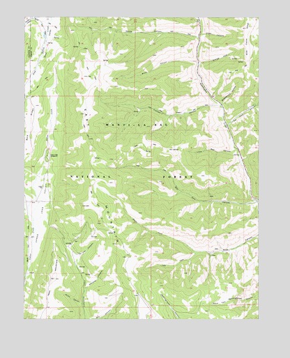
Rilda Canyon, UT USGS Topographic Map
Click on map above to begin viewing in our Map Viewer.

This topographic map contains these locations and features:
Feature Name Type Latitude Longitude GNIS ID View Map
Bald RidgeRidgeN39.4558°W111.2474°1438363View Map
Biddlecome HollowValleyN39.4647°W111.1452°1438626View Map
Blind CanyonValleyN39.4816°W111.1585°1438905View Map
Coenwal MineMineN39.4600°W111.1674°1450017View Map
Crandall CanyonValleyN39.4636°W111.1471°1440128View Map
East MountainSummitN39.4755°W111.2168°1440838View Map
Flat CanyonValleyN39.3997°W111.2210°1441118View Map
Grange HoleValleyN39.4811°W111.1566°1441410View Map
Horse CanyonValleyN39.4922°W111.1585°1441860View Map
Horse CreekStreamN39.4922°W111.1577°1451263View Map
Hunington Number 4 MineMineN39.4266°W111.1524°1455123View Map
Indian Creek CampgroundLocaleN39.4427°W111.2382°1441992View Map
Left Fork Huntington CreekStreamN39.5000°W111.1599°1442503View Map
Left Fork Rilda CanyonValleyN39.4030°W111.1585°1442522View Map
Little Bear CanyonValleyN39.4450°W111.1382°1442659View Map
Manti-La Sal National Forest - Manti DivisionForestN39.4250°W111.1757°1451293View Map
Marinus CanyonValleyN39.3877°W111.2177°1443195View Map
Mill ForkStreamN39.4239°W111.1263°1443448View Map
Paradise CreekStreamN39.4994°W111.2363°1444185View Map
Right Fork Rilda CanyonValleyN39.4030°W111.1585°1444951View Map
Scad ValleyValleyN39.4958°W111.2363°1445366View Map
Spoon CreekStreamN39.4694°W111.2374°1451352View Map
Tie Fork CanyonValleyN39.4558°W111.1413°1446596View Map
Trail MountainSummitN39.3919°W111.2346°1446686View Map
Upper Joes ValleyValleyN39.3958°W111.2482°1446865View Map
Upper Joes Valley Guard StationLocaleN39.4294°W111.2407°1451372View Map
Vicks CanyonValleyN39.4930°W111.1563°1433888View Map
Winks CanyonValleyN39.3814°W111.2196°1447482View Map

Note: Coordinates in the location and feature list above are referenced to NAD83 datum.


Copyright (C) 2008-2025 Ryan Niemi / Sunset Dynamics ... All Rights Reserved