TopoQuest Logo
Do you find TopoQuest useful?
Help keep TopoQuest running and adding new maps/features by donating!
Bitcoin:  19c7KJd3qBynnjoSw5npx9KScwjBe4ifkT
Litecoin:  LXs6TkuXGGXo1vDsWCkWVdjQX94eUKd6ui
Home View Maps Find Maps Find Places Resources & Links


Wauzeka East, Wisconsin Topographic Map

USGS Map Title: Wauzeka East, WI
USGS Map MRC: 43090A7
DRG (GeoTIFF) Download: o43090a7.tif


Neighboring USGS Topographic Map Quads:


  Crowley Ridge, WI  
43090B8
 

  Steuben, WI  
43090B7
 

  Boscobel, WI  
43090B6
 

  Wauzeka West, WI  
43090A8
 

  Wauzeka East, WI  
43090A7
 

  Long Hollow, WI  
43090A6
 

  Bloomington, WI  
42090H8
 

  Mount Hope, WI  
42090H7
 

  Fennimore, WI  
42090H6


Map MRC Location:

N44°
W91°
N44°
W90°
H8 H7 H6 H5 H4 H3 H2 H1
G8 G7 G6 G5 G4 G3 G2 G1
F8 F7 F6 F5 F4 F3 F2 F1
E8 E7 E6 E5 E4 E3 E2 E1
D8 D7 D6 D5 D4 D3 D2 D1
C8 C7 C6 C5 C4 C3 C2 C1
B8 B7 B6 B5 B4 B3 B2 B1
A8 A7 A6 A5 A4 A3 A2 A1
N43°
W91°
N43°
W90°

Wauzeka East, WI USGS 1:24K Topographic Map Preview:
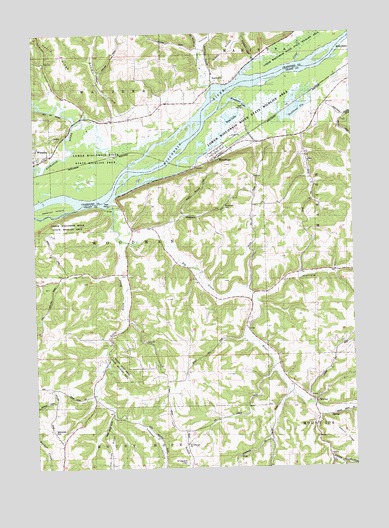
Wauzeka East, WI USGS Topographic Map
Click on map above to begin viewing in our Map Viewer.

This topographic map contains these locations and features:
Feature Name Type Latitude Longitude GNIS ID View Map
Bethlehem CemeteryCemeteryN43.0105°W90.8685°1561650View Map
Big Green RiverStreamN43.0761°W90.8448°1561727View Map
Blue Rock Kanyon RanchLocaleN43.0258°W90.8303°2709188View Map
BoydtownPopulated PlaceN43.1105°W90.8037°1577523View Map
Boydtown CemeteryCemeteryN43.1119°W90.7957°1845666View Map
Boydtown HollowValleyN43.1099°W90.8050°1845665View Map
Brown HollowValleyN43.0966°W90.8338°1845667View Map
Bullhead SloughGutN43.1011°W90.7721°1562405View Map
Clear CreekStreamN43.1161°W90.7710°1563141View Map
Dead LakeLakeN43.1005°W90.7976°1563773View Map
Dry HollowValleyN43.0497°W90.7883°1564123View Map
Foxboro HollowValleyN43.0159°W90.8447°1565239View Map
Green River SchoolSchoolN43.0530°W90.8118°1565828View Map
Little Green RiverStreamN43.0667°W90.8421°1568270View Map
Mount Hope Pond State Wildlife AreaParkN43.0297°W90.8429°1845670View Map
Newton IslandIslandN43.0742°W90.8671°1570266View Map
Rosendale CemeteryCemeteryN43.0755°W90.8004°1845673View Map
Saint Lawrence CemeteryCemeteryN43.0014°W90.8160°1845675View Map
Saint Lawrence ChurchChurchN43.0067°W90.8162°1573211View Map
Schauff Family DairyLocaleN43.0025°W90.7611°2709187View Map
Town of WoodmanCivilN43.0525°W90.8369°1584476View Map
Village of WoodmanCivilN43.0925°W90.7970°1584475View Map
Wauzeka Bottoms State Natural AreaParkN43.0833°W90.8604°2059860View Map
WerleyPopulated PlaceN43.0194°W90.7654°1577875View Map
WoodmanPopulated PlaceN43.0900°W90.8012°1577015View Map
Woodman LakeLakeN43.1059°W90.7960°1577016View Map
Woodman Lake Sand Prairie and Dead Lake State Natural AreaParkN43.0961°W90.7985°1989134View Map

Note: Coordinates in the location and feature list above are referenced to NAD83 datum.


Copyright (C) 2008-2025 Ryan Niemi / Sunset Dynamics ... All Rights Reserved