TopoQuest Logo
Do you find TopoQuest useful?
Help keep TopoQuest running and adding new maps/features by donating!
Bitcoin:  19c7KJd3qBynnjoSw5npx9KScwjBe4ifkT
Litecoin:  LXs6TkuXGGXo1vDsWCkWVdjQX94eUKd6ui
Home View Maps Find Maps Find Places Resources & Links


Waverly, Kentucky Topographic Map

USGS Map Title: Waverly, KY
USGS Map MRC: 37087F7
DRG (GeoTIFF) Download: o37087f7.tif


Neighboring USGS Topographic Map Quads:


  Uniontown, KY  
37087G8
 

  Smith Mills, KY  
37087G7
 

  Wilson, KY  
37087G6
 

  Morganfield, KY  
37087F8
 

  Waverly, KY  
37087F7
 

  Poole, KY  
37087F6
 

  Sturgis, KY  
37087E8
 

  Bordley, KY  
37087E7
 

  Dixon, KY  
37087E6


Map MRC Location:

N38°
W88°
N38°
W87°
H8 H7 H6 H5 H4 H3 H2 H1
G8 G7 G6 G5 G4 G3 G2 G1
F8 F7 F6 F5 F4 F3 F2 F1
E8 E7 E6 E5 E4 E3 E2 E1
D8 D7 D6 D5 D4 D3 D2 D1
C8 C7 C6 C5 C4 C3 C2 C1
B8 B7 B6 B5 B4 B3 B2 B1
A8 A7 A6 A5 A4 A3 A2 A1
N37°
W88°
N37°
W87°

Waverly, KY USGS 1:24K Topographic Map Preview:
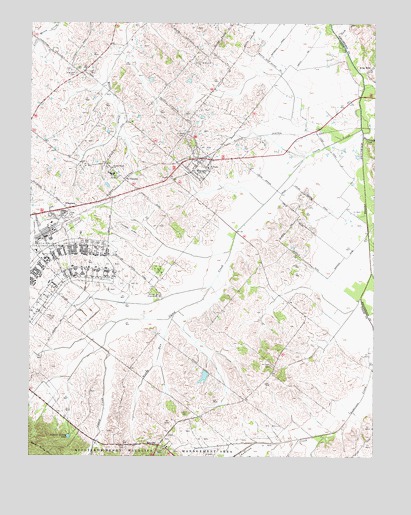
Waverly, KY USGS Topographic Map
Click on map above to begin viewing in our Map Viewer.

This topographic map contains these locations and features:
Feature Name Type Latitude Longitude GNIS ID View Map
Beaverdam CreekStreamN37.7175°W87.7542°486630View Map
BoxvillePopulated PlaceN37.6284°W87.8278°507564View Map
Breckinridge CenterPopulated PlaceN37.6828°W87.8631°1867276View Map
Breckinridge Center Census Designated PlaceCensusN37.6820°W87.8656°2402712View Map
Breckinridge Job Corps CenterLocaleN37.6839°W87.8653°487852View Map
Camp Breckinridge (historical)MilitaryN37.6789°W87.8658°2127635View Map
Camp CreekStreamN37.6784°W87.7506°488688View Map
Casey CreekStreamN37.7195°W87.7547°489044View Map
City of WaverlyCivilN37.7092°W87.8145°2405692View Map
FlournoyPopulated PlaceN37.6956°W87.8614°492269View Map
Highland CemeteryCemeteryN37.7359°W87.8580°494201View Map
King MillsPopulated PlaceN37.7367°W87.7522°508389View Map
McClure (historical)Populated PlaceN37.6515°W87.7858°2743586View Map
McClure CemeteryCemeteryN37.6511°W87.7870°497790View Map
Morganfield Airport (historical)AirportN37.6903°W87.8403°517443View Map
Muddy RunStreamN37.6659°W87.8222°499051View Map
Rock CreekStreamN37.7464°W87.7636°502112View Map
Sacred Heart ChurchChurchN37.7084°W87.8447°502551View Map
Saint Peters CemeteryCemeteryN37.7175°W87.8175°502721View Map
Saint Peters ChurchChurchN37.7084°W87.8097°502724View Map
Saint VincentPopulated PlaceN37.7048°W87.8400°509000View Map
Saint Vincent AcademySchoolN37.7064°W87.8450°502757View Map
Sulphur Spring PondLakeN37.6307°W87.8606°504766View Map
Topeka Crossroads (historical)Populated PlaceN37.6412°W87.7966°2743592View Map
WaverlyPopulated PlaceN37.7098°W87.8128°506302View Map
Waverly Volunteer Fire DepartmentBuildingN37.7108°W87.8088°2637052View Map
Whispering Meadows Volunteer Fire DepartmentBuildingN37.6787°W87.8500°2637054View Map

Note: Coordinates in the location and feature list above are referenced to NAD83 datum.


Copyright (C) 2008-2024 Ryan Niemi / Sunset Dynamics ... All Rights Reserved