TopoQuest Logo
Do you find TopoQuest useful?
Help keep TopoQuest running and adding new maps/features by donating!
Bitcoin:  19c7KJd3qBynnjoSw5npx9KScwjBe4ifkT
Litecoin:  LXs6TkuXGGXo1vDsWCkWVdjQX94eUKd6ui
Home View Maps Find Maps Find Places Resources & Links


Weber, Arkansas Topographic Map

USGS Map Title: Weber, AR
USGS Map MRC: 34091B2
DRG (GeoTIFF) Download: o34091b2.tif


Neighboring USGS Topographic Map Quads:


  De Witt, AR  
34091C3
 

  Ethel, AR  
34091C2
 

  Indian Bay SE, AR  
34091C1
 

  Tichnor, AR  
34091B3
 

  Weber, AR  
34091B2
 

  Henrico NE, AR  
34091B1
 

  Arkansas Post, AR  
34091A3
 

  Henrico SW, AR  
34091A2
 

  Snow Lake, AR  
34091A1


Map MRC Location:

N35°
W92°
N35°
W91°
H8 H7 H6 H5 H4 H3 H2 H1
G8 G7 G6 G5 G4 G3 G2 G1
F8 F7 F6 F5 F4 F3 F2 F1
E8 E7 E6 E5 E4 E3 E2 E1
D8 D7 D6 D5 D4 D3 D2 D1
C8 C7 C6 C5 C4 C3 C2 C1
B8 B7 B6 B5 B4 B3 B2 B1
A8 A7 A6 A5 A4 A3 A2 A1
N34°
W92°
N34°
W91°

Weber, AR USGS 1:24K Topographic Map Preview:
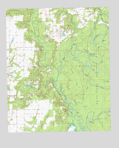
Weber, AR USGS Topographic Map
Click on map above to begin viewing in our Map Viewer.

This topographic map contains these locations and features:
Feature Name Type Latitude Longitude GNIS ID View Map
Albert PondBayN34.1543°W91.1676°45801View Map
Big CreekStreamN34.2109°W91.1707°46526View Map
Bradberry PondReservoirN34.1722°W91.2232°80891View Map
Briar RidgeRidgeN34.2207°W91.1607°46934View Map
Brooks BayouGutN34.1404°W91.1273°46978View Map
Caney BayouStreamN34.2465°W91.2160°47390View Map
Caney PointCapeN34.2120°W91.1671°47438View Map
Church of God (historical)ChurchN34.1920°W91.2462°62174View Map
Cypress BayouStreamN34.1759°W91.1926°48293View Map
DelucePopulated PlaceN34.2087°W91.2468°76779View Map
Drainie LakeLakeN34.1430°W91.1673°76815View Map
Dudley LakeReservoirN34.1823°W91.2443°80889View Map
Dudley Lake DamDamN34.1834°W91.2468°80888View Map
Eagle Nest LakeLakeN34.2164°W91.1340°76834View Map
Essex BayouStreamN34.1845°W91.1871°48916View Map
Grassy LakeLakeN34.2004°W91.1437°77056View Map
Hickory RidgeRidgeN34.1782°W91.1671°50074View Map
Hickory SloughGutN34.1629°W91.1554°50081View Map
Hole in the WallLakeN34.1368°W91.1401°77197View Map
La Grue SpringsPopulated PlaceN34.2079°W91.2118°77424View Map
Long LakeLakeN34.2210°W91.1395°77283View Map
Lower Eagle Nest LakeLakeN34.1312°W91.1507°77285View Map
Malcolm School (historical)SchoolN34.1337°W91.2485°62241View Map
Mays BluffCliffN34.1859°W91.1959°51766View Map
Moon LakesLakeN34.1891°W91.1501°77291View Map
Mud LakeLakeN34.1494°W91.1571°77295View Map
Nichols CemeteryCemeteryN34.2459°W91.2459°52768View Map
Oakdale School (historical)SchoolN34.2373°W91.1937°62270View Map
Payne School (historical)SchoolN34.2445°W91.1621°62278View Map
Potlatch Pond Number One DamDamN34.1718°W91.2218°80890View Map
Potlatch Pond Number TwoReservoirN34.1706°W91.2177°80893View Map
Potlatch Pond Number Two DamDamN34.1701°W91.2185°80892View Map
Prairie BayouGutN34.1718°W91.1471°53754View Map
Rattlesnake RidgeRidgeN34.2045°W91.1498°53911View Map
Sheppard PointPopulated PlaceN34.1912°W91.2118°57187View Map
Tarleton CreekStreamN34.2432°W91.1323°55435View Map
Tipsy BranchStreamN34.2304°W91.1676°55581View Map
Tipsy CemeteryCemeteryN34.2265°W91.1804°55582View Map
Twin LakesLakeN34.1739°W91.1305°77315View Map
Union School (historical)SchoolN34.2218°W91.1937°62322View Map
WeberPopulated PlaceN34.1459°W91.1768°58843View Map
Williams School (historical)SchoolN34.1920°W91.2385°62327View Map
Wolf LakeLakeN34.1457°W91.1257°77323View Map
Wright LakeReservoirN34.2232°W91.1803°80887View Map
Wright Lake DamDamN34.2251°W91.1818°80886View Map

Note: Coordinates in the location and feature list above are referenced to NAD83 datum.


Copyright (C) 2008-2024 Ryan Niemi / Sunset Dynamics ... All Rights Reserved