TopoQuest Logo
Do you find TopoQuest useful?
Help keep TopoQuest running and adding new maps/features by donating!
Bitcoin:  19c7KJd3qBynnjoSw5npx9KScwjBe4ifkT
Litecoin:  LXs6TkuXGGXo1vDsWCkWVdjQX94eUKd6ui
Home View Maps Find Maps Find Places Resources & Links


Indian Bay SE, Arkansas Topographic Map

USGS Map Title: Indian Bay SE, AR
USGS Map MRC: 34091C1
DRG (GeoTIFF) Download: o34091c1.tif


Neighboring USGS Topographic Map Quads:


  Crocketts Bluff, AR  
34091D2
 

  Turner, AR  
34091D1
 

  Watkins Corner, AR  
34090D8
 

  Ethel, AR  
34091C2
 

  Indian Bay SE, AR  
34091C1
 

  Lambrook, AR  
34090C8
 

  Weber, AR  
34091B2
 

  Henrico NE, AR  
34091B1
 

  Mellwood, AR  
34090B8


Map MRC Location:

N35°
W92°
N35°
W91°
H8 H7 H6 H5 H4 H3 H2 H1
G8 G7 G6 G5 G4 G3 G2 G1
F8 F7 F6 F5 F4 F3 F2 F1
E8 E7 E6 E5 E4 E3 E2 E1
D8 D7 D6 D5 D4 D3 D2 D1
C8 C7 C6 C5 C4 C3 C2 C1
B8 B7 B6 B5 B4 B3 B2 B1
A8 A7 A6 A5 A4 A3 A2 A1
N34°
W92°
N34°
W91°

Indian Bay SE, AR USGS 1:24K Topographic Map Preview:
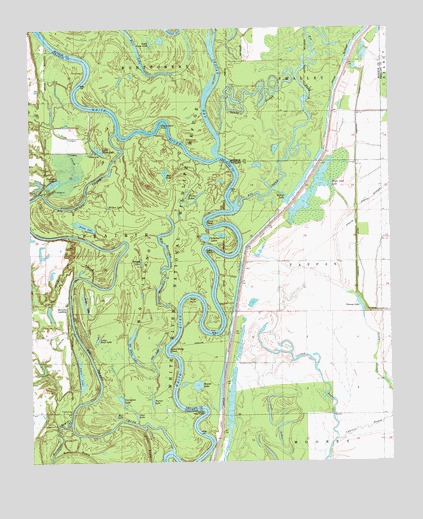
Indian Bay SE, AR USGS Topographic Map
Click on map above to begin viewing in our Map Viewer.

This topographic map contains these locations and features:
Feature Name Type Latitude Longitude GNIS ID View Map
Bass CreekStreamN34.3270°W91.1198°46136View Map
Big CreekStreamN34.3234°W91.0523°83077View Map
Big Horseshoe LakeLakeN34.3060°W91.0780°74664View Map
Big IslandFlatN34.3018°W91.0823°46573View Map
Big Island ChuteGutN34.2907°W91.1107°46578View Map
Big White LakeLakeN34.2796°W91.0891°74672View Map
Brushy LakeLakeN34.3077°W91.0867°74704View Map
Chaney LakeLakeN34.2947°W91.0104°74735View Map
Chute CemeteryCemeteryN34.3284°W91.1221°47788View Map
Cocklebur LakesLakeN34.3147°W91.0643°74751View Map
Coon PointCapeN34.3184°W91.0637°48003View Map
Cottonwood PointCapeN34.3462°W91.0787°48075View Map
Covington LakeLakeN34.2680°W91.0941°74764View Map
Cowpens (historical)Populated PlaceN34.3612°W91.0176°61120View Map
Eagle Nest LakeLakeN34.3297°W91.0203°74812View Map
Frazier LakeLakeN34.3307°W91.1170°74842View Map
Gut LakeLakeN34.2813°W91.0817°74870View Map
Horton LakeReservoirN34.2933°W91.1187°80853View Map
Horton Lake DamDamN34.2951°W91.1201°80852View Map
Hortons LandingPopulated PlaceN34.2954°W91.1126°57064View Map
Hughes BendBendN34.2870°W91.0615°62225View Map
Hurricane BayouGutN34.2573°W91.1148°50426View Map
Indian BayStreamN34.3382°W91.0598°50489View Map
Jessie SloughStreamN34.3237°W91.0118°50641View Map
Jones CemeteryCemeteryN34.2776°W91.1190°50721View Map
Jones LakeReservoirN34.2758°W91.1214°80855View Map
Jones Lake DamDamN34.2757°W91.1213°80854View Map
Lake PointCapeN34.3101°W91.0626°50949View Map
Lambrook LeveeLeveeN34.3382°W91.0115°50966View Map
Little Horseshoe LakeLakeN34.3002°W91.0802°74963View Map
Little Jones LakeLakeN34.2856°W91.1019°74968View Map
Little Long LakeLakeN34.3704°W91.0828°74971View Map
Little White LakeLakeN34.3401°W91.1012°74980View Map
Lone Willow PointCapeN34.2820°W91.0773°51408View Map
Long LakeLakeN34.2961°W91.1065°74986View Map
Lost LakesLakeN34.2609°W91.0372°75001View Map
Lower Hog PointCapeN34.2634°W91.0682°51501View Map
Moon LakeLakeN34.3646°W91.0855°75032View Map
Mud LakeLakeN34.2631°W91.0960°75041View Map
Mud LakeLakeN34.3331°W91.0781°75042View Map
Oak BayouStreamN34.2565°W91.0196°52868View Map
Otter LakeLakeN34.2635°W91.0888°75062View Map
Panther BranchStreamN34.3023°W91.1040°53149View Map
Pike PondReservoirN34.3293°W91.1225°80851View Map
Pike Pond DamDamN34.3301°W91.1201°80850View Map
Prairie Cypress CreekStreamN34.3698°W91.0279°53771View Map
Prices LakeLakeN34.3182°W91.1064°75088View Map
Raft BendBendN34.2982°W91.0690°62289View Map
Rock PointCapeN34.2968°W91.0693°54105View Map
Round LakeLakeN34.2721°W91.0675°75109View Map
Sandy SloughGutN34.2809°W91.0054°54580View Map
Sandy SloughLakeN34.3565°W91.0485°54581View Map
Turner LakeLakeN34.2674°W91.0832°75182View Map
Twin LakesLakeN34.3262°W91.0670°75185View Map
Waters BayouLakeN34.3746°W91.0727°56095View Map
Willow LakeLakeN34.3238°W91.0981°75224View Map
Willow LakeLakeN34.3276°W91.0379°75225View Map

Note: Coordinates in the location and feature list above are referenced to NAD83 datum.


Copyright (C) 2008-2025 Ryan Niemi / Sunset Dynamics ... All Rights Reserved