TopoQuest Logo
Do you find TopoQuest useful?
Help keep TopoQuest running and adding new maps/features by donating!
Bitcoin:  19c7KJd3qBynnjoSw5npx9KScwjBe4ifkT
Litecoin:  LXs6TkuXGGXo1vDsWCkWVdjQX94eUKd6ui
Home View Maps Find Maps Find Places Resources & Links


Webster Flat, Utah Topographic Map

USGS Map Title: Webster Flat, UT
USGS Map MRC: 37112E8
DRG (GeoTIFF) Download: o37112e8.tif


Neighboring USGS Topographic Map Quads:


  Cedar City, UT  
37113F1
 

  Flanigan Arch, UT  
37112F8
 

  Brian Head, UT  
37112F7
 

  Cedar Mountain, UT  
37113E1
 

  Webster Flat, UT  
37112E8
 

  Navajo Lake, UT  
37112E7
 

  Kolob Reservoir, UT  
37113D1
 

  Cogswell Point, UT  
37112D8
 

  Straight Canyon, UT  
37112D7


Map MRC Location:

N38°
W113°
N38°
W112°
H8 H7 H6 H5 H4 H3 H2 H1
G8 G7 G6 G5 G4 G3 G2 G1
F8 F7 F6 F5 F4 F3 F2 F1
E8 E7 E6 E5 E4 E3 E2 E1
D8 D7 D6 D5 D4 D3 D2 D1
C8 C7 C6 C5 C4 C3 C2 C1
B8 B7 B6 B5 B4 B3 B2 B1
A8 A7 A6 A5 A4 A3 A2 A1
N37°
W113°
N37°
W112°

Webster Flat, UT USGS 1:24K Topographic Map Preview:
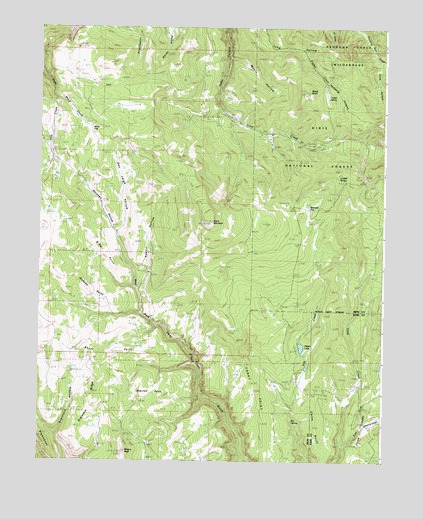
Webster Flat, UT USGS Topographic Map
Click on map above to begin viewing in our Map Viewer.

This topographic map contains these locations and features:
Feature Name Type Latitude Longitude GNIS ID View Map
Adams HollowValleyN37.5497°W112.9647°1438128View Map
Aspen LakeLakeN37.5330°W112.9049°1448093View Map
Bauer PointCapeN37.5316°W112.9852°1438423View Map
Big SpringSpringN37.5117°W112.9084°1438731View Map
Black MountainSummitN37.5694°W112.9383°1438857View Map
Blowhard HollowValleyN37.6153°W112.8752°1438921View Map
Cedar Canyon CampgroundLocaleN37.5916°W112.9008°1451206View Map
Cedar Canyon Ski AreaLocaleN37.5972°W112.9327°1448245View Map
China PointCapeN37.5094°W112.8986°1439693View Map
Corry PointCapeN37.5147°W112.9202°1439982View Map
Crystal CreekStreamN37.6178°W112.9286°1440176View Map
Crystal SpringSpringN37.6053°W112.8964°1440182View Map
Dan Leigh HollowValleyN37.5664°W112.9722°1440246View Map
Deer Haven CampgroundLocaleN37.5741°W112.9105°1451224View Map
East Fork Deep CreekStreamN37.5053°W112.8905°1440802View Map
Everstein HollowValleyN37.5080°W112.9930°1440975View Map
Everstein RidgeRidgeN37.5178°W112.9802°1440976View Map
Houchen HollowValleyN37.5664°W112.9722°1441924View Map
Jackson PointCapeN37.5503°W112.9822°1442095View Map
Kolob TerraceBenchN37.5241°W112.8913°1442355View Map
Lundell SpringSpringN37.5821°W112.8921°1443043View Map
Miners PeakSummitN37.5028°W112.9691°1443517View Map
Moots HollowValleyN37.6164°W112.9311°1443583View Map
O'Neil PointCapeN37.5616°W112.9774°1444008View Map
Schoppmann HollowValleyN37.5094°W112.8827°1445374View Map
Sherratt PointCapeN37.5178°W112.9627°1445524View Map
Slide HollowValleyN37.6175°W112.8786°1445687View Map
Spanish HollowValleyN37.5083°W112.9955°1445950View Map
SteamboatSummitN37.5066°W112.9983°1449066View Map
Three Creeks FlatFlatN37.5103°W112.8824°1449101View Map
Urie CreekStreamN37.6044°W112.9944°1446891View Map
Walts FlatFlatN37.5941°W112.9813°1446975View Map
Webster FlatFlatN37.5755°W112.9038°1447094View Map
Wood KnollSummitN37.6072°W112.9030°1447510View Map
Wood RanchLocaleN37.5939°W112.9163°1447512View Map
Zion OverlookLocaleN37.5944°W112.9336°1455590View Map

Note: Coordinates in the location and feature list above are referenced to NAD83 datum.


Copyright (C) 2008-2025 Ryan Niemi / Sunset Dynamics ... All Rights Reserved