TopoQuest Logo
Do you find TopoQuest useful?
Help keep TopoQuest running and adding new maps/features by donating!
Bitcoin:  19c7KJd3qBynnjoSw5npx9KScwjBe4ifkT
Litecoin:  LXs6TkuXGGXo1vDsWCkWVdjQX94eUKd6ui
Home View Maps Find Maps Find Places Resources & Links


Cogswell Point, Utah Topographic Map

USGS Map Title: Cogswell Point, UT
USGS Map MRC: 37112D8
DRG (GeoTIFF) Download: o37112d8.tif


Neighboring USGS Topographic Map Quads:


  Cedar Mountain, UT  
37113E1
 

  Webster Flat, UT  
37112E8
 

  Navajo Lake, UT  
37112E7
 

  Kolob Reservoir, UT  
37113D1
 

  Cogswell Point, UT  
37112D8
 

  Straight Canyon, UT  
37112D7
 

  The Guardian Angels, UT  
37113C1
 

  Temple of Sinawava, UT  
37112C8
 

  Clear Creek Mountain, UT  
37112C7


Map MRC Location:

N38°
W113°
N38°
W112°
H8 H7 H6 H5 H4 H3 H2 H1
G8 G7 G6 G5 G4 G3 G2 G1
F8 F7 F6 F5 F4 F3 F2 F1
E8 E7 E6 E5 E4 E3 E2 E1
D8 D7 D6 D5 D4 D3 D2 D1
C8 C7 C6 C5 C4 C3 C2 C1
B8 B7 B6 B5 B4 B3 B2 B1
A8 A7 A6 A5 A4 A3 A2 A1
N37°
W113°
N37°
W112°

Cogswell Point, UT USGS 1:24K Topographic Map Preview:
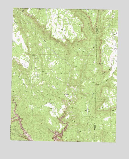
Cogswell Point, UT USGS Topographic Map
Click on map above to begin viewing in our Map Viewer.

This topographic map contains these locations and features:
Feature Name Type Latitude Longitude GNIS ID View Map
Bear CreekStreamN37.4366°W112.8813°1448115View Map
Big BirchWoodsN37.4439°W112.9463°1425461View Map
Big Oak WashValleyN37.4572°W112.9099°1435129View Map
Box CanyonValleyN37.3814°W112.9469°1425925View Map
Burnt FlatFlatN37.4044°W112.9111°1435221View Map
Cogswell PointCapeN37.4047°W112.8966°1426784View Map
Corral CanyonValleyN37.4339°W112.9152°1439965View Map
Crystal CreekStreamN37.4180°W112.9255°1440178View Map
Deep Creek North WildernessReserveN37.4526°W112.9329°2760096View Map
Deep Creek WildernessReserveN37.3887°W112.9357°2760097View Map
Fife CreekStreamN37.4941°W112.8980°1441036View Map
Gordon PointCapeN37.4436°W112.8922°1428267View Map
Hogs HeavenSummitN37.3939°W112.9308°1428757View Map
Little MountainSummitN37.4530°W112.9736°1429764View Map
O'Neil GulchValleyN37.4750°W112.9030°1444006View Map
Oak CreekStreamN37.3980°W112.9930°1430907View Map
Oak ValleyBasinN37.4236°W112.9986°1430937View Map
Puzzle DrawValleyN37.4758°W112.8819°1448884View Map
Spring Run GulchValleyN37.4516°W112.8808°1432865View Map
The ForksLocaleN37.4183°W112.9252°1433309View Map
Thorley PointCapeN37.4441°W112.9836°1433478View Map
Virgin FlatsFlatN37.4080°W112.9555°1433900View Map
Volcano KnollSummitN37.4194°W112.9363°1433905View Map
West Fork Deep CanyonStreamN37.4744°W112.9033°1438105View Map

Note: Coordinates in the location and feature list above are referenced to NAD83 datum.


Copyright (C) 2008-2025 Ryan Niemi / Sunset Dynamics ... All Rights Reserved