TopoQuest Logo
Do you find TopoQuest useful?
Help keep TopoQuest running and adding new maps/features by donating!
Bitcoin:  19c7KJd3qBynnjoSw5npx9KScwjBe4ifkT
Litecoin:  LXs6TkuXGGXo1vDsWCkWVdjQX94eUKd6ui
Home View Maps Find Maps Find Places Resources & Links


Wellington, Illinois Topographic Map

USGS Map Title: Wellington, IL
USGS Map MRC: 40087E6
DRG (GeoTIFF) Download: o40087e6.tif


Neighboring USGS Topographic Map Quads:


  Woodworth, IL  
40087F7
 

  Milford, IL  
40087F6
 

  Darrow, IL  
40087F5
 

  Claytonville, IL  
40087E7
 

  Wellington, IL  
40087E6
 

  Stockland, IL  
40087E5
 

  East Lynn, IL  
40087D7
 

  Hoopeston, IL  
40087D6
 

  Ambia, IN  
40087D5


Map MRC Location:

N41°
W88°
N41°
W87°
H8 H7 H6 H5 H4 H3 H2 H1
G8 G7 G6 G5 G4 G3 G2 G1
F8 F7 F6 F5 F4 F3 F2 F1
E8 E7 E6 E5 E4 E3 E2 E1
D8 D7 D6 D5 D4 D3 D2 D1
C8 C7 C6 C5 C4 C3 C2 C1
B8 B7 B6 B5 B4 B3 B2 B1
A8 A7 A6 A5 A4 A3 A2 A1
N40°
W88°
N40°
W87°

Wellington, IL USGS 1:24K Topographic Map Preview:
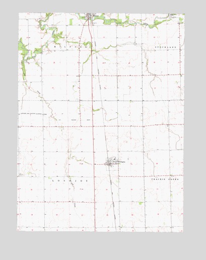
Wellington, IL USGS Topographic Map
Click on map above to begin viewing in our Map Viewer.

This topographic map contains these locations and features:
Feature Name Type Latitude Longitude GNIS ID View Map
Adsit FarmsLocaleN40.5331°W87.6492°2741202View Map
AlonzoPopulated PlaceN40.5667°W87.7311°422403View Map
Ard FarmsLocaleN40.5303°W87.7144°2741198View Map
Carlson FarmsLocaleN40.5664°W87.6572°2741201View Map
Chapman School (historical)SchoolN40.5020°W87.7286°1747975View Map
Cherry Grove School (historical)SchoolN40.5964°W87.7048°1747980View Map
Cissna Junction (historical)LocaleN40.5620°W87.6853°1747977View Map
College Center School (historical)SchoolN40.5323°W87.6253°1747981View Map
Crawford FarmLocaleN40.6064°W87.6614°2741170View Map
Evans School (historical)SchoolN40.5314°W87.7420°1747983View Map
Fairview School (historical)SchoolN40.5900°W87.6284°1747984View Map
Flag FarmLocaleN40.5983°W87.6294°2741172View Map
Freeland Junction (historical)LocaleN40.6120°W87.6931°1747986View Map
Gay CreekStreamN40.5978°W87.7456°408933View Map
Gay Creek School (historical)SchoolN40.5603°W87.7170°1747987View Map
Lamont School (historical)SchoolN40.5623°W87.6270°1747992View Map
Milford Fire Protection DistrictBuildingN40.6248°W87.6974°2682066View Map
Milquois FarmLocaleN40.6081°W87.7133°2741167View Map
Morts FarmsLocaleN40.5781°W87.7306°2741166View Map
New Gothic School (historical)SchoolN40.6042°W87.6278°1748000View Map
Old Milford CemeteryCemeteryN40.6245°W87.6928°1951871View Map
Pleasant Valley School (historical)SchoolN40.6173°W87.7423°1748008View Map
Pleasant Valley School (historical)SchoolN40.5025°W87.6909°1748009View Map
Sugar Creek ChapelChurchN40.6248°W87.6359°419290View Map
Township of LovejoyCivilN40.5314°W87.7096°429286View Map
Victor School (historical)SchoolN40.5031°W87.6336°1748012View Map
Village of WellingtonCivilN40.5404°W87.6796°2400123View Map
WellingtonPopulated PlaceN40.5392°W87.6800°420732View Map
Wellington - Greer Fire Protection DistrictBuildingN40.5386°W87.6801°2682562View Map
Wellington High School (historical)SchoolN40.5414°W87.6769°2351163View Map
Wellington Post OfficePost OfficeN40.5391°W87.6795°2741205View Map
White School (historical)SchoolN40.5967°W87.6761°1748014View Map

Note: Coordinates in the location and feature list above are referenced to NAD83 datum.


Copyright (C) 2008-2025 Ryan Niemi / Sunset Dynamics ... All Rights Reserved