TopoQuest Logo
Do you find TopoQuest useful?
Help keep TopoQuest running and adding new maps/features by donating!
Bitcoin:  19c7KJd3qBynnjoSw5npx9KScwjBe4ifkT
Litecoin:  LXs6TkuXGGXo1vDsWCkWVdjQX94eUKd6ui
Home View Maps Find Maps Find Places Resources & Links


Darrow, Illinois Topographic Map

USGS Map Title: Darrow, IL
USGS Map MRC: 40087F5
DRG (GeoTIFF) Download: o40087f5.tif


Neighboring USGS Topographic Map Quads:


  Watseka, IL  
40087G6
 

  Sheldon, IL  
40087G5
 

  Kentland, IN  
40087G4
 

  Milford, IL  
40087F6
 

  Darrow, IL  
40087F5
 

  Earl Park, IN  
40087F4
 

  Wellington, IL  
40087E6
 

  Stockland, IL  
40087E5
 

  Boswell, IN  
40087E4


Map MRC Location:

N41°
W88°
N41°
W87°
H8 H7 H6 H5 H4 H3 H2 H1
G8 G7 G6 G5 G4 G3 G2 G1
F8 F7 F6 F5 F4 F3 F2 F1
E8 E7 E6 E5 E4 E3 E2 E1
D8 D7 D6 D5 D4 D3 D2 D1
C8 C7 C6 C5 C4 C3 C2 C1
B8 B7 B6 B5 B4 B3 B2 B1
A8 A7 A6 A5 A4 A3 A2 A1
N40°
W88°
N40°
W87°

Darrow, IL USGS 1:24K Topographic Map Preview:
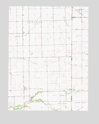
Darrow, IL USGS Topographic Map
Click on map above to begin viewing in our Map Viewer.

This topographic map contains these locations and features:
Feature Name Type Latitude Longitude GNIS ID View Map
Amos School (historical)SchoolN40.7034°W87.5928°1747971View Map
Blue Ridge CemeteryCemeteryN40.6932°W87.5007°431236View Map
Centerville School (historical)SchoolN40.7336°W87.5931°1747979View Map
Cole CreekStreamN40.6323°W87.5586°406345View Map
Corlett School (historical)SchoolN40.7045°W87.5467°1747982View Map
CutmerPopulated PlaceN40.6503°W87.6000°422599View Map
DarrowPopulated PlaceN40.7189°W87.6031°422606View Map
Disosway Airport (historical)AirportN40.7000°W87.6000°427805View Map
Fleming CemeteryCemeteryN40.7228°W87.5199°434583View Map
Herman School (historical)SchoolN40.6361°W87.5520°1747990View Map
Mitchell School (historical)SchoolN40.6711°W87.5922°1747997View Map
Mud CreekStreamN40.6489°W87.5003°439820View Map
Mud CreekStreamN40.6373°W87.5886°414176View Map
Pleasant Hill School (historical)SchoolN40.6725°W87.5459°1748005View Map
Possum Trot DitchCanalN40.7275°W87.5842°416065View Map
Township of SheldonCivilN40.7326°W87.5886°429740View Map
Township of StocklandCivilN40.6329°W87.5922°429800View Map
Willow Grove School (historical)SchoolN40.7325°W87.5506°1748015View Map

Note: Coordinates in the location and feature list above are referenced to NAD83 datum.


Copyright (C) 2008-2025 Ryan Niemi / Sunset Dynamics ... All Rights Reserved