TopoQuest Logo
Do you find TopoQuest useful?
Help keep TopoQuest running and adding new maps/features by donating!
Bitcoin:  19c7KJd3qBynnjoSw5npx9KScwjBe4ifkT
Litecoin:  LXs6TkuXGGXo1vDsWCkWVdjQX94eUKd6ui
Home View Maps Find Maps Find Places Resources & Links


Stockland, Illinois Topographic Map

USGS Map Title: Stockland, IL
USGS Map MRC: 40087E5
DRG (GeoTIFF) Download: o40087e5.tif


Neighboring USGS Topographic Map Quads:


  Milford, IL  
40087F6
 

  Darrow, IL  
40087F5
 

  Earl Park, IN  
40087F4
 

  Wellington, IL  
40087E6
 

  Stockland, IL  
40087E5
 

  Boswell, IN  
40087E4
 

  Hoopeston, IL  
40087D6
 

  Ambia, IN  
40087D5
 

  Tab, IN  
40087D4


Map MRC Location:

N41°
W88°
N41°
W87°
H8 H7 H6 H5 H4 H3 H2 H1
G8 G7 G6 G5 G4 G3 G2 G1
F8 F7 F6 F5 F4 F3 F2 F1
E8 E7 E6 E5 E4 E3 E2 E1
D8 D7 D6 D5 D4 D3 D2 D1
C8 C7 C6 C5 C4 C3 C2 C1
B8 B7 B6 B5 B4 B3 B2 B1
A8 A7 A6 A5 A4 A3 A2 A1
N40°
W88°
N40°
W87°

Stockland, IL USGS 1:24K Topographic Map Preview:
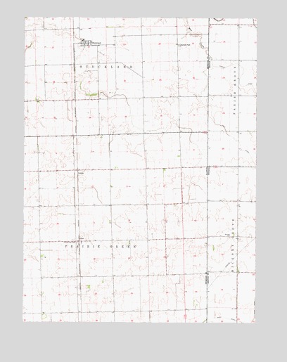
Stockland, IL USGS Topographic Map
Click on map above to begin viewing in our Map Viewer.

This topographic map contains these locations and features:
Feature Name Type Latitude Longitude GNIS ID View Map
Christian Church (historical)ChurchN40.5495°W87.5403°1747976View Map
Dawson ParkParkN40.6139°W87.5420°406998View Map
Glass School (historical)SchoolN40.5923°W87.5520°1747988View Map
GreerPopulated PlaceN40.5331°W87.5947°422759View Map
HallockPopulated PlaceN40.5614°W87.5961°422774View Map
Kult DitchCanalN40.5734°W87.5086°437475View Map
Maple Grove School (historical)SchoolN40.5636°W87.5470°1747994View Map
Marlowe School (historical)SchoolN40.5917°W87.5936°1747996View Map
Pleasant Hill School (historical)SchoolN40.5631°W87.5781°1748006View Map
Prairie Green SchoolSchoolN40.5328°W87.5972°416140View Map
Stichnoth RLA AirportAirportN40.6141°W87.5624°2770518View Map
StocklandPopulated PlaceN40.6145°W87.5928°419152View Map
Stockland Fire Protection DistrictBuildingN40.6141°W87.5931°2682501View Map
Stockland Post OfficePost OfficeN40.6146°W87.5927°1815583View Map
Totheroh CemeteryCemeteryN40.5353°W87.5141°444819View Map
Township of Prairie GreenCivilN40.5334°W87.5904°429601View Map
Wichman AirportAirportN40.6182°W87.6149°427847View Map
Willow Spring School (historical)SchoolN40.5195°W87.5759°1748016View Map

Note: Coordinates in the location and feature list above are referenced to NAD83 datum.


Copyright (C) 2008-2025 Ryan Niemi / Sunset Dynamics ... All Rights Reserved