TopoQuest Logo
Do you find TopoQuest useful?
Help keep TopoQuest running and adding new maps/features by donating!
Bitcoin:  19c7KJd3qBynnjoSw5npx9KScwjBe4ifkT
Litecoin:  LXs6TkuXGGXo1vDsWCkWVdjQX94eUKd6ui
Home View Maps Find Maps Find Places Resources & Links


Fillmore, New York Topographic Map

USGS Map Title: Fillmore, NY
USGS Map MRC: 42078D1
DRG (GeoTIFF) Download: o42078d1.tif


Neighboring USGS Topographic Map Quads:


  Pike, NY  
42078E2
 

  Portageville, NY  
42078E1
 

  Nunda, NY  
42077E8
 

  Houghton, NY  
42078D2
 

  Fillmore, NY  
42078D1
 

  Birdsall, NY  
42077D8
 

  Black Creek, NY  
42078C2
 

  Angelica, NY  
42078C1
 

  West Almond, NY  
42077C8


Map MRC Location:

N43°
W79°
N43°
W78°
H8 H7 H6 H5 H4 H3 H2 H1
G8 G7 G6 G5 G4 G3 G2 G1
F8 F7 F6 F5 F4 F3 F2 F1
E8 E7 E6 E5 E4 E3 E2 E1
D8 D7 D6 D5 D4 D3 D2 D1
C8 C7 C6 C5 C4 C3 C2 C1
B8 B7 B6 B5 B4 B3 B2 B1
A8 A7 A6 A5 A4 A3 A2 A1
N42°
W79°
N42°
W78°

Fillmore, NY USGS 1:24K Topographic Map Preview:
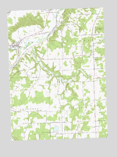
Fillmore, NY USGS Topographic Map
Click on map above to begin viewing in our Map Viewer.

This topographic map contains these locations and features:
Feature Name Type Latitude Longitude GNIS ID View Map
Allen CenterPopulated PlaceN42.3862°W78.0153°972159View Map
Central SchoolSchoolN42.4653°W78.1186°946294View Map
Cold CreekStreamN42.4637°W78.1086°947049View Map
East Caneadea CemeteryCemeteryN42.4030°W78.0901°2057578View Map
East Caneadea ChurchChurchN42.4026°W78.0897°949031View Map
FillmorePopulated PlaceN42.4662°W78.1150°950053View Map
Fillmore Census Designated PlaceCensusN42.4670°W78.1107°2389084View Map
Fillmore Fire DepartmentBuildingN42.4647°W78.1128°2700969View Map
GrangerLocaleN42.4945°W78.0061°951495View Map
Hank Miller Memorial FieldParkN42.4631°W78.1133°952164View Map
Holy Cross CemeteryCemeteryN42.4505°W78.1149°953040View Map
Hume Town HallBuildingN42.4670°W78.1118°2617629View Map
New York State Police Fillmore StationBuildingN42.4670°W78.1119°2780755View Map
Pine Grove CemeteryCemeteryN42.4599°W78.0970°960444View Map
Riverland Dairy FarmsLocaleN42.4781°W78.0883°2703655View Map
RossburgPopulated PlaceN42.4973°W78.0700°962949View Map
Rush CreekStreamN42.4695°W78.0947°963098View Map
Rush Creek BridgeBridgeN42.4492°W78.0858°963100View Map
Saint Patricks ChurchChurchN42.4665°W78.1186°964074View Map
Saint Pauls ChurchChurchN42.3856°W78.0156°964117View Map
Saint Pauls Lutheran Church CemeteryCemeteryN42.3858°W78.0161°2544237View Map
Short TractPopulated PlaceN42.4523°W78.0144°965175View Map
Short Tract CemeteryCemeteryN42.4555°W78.0172°965176View Map
Short Tract Fire CompanyBuildingN42.4489°W78.0138°2701218View Map
Town of AllenCivilN42.3914°W78.0151°978668View Map
Town of GrangerCivilN42.4748°W78.0106°979013View Map
Wesleyan ChurchChurchN42.4653°W78.1111°969070View Map
West AllenPopulated PlaceN42.3803°W78.0386°973219View Map
Wide Awake Club LibraryBuildingN42.4658°W78.1138°2617458View Map
Wiscoy - Rossburg Fire CompanyBuildingN42.4997°W78.0754°2734978View Map
Wiscoy CemeteryCemeteryN42.4994°W78.0811°2544238View Map
Wiscoy CreekStreamN42.4987°W78.0570°971519View Map

Note: Coordinates in the location and feature list above are referenced to NAD83 datum.


Copyright (C) 2008-2025 Ryan Niemi / Sunset Dynamics ... All Rights Reserved