TopoQuest Logo
Do you find TopoQuest useful?
Help keep TopoQuest running and adding new maps/features by donating!
Bitcoin:  19c7KJd3qBynnjoSw5npx9KScwjBe4ifkT
Litecoin:  LXs6TkuXGGXo1vDsWCkWVdjQX94eUKd6ui
Home View Maps Find Maps Find Places Resources & Links


Wharton, Pennsylvania Topographic Map

USGS Map Title: Wharton, PA
USGS Map MRC: 41078E1
DRG (GeoTIFF) Download: o41078e1.tif


Neighboring USGS Topographic Map Quads:


  Keating Summit, PA  
41078F2
 

  Austin, PA  
41078F1
 

  Ayers Hill, PA  
41077F8
 

  Emporium, PA  
41078E2
 

  Wharton, PA  
41078E1
 

  Conrad, PA  
41077E8
 

  Cameron, PA  
41078D2
 

  First Fork, PA  
41078D1
 

  Hammersley Fork, PA  
41077D8


Map MRC Location:

N42°
W79°
N42°
W78°
H8 H7 H6 H5 H4 H3 H2 H1
G8 G7 G6 G5 G4 G3 G2 G1
F8 F7 F6 F5 F4 F3 F2 F1
E8 E7 E6 E5 E4 E3 E2 E1
D8 D7 D6 D5 D4 D3 D2 D1
C8 C7 C6 C5 C4 C3 C2 C1
B8 B7 B6 B5 B4 B3 B2 B1
A8 A7 A6 A5 A4 A3 A2 A1
N41°
W79°
N41°
W78°

Wharton, PA USGS 1:24K Topographic Map Preview:
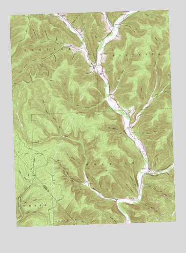
Wharton, PA USGS Topographic Map
Click on map above to begin viewing in our Map Viewer.

This topographic map contains these locations and features:
Feature Name Type Latitude Longitude GNIS ID View Map
Avery HollowValleyN41.5292°W78.0042°1168520View Map
Bailey RunLocaleN41.5142°W78.0456°1213439View Map
Bailey RunStreamN41.5126°W78.0458°1168582View Map
Bentley HollowValleyN41.5300°W78.0145°1169279View Map
Big Carlson HollowValleyN41.6087°W78.1033°1169488View Map
Big Nelson RunStreamN41.5562°W78.0342°1169542View Map
Brainard HollowValleyN41.5348°W78.0708°1170148View Map
Butternut HollowValleyN41.5709°W78.0185°1170814View Map
Card HollowValleyN41.5819°W78.0016°1171198View Map
Colbert HollowValleyN41.5142°W78.1210°1172143View Map
Cooney HollowValleyN41.6127°W78.0700°1172417View Map
Cooney HollowValleyN41.5978°W78.1018°2061891View Map
CostelloPopulated PlaceN41.5934°W78.0594°1172481View Map
Costello CemeteryCemeteryN41.6006°W78.0536°1172482View Map
Deloy HollowValleyN41.5073°W78.1189°1173141View Map
Dry HollowValleyN41.5150°W78.0297°1173512View Map
East Darian RunStreamN41.5759°W78.0483°1173795View Map
East Fork Sinnemahoning CreekStreamN41.5295°W78.0214°1192406View Map
Elevenmile HollowValleyN41.6248°W78.0331°1174095View Map
Elk Lick RunStreamN41.5215°W78.0269°1174118View Map
Fish Basket HollowValleyN41.5519°W78.0357°1174801View Map
Forksville CemeteryCemeteryN41.6158°W78.0736°1174969View Map
Freeman RunStreamN41.5937°W78.0575°1175214View Map
Garretson HollowValleyN41.6250°W78.0863°1175462View Map
Gas Well HollowValleyN41.5772°W78.0059°1175477View Map
Kirkendahl HollowValleyN41.6182°W78.0767°1178544View Map
Layton HollowValleyN41.6069°W78.0533°1179071View Map
Left Branch Big Nelson RunStreamN41.5731°W78.0167°1179135View Map
Little Bailey RunStreamN41.5209°W78.0644°1179458View Map
Little Carlson HollowValleyN41.6094°W78.0944°1179497View Map
Little Nelson RunStreamN41.5490°W78.0289°1179620View Map
Little Portage CreekStreamN41.6084°W78.0886°1179650View Map
Pine Island RunStreamN41.5134°W78.0264°1183847View Map
Post HollowValleyN41.6085°W78.0887°1184315View Map
Railroad HollowValleyN41.6034°W78.0059°1184602View Map
Rees CemeteryCemeteryN41.6231°W78.0334°1184840View Map
Reesville SchoolSchoolN41.6176°W78.0389°1184850View Map
Right Branch Bailey RunStreamN41.5528°W78.0867°1185067View Map
Right Branch Big Nelson RunStreamN41.5731°W78.0167°1185069View Map
Ripple HollowValleyN41.6038°W78.0727°1185102View Map
Road HollowValleyN41.5241°W78.0711°1185157View Map
Saint Joseph CemeteryCemeteryN41.5896°W78.0524°1186193View Map
Schoolhouse HollowValleyN41.6178°W78.0379°1187111View Map
Schoolhouse RunStreamN41.5190°W78.0281°1187115View Map
Shanty BranchStreamN41.5276°W78.1147°1187363View Map
South Branch Little Portage CreekStreamN41.6059°W78.0825°1193401View Map
South Woods BranchStreamN41.6162°W78.0433°1188123View Map
Splash DamDamN41.5334°W78.0678°1188183View Map
Sprague HollowValleyN41.6011°W78.0914°1188201View Map
State Road BranchStreamN41.5276°W78.1147°1193464View Map
Township of SylvaniaCivilN41.6094°W78.0138°1216987View Map
West Darian RunStreamN41.5726°W78.0503°1191001View Map
WhartonPopulated PlaceN41.5317°W78.0197°1204939View Map
Wharton CemeteryCemeteryN41.5138°W78.0328°1191202View Map
Young HollowValleyN41.5916°W78.0601°1191914View Map

Note: Coordinates in the location and feature list above are referenced to NAD83 datum.


Copyright (C) 2008-2025 Ryan Niemi / Sunset Dynamics ... All Rights Reserved