TopoQuest Logo
Do you find TopoQuest useful?
Help keep TopoQuest running and adding new maps/features by donating!
Bitcoin:  19c7KJd3qBynnjoSw5npx9KScwjBe4ifkT
Litecoin:  LXs6TkuXGGXo1vDsWCkWVdjQX94eUKd6ui
Home View Maps Find Maps Find Places Resources & Links


Williamsburg, Missouri Topographic Map

USGS Map Title: Williamsburg, MO
USGS Map MRC: 38091H6
DRG (GeoTIFF) Download: o38091h6.tif


Neighboring USGS Topographic Map Quads:


  Mexico SE, MO  
39091A7
 

  Martinsburg, MO  
39091A6
 

  Wellsville, MO  
39091A5
 

  Calwood, MO  
38091H7
 

  Williamsburg, MO  
38091H6
 

  Montgomery City, MO  
38091H5
 

  Reform, MO  
38091G7
 

  Readsville, MO  
38091G6
 

  Americus, MO  
38091G5


Map MRC Location:

N39°
W92°
N39°
W91°
H8 H7 H6 H5 H4 H3 H2 H1
G8 G7 G6 G5 G4 G3 G2 G1
F8 F7 F6 F5 F4 F3 F2 F1
E8 E7 E6 E5 E4 E3 E2 E1
D8 D7 D6 D5 D4 D3 D2 D1
C8 C7 C6 C5 C4 C3 C2 C1
B8 B7 B6 B5 B4 B3 B2 B1
A8 A7 A6 A5 A4 A3 A2 A1
N38°
W92°
N38°
W91°

Williamsburg, MO USGS 1:24K Topographic Map Preview:
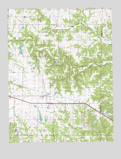
Williamsburg, MO USGS Topographic Map
Click on map above to begin viewing in our Map Viewer.

This topographic map contains these locations and features:
Feature Name Type Latitude Longitude GNIS ID View Map
American Central Corporation Lower DamDamN38.8984°W91.6535°764692View Map
American Central Corporation Upper DamDamN38.9034°W91.6552°762001View Map
Appling BranchStreamN38.9614°W91.7143°713362View Map
Augusta CemeteryCemeteryN38.9884°W91.7116°713482View Map
Augusta Church (historical)ChurchN38.9875°W91.7099°743429View Map
Bachelor CreekStreamN38.9878°W91.6616°713515View Map
Dog BranchStreamN38.9675°W91.6363°716949View Map
E R Hooks LakeReservoirN38.8956°W91.7061°760309View Map
Eckerts Airstrip (historical)AirportN38.9145°W91.7043°759000View Map
Elm Spring School (historical)SchoolN38.9917°W91.7224°743433View Map
Eugene Hooks LakeReservoirN38.8975°W91.7120°760240View Map
Flying V Ranch AirportAirportN38.9165°W91.6828°2717170View Map
G and G Cattle Company East DamDamN38.8950°W91.7068°760308View Map
G and G Cattle Company West DamDamN38.8950°W91.7118°760239View Map
Gasper DamDamN38.9217°W91.6918°760241View Map
Heat String CreekStreamN38.9706°W91.7399°719319View Map
High Point ChurchChurchN38.9773°W91.6563°729322View Map
High Point School (historical)SchoolN38.9625°W91.6668°743449View Map
Holt - Covington CemeteryCemeteryN38.9001°W91.6348°716401View Map
Jack Knittle LakeReservoirN38.8827°W91.7401°760238View Map
John Gasper LakeReservoirN38.9209°W91.6937°760242View Map
Johnson ChapelChurchN38.9320°W91.6988°743450View Map
Knittel DamDamN38.8817°W91.7418°760237View Map
Knittel Dam Number 2DamN38.8850°W91.7418°762003View Map
Nine Mile PrairieAreaN38.9167°W91.7168°738640View Map
North Callaway Fire Protection District Station 2BuildingN38.9164°W91.7008°2621339View Map
Oak Grove CemeteryCemeteryN38.8820°W91.6599°723566View Map
Oak Grove ChurchChurchN38.8820°W91.6599°743455View Map
Pepmiller Lake DamDamN38.9017°W91.6318°764751View Map
Redgate Ranch AirportAirportN38.9032°W91.6352°759001View Map
Sandbank HollowValleyN38.9417°W91.6643°726024View Map
Township of Nine Mile PrairieCivilN38.8929°W91.7158°766382View Map
Union School (historical)SchoolN38.9933°W91.6364°744429View Map
Weeks School (historical)SchoolN38.9021°W91.6632°743469View Map
Whetstone Creek State Wildlife AreaParkN38.9617°W91.7102°743172View Map
Whetstone Creek Wildlife Area Section 32 DamDamN38.9817°W91.7318°762744View Map
Whetstone Creek Wildlife Area Section 6 Lower DamDamN38.9650°W91.7352°761507View Map
Whetstone Creek Wildlife Area Section 6 Upper DamDamN38.9600°W91.7335°762004View Map
Whetstone Creek Wildlife Area Section 8 DamDamN38.9450°W91.7185°762005View Map
WilliamsburgPopulated PlaceN38.9203°W91.7016°729412View Map
Williamsburg Elementary SchoolSchoolN38.9178°W91.7091°715205View Map
Williamsburg Post OfficePost OfficeN38.9165°W91.7001°2782851View Map

Note: Coordinates in the location and feature list above are referenced to NAD83 datum.


Copyright (C) 2008-2025 Ryan Niemi / Sunset Dynamics ... All Rights Reserved