TopoQuest Logo
Do you find TopoQuest useful?
Help keep TopoQuest running and adding new maps/features by donating!
Bitcoin:  19c7KJd3qBynnjoSw5npx9KScwjBe4ifkT
Litecoin:  LXs6TkuXGGXo1vDsWCkWVdjQX94eUKd6ui
Home View Maps Find Maps Find Places Resources & Links


Williamstown, Kansas Topographic Map

USGS Map Title: Williamstown, KS
USGS Map MRC: 39095A3
DRG (GeoTIFF) Download: o39095a3.tif


Neighboring USGS Topographic Map Quads:


  Ozawkie, KS  
39095B4
 

  Oskaloosa, KS  
39095B3
 

  McLouth, KS  
39095B2
 

  Perry, KS  
39095A4
 

  Williamstown, KS  
39095A3
 

  Midland, KS  
39095A2
 

  Clinton, KS  
38095H4
 

  Lawrence West, KS  
38095H3
 

  Lawrence East, KS  
38095H2


Map MRC Location:

N40°
W96°
N40°
W95°
H8 H7 H6 H5 H4 H3 H2 H1
G8 G7 G6 G5 G4 G3 G2 G1
F8 F7 F6 F5 F4 F3 F2 F1
E8 E7 E6 E5 E4 E3 E2 E1
D8 D7 D6 D5 D4 D3 D2 D1
C8 C7 C6 C5 C4 C3 C2 C1
B8 B7 B6 B5 B4 B3 B2 B1
A8 A7 A6 A5 A4 A3 A2 A1
N39°
W96°
N39°
W95°

Williamstown, KS USGS 1:24K Topographic Map Preview:
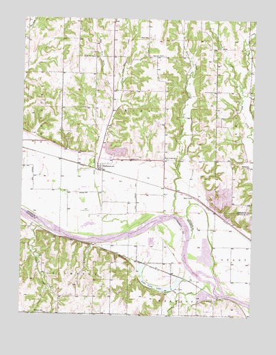
Williamstown, KS USGS Topographic Map
Click on map above to begin viewing in our Map Viewer.

This topographic map contains these locations and features:
Feature Name Type Latitude Longitude GNIS ID View Map
Baldwin CreekStreamN39.0119°W95.2700°479115View Map
Buck CreekStreamN39.0431°W95.2925°478505View Map
Buck CreekPopulated PlaceN39.0500°W95.2822°484943View Map
Buck Creek SchoolSchoolN39.0658°W95.2969°478823View Map
Chester (historical)LocaleN39.0950°W95.2705°482263View Map
Clover Hill SchoolSchoolN39.1092°W95.3372°478825View Map
Dean SchoolSchoolN39.1172°W95.3086°484358View Map
East Stone House CreekStreamN39.0936°W95.3244°478503View Map
Holliday CemeteryCemeteryN39.0439°W95.3389°478820View Map
Lake ViewLocaleN39.0172°W95.2925°481925View Map
Lake View LakeLakeN39.0122°W95.3016°478818View Map
Lake View StationLocaleN39.0178°W95.2933°478819View Map
Lake View Station (historical)LocaleN39.0228°W95.3114°482167View Map
Lewis - Crowder - Lakeview CemeteryCemeteryN39.0223°W95.3171°2775086View Map
Nolan HillSummitN39.1089°W95.3022°478826View Map
Oakley CreekStreamN39.0372°W95.3636°478816View Map
Perry United Methodist ChurchChurchN39.0646°W95.3348°2509987View Map
Plum CreekStreamN39.0953°W95.2566°478506View Map
Rural Township Fire DepartmentBuildingN39.0649°W95.3345°2111802View Map
Sarcoxie Township Fire District 4 North StationBuildingN39.1144°W95.2527°2111838View Map
Stone Horse CreekStreamN39.0333°W95.3308°478827View Map
Stonehenge AirportAirportN39.1033°W95.2928°2651077View Map
Sunnyside SchoolSchoolN39.0625°W95.2525°478824View Map
Township of RuralCivilN39.0895°W95.3131°478497View Map
Underwood CemeteryCemeteryN39.0664°W95.3118°478822View Map
Wakarusa Township Fire Station 2BuildingN39.0011°W95.2726°2111958View Map
West Stone House CreekStreamN39.0936°W95.3244°478502View Map
WilliamstownPopulated PlaceN39.0628°W95.3328°478821View Map
Williamstown Assembly of God ChurchChurchN39.0645°W95.3348°2509867View Map
Williamstown Assembly of God ChurchChurchN39.0622°W95.3346°2510412View Map
Winters School (historical)SchoolN39.0008°W95.3647°478817View Map

Note: Coordinates in the location and feature list above are referenced to NAD83 datum.


Copyright (C) 2008-2025 Ryan Niemi / Sunset Dynamics ... All Rights Reserved