TopoQuest Logo
Do you find TopoQuest useful?
Help keep TopoQuest running and adding new maps/features by donating!
Bitcoin:  19c7KJd3qBynnjoSw5npx9KScwjBe4ifkT
Litecoin:  LXs6TkuXGGXo1vDsWCkWVdjQX94eUKd6ui
Home View Maps Find Maps Find Places Resources & Links


Keystone Peak, Montana Topographic Map

USGS Map Title: Keystone Peak, MT
USGS Map MRC: 47114C8
DRG (GeoTIFF) Download: o47114c8.tif


Neighboring USGS Topographic Map Quads:


  Sunset Peak, MT  
47115D1
 

  Plains, MT  
47114D8
 

  Paradise, MT  
47114D7
 

  Saint Regis, MT  
47115C1
 

  Keystone Peak, MT  
47114C8
 

  Quinns Hot Springs, MT  
47114C7
 

  Wilson Gulch, MT  
47115B1
 

  Superior, MT  
47114B8
 

  Idaho Gulch, MT  
47114B7


Map MRC Location:

N48°
W115°
N48°
W114°
H8 H7 H6 H5 H4 H3 H2 H1
G8 G7 G6 G5 G4 G3 G2 G1
F8 F7 F6 F5 F4 F3 F2 F1
E8 E7 E6 E5 E4 E3 E2 E1
D8 D7 D6 D5 D4 D3 D2 D1
C8 C7 C6 C5 C4 C3 C2 C1
B8 B7 B6 B5 B4 B3 B2 B1
A8 A7 A6 A5 A4 A3 A2 A1
N47°
W115°
N47°
W114°

Keystone Peak, MT USGS 1:24K Topographic Map Preview:
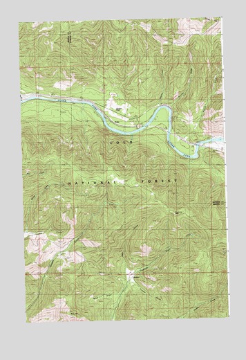
Keystone Peak, MT USGS Topographic Map
Click on map above to begin viewing in our Map Viewer.

This topographic map contains these locations and features:
Feature Name Type Latitude Longitude GNIS ID View Map
Bald HillSummitN47.2527°W114.9732°779280View Map
Brian GulchValleyN47.2613°W114.9462°807050View Map
Carter (historical)LocaleN47.2683°W114.9357°1781683View Map
Carter Post Office (historical)Post OfficeN47.2683°W114.9357°1781664View Map
Carter School (historical)SchoolN47.2683°W114.9368°1781682View Map
Chevrolet Number 1 and 2 MineMineN47.3022°W114.9576°804748View Map
DonlanPopulated PlaceN47.3302°W114.9354°782472View Map
Donlan FlatsFlatN47.3380°W114.9393°782473View Map
Dunns DrawValleyN47.3388°W114.9082°782715View Map
Firman GulchValleyN47.2658°W114.9329°807049View Map
KeystonePopulated PlaceN47.2683°W114.9357°785703View Map
Keystone MineMineN47.2727°W114.9287°804776View Map
Keystone PeakSummitN47.2938°W114.9065°785709View Map
Keystone Post Office (historical)Post OfficeN47.2683°W114.9357°1781665View Map
Keystone School (historical)SchoolN47.2683°W114.9357°1781684View Map
Little Anaconda MineMineN47.2777°W114.8774°804779View Map
Little Pittsburg MineMineN47.2694°W114.9854°786343View Map
Little Pittsburg MineMineN47.2688°W114.9857°804712View Map
Lower Prosperity MineMineN47.2810°W114.9024°804786View Map
Nancy Lee MillsiteMineN47.2652°W114.9401°804784View Map
Nancy Lee MineMineN47.2699°W114.9543°804704View Map
Nancy Lee MineMineN47.2719°W114.9510°787905View Map
Nancy Lee/Fawcett MineMineN47.2758°W114.9515°804782View Map
Nite Owl Number 2 MineMineN47.2744°W114.9190°804788View Map
Nite Owl Number 3 MineMineN47.2749°W114.9196°804787View Map
Nite Owl Number 8 MineMineN47.2694°W114.9218°804789View Map
O R and N MineMineN47.2763°W114.9476°804783View Map
Pack GulchValleyN47.2691°W114.9379°788556View Map
Patrick CreekStreamN47.3269°W114.9090°788686View Map
S and H MineMineN47.3263°W114.9399°805127View Map
Santa Rita MineMineN47.2708°W114.9329°804790View Map
Sesame CreekStreamN47.3385°W114.9137°790240View Map
Seven Mile Creek MineMineN47.3583°W114.9940°804747View Map
Sevenmile CreekStreamN47.3424°W114.9968°790250View Map
Triumph MineMineN47.2763°W114.8765°804778View Map
Upper Keesey MineMineN47.3013°W114.9551°804743View Map
Upper Nancy Lee MineMineN47.2727°W114.9565°804791View Map
Upper Prosperity MineMineN47.2847°W114.8968°804785View Map

Note: Coordinates in the location and feature list above are referenced to NAD83 datum.


Copyright (C) 2008-2025 Ryan Niemi / Sunset Dynamics ... All Rights Reserved