TopoQuest Logo
Do you find TopoQuest useful?
Help keep TopoQuest running and adding new maps/features by donating!
Bitcoin:  19c7KJd3qBynnjoSw5npx9KScwjBe4ifkT
Litecoin:  LXs6TkuXGGXo1vDsWCkWVdjQX94eUKd6ui
Home View Maps Find Maps Find Places Resources & Links


Woodward, Pennsylvania Topographic Map

USGS Map Title: Woodward, PA
USGS Map MRC: 40077H3
DRG (GeoTIFF) Download: o40077h3.tif


Neighboring USGS Topographic Map Quads:


  Mill Hall, PA  
41077A4
 

  Loganton, PA  
41077A3
 

  Carroll, PA  
41077A2
 

  Millheim, PA  
40077H4
 

  Woodward, PA  
40077H3
 

  Hartleton, PA  
40077H2
 

  Coburn, PA  
40077G4
 

  Weikert, PA  
40077G3
 

  Beavertown, PA  
40077G2


Map MRC Location:

N41°
W78°
N41°
W77°
H8 H7 H6 H5 H4 H3 H2 H1
G8 G7 G6 G5 G4 G3 G2 G1
F8 F7 F6 F5 F4 F3 F2 F1
E8 E7 E6 E5 E4 E3 E2 E1
D8 D7 D6 D5 D4 D3 D2 D1
C8 C7 C6 C5 C4 C3 C2 C1
B8 B7 B6 B5 B4 B3 B2 B1
A8 A7 A6 A5 A4 A3 A2 A1
N40°
W78°
N40°
W77°

Woodward, PA USGS 1:24K Topographic Map Preview:
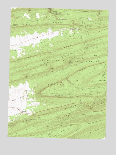
Woodward, PA USGS Topographic Map
Click on map above to begin viewing in our Map Viewer.

This topographic map contains these locations and features:
Feature Name Type Latitude Longitude GNIS ID View Map
Barner GapGapN40.9417°W77.3228°1168731View Map
Barner RunStreamN40.9340°W77.3230°1201880View Map
Bear GapGapN40.8970°W77.3016°1168873View Map
Bear MountainSummitN40.8984°W77.2969°1168892View Map
Bear RunStreamN40.8990°W77.2647°1168920View Map
Bear Run TrailTrailN40.8842°W77.3308°1168937View Map
Black Gap TrailTrailN40.9962°W77.2569°1206943View Map
Brungart Church (historical)ChurchN40.9706°W77.3447°1196953View Map
Brush Hollow TrailTrailN40.9645°W77.2594°1170442View Map
Bull Run GapGapN40.9992°W77.3250°1170651View Map
CCC Camp (historical)LocaleN40.9017°W77.2683°1196954View Map
Cherry Run TrailTrailN40.8792°W77.3036°1171675View Map
Cinder Pile SpringSpringN40.9248°W77.2572°1171878View Map
Fallen Timber TrailTrailN40.9645°W77.2597°1174587View Map
Greenburr GapGapN40.9973°W77.3516°1176139View Map
Haines GapGapN40.8881°W77.3678°1176368View Map
Haines PathTrailN40.8787°W77.3658°1192575View Map
Hairy John TrailTrailN40.9165°W77.2711°1176370View Map
Hairy Johns Picnic AreaAreaN40.9017°W77.2814°1212805View Map
Hall MountainSummitN40.9973°W77.2780°1176395View Map
Hall TrailTrailN40.9928°W77.3022°1206923View Map
Hayes HollowValleyN40.9276°W77.2921°1176687View Map
Horse Path SpringSpringN40.9628°W77.2744°1177444View Map
Hosterman GapGapN40.9340°W77.3536°1177489View Map
Hough GapGapN40.9984°W77.2622°1177498View Map
Hough MountainSummitN40.9831°W77.2719°1177499View Map
Hough Mountain TrailTrailN40.9851°W77.2822°1177500View Map
Joyce Kilmer MonumentParkN40.8881°W77.2778°1197676View Map
Joyce Kilmer TrailTrailN40.8967°W77.2678°1178177View Map
Kesseler TrailTrailN40.9392°W77.2630°1178415View Map
LivoniaPopulated PlaceN40.9806°W77.2916°1179728View Map
Martin Hollow TrailTrailN40.8873°W77.3608°1180491View Map
Negro HollowValleyN40.9277°W77.2922°1182223View Map
Nittany MountainRidgeN40.9820°W77.3664°1193028View Map
North Prong Thick MountainCapeN40.8920°W77.3197°1182624View Map
Old Tar TrailTrailN40.9423°W77.3550°1193064View Map
Paddy MountainSummitN40.8881°W77.2789°1183181View Map
Panther Hollow TrailTrailN40.9542°W77.2794°1183258View Map
Railroad CreekStreamN40.9728°W77.2950°1184601View Map
Rock Knob TrailTrailN40.8853°W77.3408°1185266View Map
Sand HollowValleyN40.8909°W77.3487°1186910View Map
Sand Hollow Fire TrailTrailN40.9009°W77.3014°1206920View Map
Sand Hollow TrailTrailN40.9012°W77.2994°1186911View Map
Sand MountainSummitN40.8973°W77.3241°1186913View Map
Schade TrailTrailN40.9856°W77.2805°1206924View Map
Sharpback MountainSummitN40.9409°W77.2822°1187375View Map
Sharpback TrailTrailN40.9401°W77.2825°1206931View Map
Sheesley Hollow TrailTrailN40.9176°W77.2614°1187431View Map
Sheesley RunStreamN40.9059°W77.2694°1187432View Map
Shriner MountainSummitN40.9437°W77.3464°1187620View Map
South Prong Thick MountainCapeN40.8854°W77.3150°1188101View Map
Stony RunStreamN40.9401°W77.3058°1188792View Map
Stover GapGapN40.9681°W77.2794°1188826View Map
Third Green KnobSummitN40.8770°W77.3203°1189458View Map
Township of HainesCivilN40.9012°W77.3625°1216125View Map
Township of MilesCivilN40.9649°W77.3705°1216132View Map
Voneida RunStreamN40.9042°W77.3516°1190454View Map
Voneida State Forest Park (historical)ParkN40.9117°W77.2672°1197675View Map
Whetstone GapGapN40.9481°W77.2994°1191226View Map
Winkelblech GapGapN40.9287°W77.3091°1217378View Map
Winkelblech MountainSummitN40.9178°W77.3322°1191601View Map
Wohlford GapGapN40.9576°W77.3247°1191643View Map
Wohlford RunStreamN40.9653°W77.3383°1201554View Map
Wolfs Store GapGapN40.9487°W77.3658°1191708View Map
WoodwardPopulated PlaceN40.8987°W77.3561°1191777View Map
Woodward Census Designated PlaceCensusN40.8997°W77.3471°2390540View Map
Woodward GapGapN40.8915°W77.3494°1191779View Map
Woodward MountainSummitN40.8890°W77.3592°1193696View Map
Woodward MountainRidgeN40.8890°W77.3592°1190967View Map
Woodward Post OfficePost OfficeN40.8985°W77.3562°2779649View Map

Note: Coordinates in the location and feature list above are referenced to NAD83 datum.


Copyright (C) 2008-2024 Ryan Niemi / Sunset Dynamics ... All Rights Reserved